-
Hello, please take a minute to check out our awesome content, contributed by the wonderful members of our community. We hope you'll add your own thoughts and opinions by making a free account!
You are using an out of date browser. It may not display this or other websites correctly.
You should upgrade or use an alternative browser.
You should upgrade or use an alternative browser.
Wintry January 21-23 2025
- Thread starter SD
- Start date
Stormsfury
Member
NBAcentel
Member
Just deflating to watch. Trending to zilch as we get closer for the Carolinas. Absolute pain and what could have been
Stormsfury
Member
Yeah, for CLT to RAH it’s not promising but 95 corridor is still in the game. I would be shocked if they don’t at least see 1-2”.Just deflating to watch. Trending to zilch as we get closer for the Carolinas. Absolute pain and what could have been
NBAcentel
Member
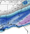
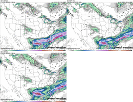
Our only hope is that something is coming onshore that hasn't been sampled well. And there's like maybe a 3% chance of that.My only solution now is we trend away from the northern stream press and get the digging energy back to better tilt over Texas and sharpen it like the AI a couple days ago View attachment 165378 but other then that I got nothing and I really don’t think we have enough time to get this at H5 in time
Genuine question, why is the NWS forecast a decent amount more north than what these models show, even from earlier? Do they use the same models or have access to more information, or do you think that will change soon
Probably adjusting for known model biases if I had to guess.Genuine question, why is the NWS forecast a decent amount more north than what these models show, even from earlier? Do they use the same models or have access to more information
NWS largely uses NBM, which is more north than most models.Genuine question, why is the NWS forecast a decent amount more north than what these models show, even from earlier? Do they use the same models or have access to more information, or do you think that will change soon
NBAcentel
Member
Is it too late to pinch off the southern part of the vort and sharpen it and let the northern stream slide off ? Genuine question
Stormsfury
Member
There's a chance that embedded little s/w aren't being sampled but based on what I'm seeing with the trend maps I put together, we're seeing timing issues both northern and southern streams and a harder press in the SE. Plus how did we get around to popping up a 2nd system later in the week.Our only hope is that something is coming onshore that hasn't been sampled well. And there's like maybe a 3% chance of that.
NEGaweather
Member

Sent from my iPhone using Tapatalk
Isn't this what the NAM might be trying to do with the late week system?Is it too late to pinch off the southern part of the vort and sharpen it and let the northern stream slide off ? Genuine question
NBAcentel
Member
Ron Burgundy
Member
*ahem*But if the trends continue NWS will start backing off tomorrow, NBM looks good but is also headed in wrong direction
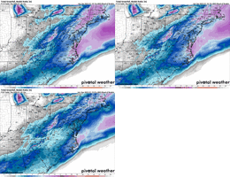
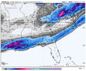
View attachment 165380
Similar shift (larger degree) to most recent euro run(s), the big 00z notwithstanding.
Had a sizeable jump west with qpf too, not there yet but just enough to keep me interested lol
accu35
Member
UK/Icon trended north tonight.
10% chance….. smash.This is a NWS product that is within the realm of possibilities...
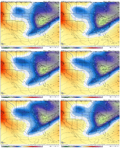
View attachment 165384
Smidge, digging farther, tending, model bias, northern stream energy, there are about twenty words that could literally diaf…..Y’all get to emotionally invested. You live in the south. models are gonna go up and down, sideways and throw you a curveball every now and again. Just stay patient and observe and let it play out
Sent from my iPhone using Tapatalk
iGRXY
Member
Problem is they were borderline a non event for almost everybody not named Louisiana to begin with. Going to need some legit heroics in the next day at H5. Which really makes this painful because just a mediocre H5 look gets you enough lift to let WAA and FGEN do its thing. There’s still technically time but models need to make some legit strides here in very short amount of time and not just a nudge here and there.UK/Icon trended north tonight.
every board member that is further than an hour away from the closest beach has a right to panic. this storm was about as close to a layup as you can get and it didn't work out, i think everyone has a right to be a little pissed off. particularly demoralizing for the rdu/clt crowd. there's still time for marginal improvements but overall think we're a day late and a dollar short for the northern half of this boardStop panicking the storm will come back, everyone just chill and stop looking at every model run and making a decision off of them. Let’s see what the hi res models say
Sent from my iPhone using Tapatalk
NBAcentel
Member
Euro looks worse at H5. As expected
NBAcentel
Member
Sctvman
Member
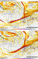
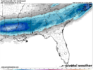
Amazing how rock solid the Euro has been for CHS. But still so much question on what actually is gonna happen. GFS 1” with some being freezing rain and this 5-6 or more, that’s a world of different impacts.Euro ticked south a good bit. I wish I never saw the run from 0z last night View attachment 165394
iGRXY
Member
I’m not saying the fat lady is singing yet but she’s tuning those vocals up. The only area I feel confident about right now is Louisiana and Mississippi. Even the immediate coast in the Carolina’s is getting scary at this point. I think they’ll see snow but even they’ve got to be getting sweaty. A day and a half ago I thought the I20 corridor was pretty much a lock for a nice 3-6” snow and they’re dwindling down to maybe an inch the way things are looking?
accu35
Member
Wondering if the models are just trying to correct itself? Gfs/Euro suppress and uk/Icon trending north. Or should we be looking more at the short range at this time?
Sctvman
Member
WarEagle22
Member
Depends on the location to be fair. It looks better for N and C AL, GA, N SC, and into TN.But if the trends continue NWS will start backing off tomorrow, NBM looks good but is also headed in wrong direction
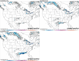
View attachment 165380
scared to ask but is this a reliable model?
SnowDoomer21
Member
Depends on the location to be fair. It looks better for N and C AL, GA, N SC, and into TN.
And S AL/GA into Florida
Sent from my iPhone using Tapatalk
Woke up to only 5 new pages & knew it was gonna be bad.
SnowDoomer21
Member

New 06z NAM is running everyone join hands and let’s manifest snow for everyone!
Sent from my iPhone using Tapatalk

