• Hello, please take a minute to check out our awesome content, contributed by the wonderful members of our community. We hope you'll add your own thoughts and opinions by making a free account!

Wintry January 21-23 2025

I just don’t think the models are capturing the warm air advection with the 140-150kt jet stream overhead. It makes sense for there to be more precip than what’s depicted. We need to get closer to range and allow the mesoscale high resolution models to get a better grip on what may actually happen.


Sent from my iPhone using Tapatalk
 
RAH discussion from this morning below. They seem to think the 1040 mb high pressure with very dry air is limiting the precip this far north.

Now, the lower confidence portion of the extended forecast - snow
Tuesday into Wednesday. The massive high pressure system that will
cover most of the United States will be hard to dislodge as low
pressure develops over the Gulf of Mexico, crosses Florida, and
emerges over the Atlantic Ocean. By Wednesday morning, all models
are showing a lobe of the high pressure at nearly 1040 mb over West
Virginia, and with such cold/dry air, it will be hard for
precipitation to make much inward progress from the coastline. This
will be an unusual storm in that models have consistently shown that
higher snowfall totals will occur along the coastline, where warmer
air would normally allow for a changeover to rain. However, the 00Z
models have suppressed higher liquid totals closer to the coast,
reducing precipitation amounts inland. There is still high
confidence that all precipitation locally will fall as snow, and did
not make much chance to the chances of precipitation with this
forecast - snow is still likely generally along and east of the US-1
corridor. The window for snow to fall has shrunk slightly, with the
chance of snow moving in from the south late Tuesday, peaking in the
late evening, and departing to the east by late Wednesday morning.
 
Well, look, I know this thing has trended away from a lot on this board and I'm truly sorry about that -- I remember the disappointment of losing what seemed like a surefire "Big Dog."

BUT, I hope you'll hang in there with me and a few others as we track what is truly a potentially historic situation in Louisiana, Florida and along the coast.

Unfortunately, it looks like I don't have much to root for other than a sleet storm -- I have have ice storm PTSD -- they are awful.

Regardless, I've got one model showing .7 of ZR even using the FRAM method, another with a raging sleetstorm with 1 inch of QPF and others with combinations of snow, ip and zr. And of course, the GFS shows mainly rain and not much of it.

Anyway, I could use the help bringing this one home -- who knows, maybe it will keep trending worse and I'll get the shaft, too. But if it's going to be a situation, it could very well be one for the history books.
I’m hoping the cold backs off for you to minimize a potential ice storm. Stay safe!
 
I don't expect big changes with the EURO/GFS/etc at this point, but would at least like to see a slight trend back in the right direction. Then maybe the mesoscale models can pick it up run from there in our direction, at least some but I don't expect big changes.
The positive (and negative) is it seems to be effecting the northern portion of the storm (NC/SC) the most, so I would not think it would take much to increase the moisture back in these areas again.
 
Well, look, I know this thing has trended away from a lot on this board and I'm truly sorry about that -- I remember the disappointment of losing what seemed like a surefire "Big Dog."

BUT, I hope you'll hang in there with me and a few others as we track what is truly a potentially historic situation in Louisiana, Florida and along the coast.

Unfortunately, it looks like I don't have much to root for other than a sleet storm -- I have have ice storm PTSD -- they are awful.

Regardless, I've got one model showing .7 of ZR even using the FRAM method, another with a raging sleetstorm with 1 inch of QPF and others with combinations of snow, ip and zr. And of course, the GFS shows mainly rain and not much of it.

Anyway, I could use the help bringing this one home -- who knows, maybe it will keep trending worse and I'll get the shaft, too. But if it's going to be a situation, it could very well be one for the history books.
You guys deserve it more than anyone else. We complain about going 3 years without snow. You guys go a decade or more in some locations. Stay safe and enjoy. Rooting hard for you from WNC!!!! I do believe you guys will have some mixing issues but its almost meso scale time.
 
For folks east of 95 this literally couldn't have timed out any worse. It could have missed that southern wave but it drags it and positively tilts it to oblivion. But, that gets the deep south there event so it works for some.

floop-ecmwf_full-2025011900.500hv.conus.gif
 
Here on the Coast..

Interesting Write up by the KILM NWS..

.SHORT TERM /MONDAY THROUGH TUESDAY NIGHT/...
Expansive and amplified longwave upper trof to dominate this
period, keeping a direct line of Arctic air pumping across the
area from Canada. Mon night could see apparent temps (wind
chills) reach Cold Weather Advisory thresholds of 15 degrees F
or less. For Tue, sfc baroclinic zone will lie just offshore
from the SE States Coast. A southern stream mid-level s/w trof
will dive out of the Rockies and pick up Gulf moisture and a
developing low pressure system by early Tue. The sfc system will
push off the FL east Coast during Tue evening, hooking up with
the existing baroclinic zone. Although the s/w trof aloft
remains pos tilt, the entire pcpn shield off the SE Coast does
retrograde to the coast and onshore with overrunning dynamics
playing a key role. Look for wintry pcpn to break out across the
FA at the coast initially Tue aftn and further inland by
evening. The pcpn activity will peak its intensity Tue evening
thru the pre-dawn Wed hrs as the sfc low tracks NE, remaining
well offshore as it moves by the FA. With winds staying more
northerly in direction at the sfc, do not expect the "mild" air
from off the Atlantic to play with pcpn type, even along the
immediate coast. This could very well end up as a majority snow
event. The amount of workable PWs will be key to how much snow
is able accumulate given ground temp and conditions already
favorable for snow to stick and not immediately melt. This may
result in hier snow ratios, ie. greater than the 7:1 ratio
normally exhibited this far south.


Northerly winds to become
quite active especially at the coast and over the adjacent
waters as the sfc pg tightens considerably. Wind chills will
again reach 15 or less Tue night into daylight Wed, likely
prompting a CWA in addition to a possible WSW for portions of
the FA given possible snow amounts exceeding 2 inches. Mon, Tue
and Wed highs will struggle into the 30s, possibly having a
difficult time reaching above 32 degrees Wed.
Various models
continue to exhibit non-conformist characteristics. Making it
more difficult for a common scenario to be applied to this
winter storm event.


Thus, its prudent to remain vigilant to this
winter storm and especially the bitterly cold conditions
expected thruout the upcoming workweek which the models do agree
on.

&&

.LONG TERM /WEDNESDAY THROUGH SATURDAY/...
Main concern this period will be the continued bitterly cold
temperatures. Wed night, in the wake of the winter pcpn event,
will have a snow cover (depth still needing to be ironed out).
This will combine with the Arctic air across the region,
providing possibly the coldest night of this week. Widespread
teens with wind chills at or below 10 degrees which would
require a CWA. FYI, Extreme Cold Warning are when Apparent
temps, wind chills, reach 0 degrees or lower. At this point,
we are safe from that occurrence.

Inverted sfc trof just off the Carolina Coasts and offshore will result in possible
overrunning pcpn on the west side of the trof. Once again,
wintry pcpn remains possible given this trof not expected to
move onshore with accompanying mild temps. Instead these milder
temps will occur aloft and with temps at or below freezing,
could see a round or 2 of freezing pcpn Thu before temps climb
above 32 at the coast. Another re-enforcing shot of cold/Arctic
air to occur Fri into Sat as the longwave upper trof persists.
 
Interesting to see the WPC and NWS pretty much accounting for a last minute NW trend in their graphics above. I’m rooting hard for a Jan 2014 type solution for many of us on the northern edge right now. Hopefully the mesoscale models will pick up on something today into tomorrow and we will see what happens to the west.

The eps leaves some hope!

IMG_7270.png
 
We still have at least 36 more hours to go, all the short term high resolution models haven’t got in range yet, and the pieces of energy (esp the Pacific) have just gotten into the upper air network. Adjustments are still possible IMO.


Sent from my iPhone using Tapatalk
Thank you voice of reason! Just as quick as this storm is supposedly poof, gone….. it’ll be back. I can’t help but think that the extreme amount of artic air coming down is likely confusing the models. I’m an amateur at best but more will be revealed with this one imo
 
NWS forecast just updated. First forecast below. Having a hard time believing Atlanta gets more snow than Columbia. But who knows.
View attachment 165424
Tbh this looks like some of the offices need to get on a zoom and get on the same page
Yeah I don't buy this happening. Everything,except for maybe the Euro is leaning towards major suppression.
I wouldn’t be surprised if theres slight fill in for NW areas as we get close to verification, still room for a humble NW trend
 
We are still out 48 hrs, before the Lp, if there is one forms in the Gulf. I know the Models are going on data they receive as this system approaches and changes according to ground truth. I know it is exciting when we are in the jackpot, and disappointing when we are just outside, but we can't have much certainty until the LP appears and starts moving across. Its not time to cry or to celebrate!
Just look how much the Gfs has changed in 48 hours. I have definitely seen it move north (more times than not) more than that before in 48?
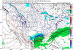
1737293812260.png
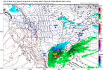
1737293587999.png
 
to my vantage, a solid amount of negativity is because of the trends and the inertia of those trends. I think the main one has been more southeastward press with the northern stream which lowers the tide for everyone. There’s still room and under the hood the southern stream wave has made some marginal improvements. There’s some twinkles of hope for select members for these 12z models if you squint hard. I think the most important thing will be getting that northern stream to relax some or slow down
 
We are still out 48 hrs, before the Lp, if there is one forms in the Gulf. I know the Models are going on data they receive as this system approaches and changes according to ground truth. I know it is exciting when we are in the jackpot, and disappointing when we are just outside, but we can't have much certainty until the LP appears and starts moving across. Its not time to cry or to celebrate!
Just look how much the Gfs has changed in 48 hours. I have definitely seen it move north (more times than not) more than that before in 48?
View attachment 165434
View attachment 165433
And yes I think that weird front running finger over north ga is a symptom of a slightly healthier southern stream look that’s emerged
 
Back
Top