-
Hello, please take a minute to check out our awesome content, contributed by the wonderful members of our community. We hope you'll add your own thoughts and opinions by making a free account!
You are using an out of date browser. It may not display this or other websites correctly.
You should upgrade or use an alternative browser.
You should upgrade or use an alternative browser.
Wintry January 21-23 2025
- Thread starter SD
- Start date
beanskip
Member
Surface low is 1012mb at 60 hours -- had been 1016 at 0z Wednesday the prior 3 runs.
RollTide18
Member
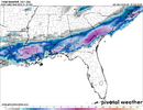
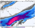
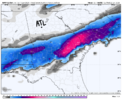
NAM looks a lot better, even I need this north trend for more precip
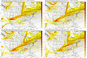
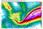
I think we need that kicker entering Alberta further west to help the northern stream from getting pushed eastView attachment 165466
surprise! this is not a model progression, it is a trend lol
it actually looked like there was a little more press that got balanced out by better tilt on the shortwave amplifying heights ahead a little bit. all in all, i think this could be a redeeming run for the coast, and for my mom, who texted me this morning asking why wilmington is only getting 2 inches nowNS press backed off here?
Webberweather53
Meteorologist
We’re largely settling in to a solution with this storm and I don’t hate where we’re at, esp knowing what will be forcing the a lot of the precip here (warm advection aloft).
beanskip
Member
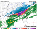
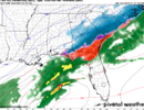
NAM a bit faster than prior runs -- also a little more NW component to precip shield. Still a brutal ice/sleet storm for north Florida/SE Ga.
rburrel2
Member
SimeonNC
Member
I think this is the first run that brings precip back to the mountains, which is a good sign
NAM is better & a little faster.
RollTide18
Member
it actually looked like there was a little more press that got balanced out by better tilt on the shortwave amplifying heights ahead a little bit. all in all, i think this could be a redeeming run for the coast, and for my mom, who texted me this morning asking why wilmington is only getting 2 inches now
Seemed a little colder for sure, there was less sleet and more snow in the FL Panhandle this run
We’re largely settling in to a solution with this storm and I don’t hate where we’re at, esp knowing what will be forcing the a lot of the precip here (warm advection aloft).
Do you still think we see the precip shield expand further North as we near closer?
rburrel2
Member
That stupid kicker in the Pacific northwest has been trending faster for like 36 hours now... if we could get that puppy to bounce back the other way over the next few runs we would really be cooking.
GeorgiaGirl
Member
Webberweather53
Meteorologist
SimeonNC
Member
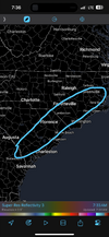
Hey it’s hr 66 and I’ve seen bigger shifts inside 48 before. I’m a snow weenie and I’m tracking this until I see snow 200 miles to my southView attachment 165473
This is gonna be a meme associated with me isn't it? lol Anyway, with what the NAM is showing and this, I don't hate where I'm at in CLT.
Tokenfreak
Member
I’m in that area too. Hopefully we get a decent amount but we shall see.I would definitely say this is a "NAM'ing", but I don't think it'd be for anyone on this board outside of accu, RollTide, and Phil (close to it for me):
View attachment 165470
I'd take it though personally.
Cotton country smoked. I did contract work down in the Allendale, Hampton, Fairfax area for many years. Hot summersInsane gradient.
View attachment 165474
That's pretty much what I'm thinking as well. Higher ratios, no mixing. I actually told my mom this yesterday (lives in Benson) to get the bed sheets ready, the kids and I may be coming for a visit! Been a long time for folks in that area as well. A lot of sleet or rain events when others just to the north cashed in.I think the sweet spot in the Carolinas is probably gonna be along or just east of I-95. Closer to the coast I’m afraid mixing with sleet could be an issue
View attachment 165471
BHS1975
Member
How does this compare to Jan 2014 at this stage?
Parts to the north are sorta on life support and this is the thin limb we are on we shall see if can slowly build anything back but man its been pretty rock bottom for 24 hoursWe want to keep this trend without sacrificing any more eastward movement. In fact let’s move it 200 miles west and keep the tilt goingthat’s how I’d draw it up in a perfect world View attachment 165468
No doubt. Hard to think it will be that tight on the cut off. Maybe??Insane gradient.
View attachment 165474
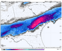
Insane gradient.
View attachment 165474
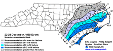
I saw this type of gradient with the December 1989 coastal snow event. I had about 3", 20 miles to my west, just a trace. One county east was 10"+.
Iceagewhereartthou
Member
I don't know about track and qpf, but the precip type on the graf did TERRIBLE for the upstate. It consistently showed much of the upstate as all snow for the entirety of the event and that could not have been more wrong.How did the GRAF do for our area for the January 10 storm? I do know it was one of the few that showed the precipitation starting earlier than the other forecast. As I didn’t understand why schools still didn’t go to elearning the night before when it kept showing sleet starting during the time of the early dismissal.
SimeonNC
Member
I will say for areas in the CLT region, GSP, and Atlanta, if we get any unexpected measurable snow, especially on the roads, even if it's a half inch or so. We might end up having an January 2014 situation when it comes to traffic that next morning.
Tokenfreak
Member
albertwilsonjr
Member
I don't know about track and qpf, but the precip type on the graf did TERRIBLE for the upstate. It consistently showed much of the upstate as all snow for the entirety of the event and that could not have been more wrong.
That because most of it melted due to was
Sent from my iPhone using Tapatalk
Snow began at noon for me and didn’t really start to stick until 2:30.That because most of it melted due to was
Sent from my iPhone using Tapatalk
justin2k23
Member
- Joined
- Jan 3, 2017
- Messages
- 25
- Reaction score
- 39
Dublin Ga here. I'd do backflips if that "NAMing" happened here!I would definitely say this is a "NAM'ing", but I don't think it'd be for anyone on this board outside of accu, RollTide, and Phil (close to it for me):
View attachment 165470
I'd take it though personally.
rburrel2
Member
It was actually way too dry in the Upstate. It had hardly anything falling after the initial round of precip moved through, and we wound up getting like 1/2 inch of liquid from that.I don't know about track and qpf, but the precip type on the graf did TERRIBLE for the upstate. It consistently showed much of the upstate as all snow for the entirety of the event and that could not have been more wrong.
Sctvman
Member
James Island getting 2" and Mt. Pleasant 7 would be wild. And Georgia Southern, expect to be out the rest of week.Insane gradient.
View attachment 165474
BKWRN29
Member
Why would it not be likely? I can’t even tell you have many times I have been in the sweet spot or southern cut off line at this time frame and ended up with nothing. That is why I am hopeful things will tread NW like they always do!Speaking as a homer - would take about a 60 mile shift on the NAM to bring significant impacts to ATL. So 60 miles in the next 60 hours. Feels pretty doable? But also not likelyView attachment 165478

