-
Hello, please take a minute to check out our awesome content, contributed by the wonderful members of our community. We hope you'll add your own thoughts and opinions by making a free account!
You are using an out of date browser. It may not display this or other websites correctly.
You should upgrade or use an alternative browser.
You should upgrade or use an alternative browser.
Wintry January 21-23 2025
- Thread starter SD
- Start date
1 in 10 chance but you can see das finger of moisture.
We need to miss it entirely here
- Joined
- Jan 2, 2017
- Messages
- 1,566
- Reaction score
- 4,279
It's like Lloyd said...so you're saying there's a chance!1 in 10 chance but you can see das finger of moisture.
Just don't feel like the wild swings are done yet.
SimeonNC
Member
Thought GSP's discussion on the event from this afternoon was interesting
As of 200 PM EST Saturday: Strong arctic airmass will be in the
midst of spilling over the southeastern CONUS Monday as a strong
arctic surface high moves in across the Plains and stout CAA
filters in across the area. Factor in very broad upper troughiness
over most of the CONUS and the stage will be set for a very cold
and dry airmass. An upper ridge will begin to build over the West
Coast and eastern Pacific Monday into Tuesday and will allow for a
shortwave to carve out across the Southern Plains by Tuesday. As the
trough begins to sharpen from the Great Lakes region through the MS
Valley, surface cyclogenesis will be underway within the coastal
baroclinic zone over the Gulf of Mexico. In this case, a surface
low is expected to develop over the western Gulf of Mexico and push
across the Gulf of Mexico Tuesday through Wednesday. Depending on
the track of the low and how close or not close it will be to the
Gulf Coast will play a vital role into what the CFWA receives. The
cold air through the vertical column will be established, so any
precipitation that does fall will be all snow. This is a rare
occasion where the best chances of snow will actually be along and
south/east of I-85. Right now, model guidance only give our CFWA
a glimpse of snow as there is a lot of dry air in place for the
atmosphere to overcome for snow to reach the surface. The better
isentropic lift and available moisture will be to our south and
east, mainly over the Midlands/Pee Dee/Low Country. If the surface
low trends northwestward, closer along the Gulf Coast, then the I-85
corridor points south will be in business for a decent winter storm
that will be all snow. P-type concerns will remain well to the south
where WAA in the mid-levels could create this concern. There is the
instance that the area doesn`t receive much as the dry air will
eat into our snow chances and the storm track becomes suppressed
too far south and the areas just mentioned end up being the big
winners as far as snow amounts. Model guidance still favor a more
coastal track, but there are still uncertainties as the guidance
continues to waffle on the location of the surface low and how much
moisture is available. Once the high resolution models get a hold of
the system, then we will have a much better understanding of what we
will see and how much. A northwestward trend of ~50 miles for the
surface low and from what the model guidance currently indicate
could be the difference between hardly anything at all and a major
snow storm.
NBAcentel
Member
Basically want that wave out west to dig more equatorward - but not further west into the weakness/ULL. But want the northern stream further west
Blue_Ridge_Escarpment
Member
If we could actually get a couple more of these nudges we could get the big dog back in play, but every cycle we take one step forward, the next cycle we go backwards. Good step, but we'll have to see if we can keep it going.
Blue_Ridge_Escarpment
Member
Higher heights for sure in SE at hour 42
ForsythSnow
Moderator
I see more dig less interaction with the pac low so far. Good signs. Let's see if the NS and SW phase again.
NBAcentel
Member
Basically want the trough axis closer to a 6 clock position vs a flat 9:10 position. The closer it is the golden 6 a clock position aka closer to neutral, the better
beanskip
Member
Yeah the pacific low seems to be cooperating, but not sure I'm seeing what we want from the NS.I see more dig less interaction with the pac low so far. Good signs. Let's see if the NS and SW phase again.
- Joined
- Jan 23, 2021
- Messages
- 4,602
- Reaction score
- 15,197
- Location
- Lebanon Township, Durham County NC
NBM up to 4.5” here 

Nam is probably going to be better than 18z but it's still loading too much energy in the Vegas/so Cal region
can post the latest NBM?NBM up to 4.5” here
Six Mile Wx
Member
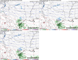
Wave dropping in much faster on the 0z Nam
NBAcentel
Member
ForsythSnow
Moderator
Was just about to post the same. That's a huge change across the board on positioning. I think the speed of the northern energy could potentially be driving a divide between the SW and that annoying low in the Pacific.
beanskip
Member
That's a pretty big shift at 63 hours, even for the NAM.
I hate kicking energy until it's helping energy then I love it
Forevertothee
Member
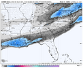
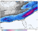
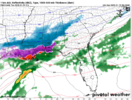
It has a 1065 H at this moment over Colorado.Precip a bit better at 60 back west
View attachment 165296
- Joined
- Jan 2, 2017
- Messages
- 1,566
- Reaction score
- 4,279
This LP track from here is key for usPrecip a bit better at 60 back west
View attachment 165296
From an ATL imb perspective. This is a crazy storm coming for us. This setup hardly ever happens. Wicked cold in place with 100% of our precip coming in frozen form.
NAM should be improved. Nowhere near 12z but should be better
SimeonNC
Member
Interesting how the NBM keeps increasing, even with the bad runs lol
beanskip
Member
At 66 hours, NAM definitely getting friskier with QPF. Not quite back to 6z run from earlier today but a nice comeback.
ForsythSnow
Moderator
Nam is trying hard here, you’d think there would be more precip with that look. Looks more overrunning to me
beanskip
Member
This is a great start to the 0z suite!
NBAcentel
Member
The nam is a little bit more progressive with the northern stream but the southern wave digging more equatorward and the southern wave tilted better is inducing a bigger forcing response
Correct me if I am wrong, but I think that also includes the second system for Thur/Fri timeframe?
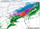
You know it's a lot more WAA/wetter when it starts out as rain and sleet in coastal SC and then turns over to hard sleet. Haven't really seen much of that rain start yet on modeling. Maybe its a timing thing too though.

