-
Hello, please take a minute to check out our awesome content, contributed by the wonderful members of our community. We hope you'll add your own thoughts and opinions by making a free account!
You are using an out of date browser. It may not display this or other websites correctly.
You should upgrade or use an alternative browser.
You should upgrade or use an alternative browser.
Wintry January 21-23 2025
- Thread starter SD
- Start date
beanskip
Member
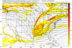
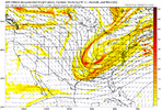
Upper level changes not really translating to the sensible weather, but it's the kind of thing that might be a good harbinger for the 0z run.
NBAcentel
Member
This honestly looks like a sloppier version of January 21st 2022 if we can fix the northern stream. Almost same footprint. we were staring down bad trends around this range as well, but we flipped it towards hr 48. Don’t know if we do it again this time
Cad Wedge NC
Member
Don't really understand why that didn't result in a much better surface reflection. H5 still not there but, looked much improved.
I must be missing something. 18z NAM and 18z GFS looked opposite regarding depth of the energy out west & interaction with the pacific LP, but output very similarly at the surface. Looking at h5, you'd expect the outcomes to be very different.
Tsappfrog20
Member
I must be missing something. 18z NAM and 18z GFS looked opposite regarding depth of the energy out west & interaction with the pacific LP, but output very similarly at the surface. Looking at h5, you'd expect the outcomes to be very different.
It will work out at 0z
Sent from my iPhone using Tapatalk
NBAcentel
Member
Reason why gfs sucked is because while the northern stream digged more, regionally the whole height field was further suppressed
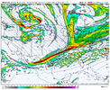
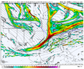
it’s didn’t really make much of a difference in particular on this run. But ideally you’d like to see the northern stream not outrunning the wave as much as it has been in recent runs. This run started better but looks like we ended up losing the northern stream a bit quicker so it was basically a wash in the end. If you can get that interaction to be more naturally north/south tilted like the Canadian was doing yesterday. You get a lot of precip.Learning here… What exactly makes this better? is it better in terms of more precip and a wider storm?
18z GFS
12Z Canadian yesterday (sadly this seems out of reach now)
SnowDoomer21
Member

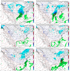
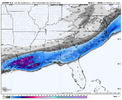
Good snow totals coming off the RGEM for the southeast but in my opinion it may be overdoing it some
Sent from my iPhone using Tapatalk
I do wonder what the 2nd wave Thursday into Friday is going to do
Six Mile Wx
Member
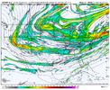
The interaction between our big vortex and the western Ridge is what’s going to make or break us. At this point it’s still very much undetermined. We don’t want our northern stream digging west as the Euro and NAM showed today. We want it to dig southwest and grab the wave diving south, pulling it out of there just before getting squashed by the collapsing ridge that’s falling down the jet stream. We have a little over 24 hours before that interaction takes place. We’ll see what happens.
Latest GFS also showing the trough digging too deep, hanging back, and getting squashed by the jet.
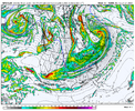
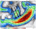
Latest GFS also showing the trough digging too deep, hanging back, and getting squashed by the jet.


WeatherManNC
Member
Anyways the euro has been consistent at showing a northward trend so I’m tossing the gfs and relying on it + the cmc
GeorgiaGirl
Member
Eh, it'd be nice if the ULL got scooped up, but it's not really necessary (would be to score big though).
It'd be better if the wave dropping out of Canada missed interaction at this point. The Euro showed a way to score that way.
Anyway, the GEFS seems a bit more suppressed.
It'd be better if the wave dropping out of Canada missed interaction at this point. The Euro showed a way to score that way.
Anyway, the GEFS seems a bit more suppressed.
packfan98
Moderator
I don’t care how disappointed you are right now. This is not the thread for banter and trolling posts and posters will not be allowed.
packfan98
Moderator
One more crap post in this thread will get you locked out.So the 18z GFS just puts no snow in sc, nc, and ga. This is why it sucks
RollTide18
Member
MichaelJ
Member
If we can get the N stream to slow down or the SW to speed up there is still a chance, small one but at least a hope
gawxnative
Member
SUPER EASY to understand for all…. He says what some others have…. Easiest way to get this further NW is to sacrifice the HP to a degree. Like it’s that simple …. Kind of. Also “NW trend is only gospel to STRONG LP’s…. This is around 1015 … that’s not strong enough to wrap up and bend backwards NW that’s why it’s sliding or staying South, SE”
Sent from my iPhone using Tapatalk
Keep in mind that "Polar/Artic" highs do tend to "flatten out" more when they spread deep into SE... Bill Harms longtime MIC for KATL office explained that at an AMS meeting I attended back in early 80's
Pops
Member
Has this energy been sampled tet?
Nice catch. GEFS followed same gameplan. H5 looked significantly better but heights in the south got suppressed like a lowering tide. Enough to really shut off lift and shunt qpf south. Despite the disappointing result… really something to keep an eye on if this is the start of a trend reversalReason why gfs sucked is because while the northern stream digged more, regionally the whole height field was further suppressed
Tokenfreak
Member
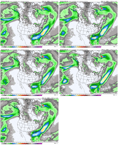
GEFS completely lost the storm on all members it looks like. Good lord.
Tokenfreak
Member
Member 5 has a little something but that’s about it unfortunatelyGEFS completely lost the storm on all members it looks like. Good lord.
Seems like a slightly important Euro coming up. Just slightly
WolfpackHomer91
Member
Seems like a slightly important Euro coming up. Just slightly
100% it improves …. Just to Laugh at us, but in all seriousness, if it did hold especially improve … you gotta wonder just what in the Heck happened on GFS. I mean , Trending worse …. Sure. Losing the storm completely has to be a glitch or something
Sent from my iPhone using Tapatalk
packfan98
Moderator
I hope the 0z suite can give us a little hope and something to build a grand with tomorrow. Otherwise, it’s pretty bleak for many of us.Seems like a slightly important Euro coming up. Just slightly
I want some of what your having... definitely been a crap overall day maybe 00z runs will turn frowns upside down and this epic cold and systen just being hard to model because we sorta been all over place in models for past 3-4 daysMan when this thing comes roaring back tomorrow it’s going to be epic.
SnowDoomer21
Member
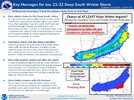
The NWS in New Orleans just up the snow totals on their watch
Sent from my iPhone using Tapatalk
Sent from my iPhone using Tapatalk
They will start coming in around 9pm up thru after midnightJust a general question when do the 0z runs begin? I'm new here and get confused between Z Time and EST/EDT time
going to be odd almost if it holds serve. I give it a 10/100 chance considering those dreadful ensembles we just sawSeems like a slightly important Euro coming up. Just slightly
BKWRN29
Member
Isn’t the GEFS really for long range and becomes less accurate the closer to the event?GEFS completely lost the storm on all members it looks like. Good lord.
Euro pretty consistent except for that 00z run last night where I made a fool of myself. Just to be clear on where I stand, I think we can still see a northwest adjustment absolutely. In fact, I think it's probably going to happen. But as @packfan98 said, our ceiling has lowered significantly most likely, unless we can somehow back the trough axis up. There's still time to do it, but not much (to increase our ceiling).
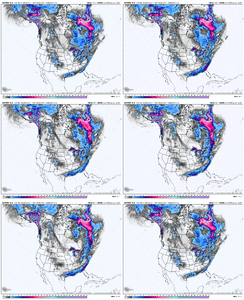

I think most of us can live with that. The timeframe for NW movement is shrinking, but there is still some wiggle room.Euro ticked south but basically a hold from 12zView attachment 165232

