• Hello, please take a minute to check out our awesome content, contributed by the wonderful members of our community. We hope you'll add your own thoughts and opinions by making a free account!

Pattern January 2021 - Joyless January

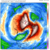
I don't know, I'm really not a fan of the N Pacific/AK low. That sucker looks like it wants to hang around a while. The NAO looks to go nicely negative but I think the pacific has the potential to really hurt us, keep us marginal on temps. Can't see the EPS at this range but I hope the expected western ridging starts showing up soon.

1608736256979.png
 
What does this mean for southeast?

Sudden stratospheric warming events usually lead to significantly colder than normal weather in the SE US (shading & stippling). Since 1958, about 75% of SSWEs that occurred in December or January have been followed by below average temps here. It's not a guarantee that the stratospheric circulation anomalies will propagate into the troposphere, but these types of events have been associated with very prolonged periods of high latitude blocking that increase our chances for cold & sometimes snow.

SSWC_tsfcAnom60_JRA55_compOnly.png
 
Sudden stratospheric warming events usually lead to significantly colder than normal weather in the SE US (shading & stippling). Since 1958, about 75% of SSWEs that occurred in December or January have been followed by below average temps here. It's not a guarantee that the stratospheric circulation anomalies will propagate into the troposphere, but these types of events have been associated with very prolonged periods of high latitude blocking that increase our chances for cold & sometimes snow.

View attachment 59620

Do you know what factors lead to cold air making it into the troposphere? Like are there any noticeable pattern differences for when we get cold (instead of the alternative)?
 
I don't know, I'm really not a fan of the N Pacific/AK low. That sucker looks like wants to hang around a while. The NAO looks to go nicely negative but I think the pacific has the potential to really hurt us, keep us marginal on temps. Can't see the EPS at this range but I hope the expected western ridging starts showing up soon.

View attachment 59618

Continental polar air masses are fine in the heart of winter, & odds are the wavelengths will probably end up being a bit shorter than shown on this ensemble mean. Moderately below average temps with storminess is a good look for us in early January when our climo is in the low 50s. It's a strong Miller A pattern which often screws over folks like you in the SW piedmont unfortunately.
 
Do you know what factors lead to cold air making into the troposphere? Like are there any noticeable pattern differences for when we get cold (instead of the alternative)?

The biggest differences I've noticed off the bat are that the colder patterns following early-mid winter SSWE were more frequent earlier in the record (long-term warming of the climate to blame) and are more frequent in El Ninos than La Ninas.

Oth, I'm actually not sure if that's largely because of the wave pattern created by El Ninos that naturally suppresses the SE ridge or is it tied to the propensity for SSWEs in El Ninos to be displacement (k = 1, polar vortex is shoved equatorward/off the pole), whereas in La Nina SSWEs are more frequently k =2 (polar vortex splits into 2 (or more) pieces)? This year we're actually going to see more of a displacement SSWE which is an El Nino-like SSWE, so this may throw a wrench into things & given how this December is one of the coldest in the past decade, it gives me hope we can take a different path this time around
 
Continental polar air masses are fine in the heart of winter, & odds are the wavelengths will probably end up being a bit shorter than shown on this ensemble mean. Moderately below average temps with storminess is a good look for us in early January when our climo is in the low 50s. It's a strong Miller A pattern which often screws over folks like you in the SW piedmont unfortunately.
is Miller a good for upstate mainly north of i85
 
Continental polar air masses are fine in the heart of winter, & odds are the wavelengths will probably end up being a bit shorter than shown on this ensemble mean. Moderately below average temps with storminess is a good look for us in early January when our climo is in the low 50s. It's a strong Miller A pattern which often screws over folks like you in the SW piedmont unfortunately.

I'd argue that Miller B's are worse for CLT area than Miller A's. And I do like the above pattern for Miller As like you say. If we're going to be dealing with pacific origin air masses, we better hope the 50/50 low is cranking some serious confluence with cold air in SE Canada in place. It would just be so much easier with a nice AK/WC ridge. But I guess that's how we roll.....
 
I'm a bit surprised Charlotte and the surrounding region doesn't do well with Miller A's. Atlanta does well with them, so logically, I would expect that to translate downstream to the upper half of SC and the western half of NC considering Millers A's SLPs like to ride the coastline along the Gulf and Atlantic. I assumed Charlotte would get decent moisture from them.
 
I have always seen our best snow storms happen from Miller A's in the upstate. They just don't happen anymore at this point. Miller B's are more common since generally our cold air source is from CAD but that is almost always going to be ZR/Sleet. Even if we do get Miller A tracks it's always when cold air isn't to be found.
 
I'd argue that Miller B's are worse for CLT area than Miller A's. And I do like the above pattern for Miller As like you say. If we're going to be dealing with pacific origin air masses, we better hope the 50/50 low is cranking some serious confluence with cold air in SE Canada in place. It would just be so much easier with a nice AK/WC ridge. But I guess that's how we roll.....

I Want to agree with you here in the NW Piedmont. Just from past experience, when the coastal transfer is taking place, there tends to be a nice little dry slot that forms, and it's usually over the western piedmont through charlotte.
 
I Want to agree with you here in the NW Piedmont. Just from past experience, when the coastal transfer is taking place, there tends to be a nice little dry slot that forms, and it's usually over the western piedmont through charlotte.
Yep, this ? unless it’s a super amped one, then gg lol
 
I'd argue that Miller B's are worse for CLT area than Miller A's. And I do like the above pattern for Miller As like you say. If we're going to be dealing with pacific origin air masses, we better hope the 50/50 low is cranking some serious confluence with cold air in SE Canada in place. It would just be so much easier with a nice AK/WC ridge. But I guess that's how we roll.....

Miller Bs are better for CLT than Miller As imo based on research I've conducted for winter storms going back to the late 1800s. You rarely see a real big snowstorm in Charlotte w/ a Miller Acoastal low because the axis of heavy snow is usually well to your east or NW w/ the SW piedmont being dry slotted in the process from the coastal transfer. No storm epitomizes this tendency more than Dec 2010


December 25-26 2010 NC Snowmap.gif


I looked at over 100 storms since 1948 in NC which produced at least 1" of snow in at least 3 of the 5 locations: (Charlotte, Greensboro, Raleigh, Norfolk/Elizabeth City, Wilmington).

Be careful what you wish for because Charlotte usually gets screwed over in Miller As relative to places like RDU & GSO, seeing on average ~50% less snow than RDU & about half of what GSO sees. Notice however the averages over a few-several tens of Miller Bs &/or Hybrid Miller A-Bs are basically indistinguishable between GSO, Raleigh, & Charlotte. (Many of these hybrid events are overrunning (like Jan 88)).

Screen Shot 2020-12-23 at 10.50.59 AM.png
 
is Miller a good for upstate mainly north of i85

Usually they aren't (w/ rare exceptions like Mar 1993), you'll often get dry slotted in Miller As unless the coastal cyclone is very strong, at which point warm advection would entice mixed precip or cold rain w/ snow mainly confined to the mountains & far NW piedmont of NC. Your best bet in the upstate of SC and southwestern piedmont of NC to Charlotte is to hope for CAD, a hybrid Miller A/B, &/or overrunning event w/ deep arctic air mass being well established in advance of prolonged light-moderate precipitation (Jan 1988 for ex). Upper lows (Feb 1969, Feb 2004, & Mar 2009 for ex) are also capable of being pretty kind to the SW piedmont.
 
Usually they aren't (w/ rare exceptions like Mar 1993), you'll often get dry slotted in Miller As unless the coastal cyclone is very strong, at which point warm advection would entice mixed precip or cold rain w/ snow mainly confined to the mountains & far NW piedmont of NC. Your best bet in the upstate of SC and southwestern piedmont of NC to Charlotte is to hope for CAD, a hybrid Miller A/B, &/or overrunning event w/ deep arctic air mass being well established in advance of prolonged light-moderate precipitation (Jan 1988 for ex). Upper lows (Feb 1969, Feb 2004, & Mar 2009 for ex) are also capable of being pretty kind to the SW piedmont.
So with this pattern that is coming up in January are you seeing more of a Miller A pattern setting up
 
Back
Top