Stormlover
Member
True, but Trevor isn't winning either Heisman or Natty.Ask about how to read maps. Not every red means bad. Don’t take what you see for face value.
")
True, but Trevor isn't winning either Heisman or Natty.Ask about how to read maps. Not every red means bad. Don’t take what you see for face value.


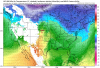
Lol wheres that torch it showed the week of Christmas ? doesn’t look right to me, would think something gets buried under the blockI don't think this is going the way we think it's going. Or hopefully GEFS is out to lunch.
View attachment 60208
View attachment 60210
What's the EPS look like?I don't think this is going the way we think it's going. Or hopefully GEFS is out to lunch.
View attachment 60208
View attachment 60210
True, but Trevor isn't winning either Heisman or Natty.


Lol wheres that torch it showed the week of Christmas ? doesn’t look right to me, would think something gets buried under the block
Yeah looks horrible.Wait no..... I take back what I said, lolView attachment 60215
Yeah looks horrible.


It better block as hard as it can. The Pacific is a train wreck and getting worse.BUT that -NAO will save us!
Sent from my iPhone using Tapatalk
As long as the SER isn’t pictured I think we’re going to be just fine.I don't think this is going the way we think it's going. Or hopefully GEFS is out to lunch.
View attachment 60208
View attachment 60210
This pattern favors transient periods of warmth and cold overall it’ll end up seasonable and I don’t see anything yet to change my thinking on that.Wait no..... I take back what I said, lolView attachment 60215
Honestly yeah I’m not that worried, as long as we don’t see a wall to wall southeast ridge, that’s the killerAs long as the SER isn’t pictured I think we’re going to be just fine.
It better block as hard as it can. The Pacific is a train wreck and getting worse.
We can get every single kind of pattern in the winter except a cold and stormy one.Honestly yeah I’m not that worried, as long as we don’t see a wall to wall southeast ridge, that’s the killer
Better than a death ridge parked over us though, That pattern > -EPO/-PNA/southeast ridge by a mile, at least with that look you can get cutoffs and certain other things like that, a southeast ridge is just a complete shutoutWe can get every single kind of pattern in the winter except a cold and stormy one.
Agreed! I think this winter models will trend colder closer to verification time. Remember December WAS forecasted to be above normal.This pattern favors transient periods of warmth and cold overall it’ll end up seasonable and I don’t see anything yet to change my thinking on that.
We can get every single kind of pattern in the winter except a cold and stormy one.


Why are these events always at the tail end of the models? Can't we at least get there at D8 or something so we can run it forward a couple more frames?!You guys keep freaking out, I don’t see anything wrong with this pattern, as long as we can get some shorter wavelengths into the pattern, we can score with an event. Nobody posted this, but this was the CMC last night.
View attachment 60228
View attachment 60229
I thought the mountain torque was going to save us?Why are these events always at the tail end of the models? Can't we at least get there at D8 or something so we can run it forward a couple more frames?!
Exactly....nothing is going to "stick" around for long...warm or cold. Just have to time the cold with moisture, which is ALWAYS tough in the SEThis pattern favors transient periods of warmth and cold overall it’ll end up seasonable and I don’t see anything yet to change my thinking on that.


Sent from my iPhone using Tapatalk
This has been consistently appearing on the euro/CMC with some sort of southern/suppressed wave yet there’s still complaining, lol, I know we live in the SE and it’s far out but that’s a good look
Mountain torque and the downstream pattern that emanates from it evolves over periods of 2-3 weeks, there will be at least muted +PNA with an extended pacific jet like thisI thought the mountain torque was going to save us?
Yep as long as that big block sits over Greenland there isn’t going to be much in the way of an extended warm up or southeast ridge anytime soon, quite the opposite actually.Exactly....nothing is going to "stick" around for long...warm or cold. Just have to time the cold with moisture, which is ALWAYS tough in the SE


Webb our local met said temps would moderate in the long range. I dont know what theyre seeing to determine that.Yep as long as that big block sits over Greenland there isn’t going to be much in the way of an extended warm up or southeast ridge anytime soon, quite the opposite actually.

Smh. It sucks hereWe bouta do this poop again ? View attachment 60265