smast16
Member
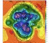
The gefs is actually showing blue colors at
The surface in the longer range ? Almost can’t believe it View attachment 63539
Doom
Going to be pipes bursting with your pants.
The gefs is actually showing blue colors at
The surface in the longer range ? Almost can’t believe it View attachment 63539
Doom
Yes! Cash money. This is about the best we can do. IF this ends up verifying, we have very cold air nearby, very favorable teleconnections, an active pattern, and a pretty favorable longwave trough orientation. I think generally, the biggest issue would be suppression. But I'd way rather risk that and have too much cold than deal with these stupid marginal air masses where the warm nose runs up to the moon and where the frozen/liquid demarcation zone runs NW from the extreme upstate through west-central VA.

Hell yes. Jimmy stamp of approval.This is January 2018 but basically with a -NAO View attachment 63533View attachment 63534


I love clippers, more than you NC peepsYes! Cash money. This is about the best we can do. IF this ends up verifying, we have very cold air nearby, very favorable teleconnections, an active pattern, and a pretty favorable longwave trough orientation. I think generally, the biggest issue would be suppression. But I'd way rather risk that and have too much cold than deal with these stupid marginal air masses where the warm nose runs up to the moon and where the frozen/liquid demarcation zone runs NW from the extreme upstate through west-central VA.


January 1985 says hi...

Looking off that map looks like a -WPO was maybe trying to get going
January 1985 says hi...


December 17 redux?Something did happen View attachment 63832
December 17 redux?


Both the GEPS and EPS are similar in their look as well. Only time will tell if they are right and if it leads to winter weather for the SE.


That should swing SE. hmm for real.
That should swing SE. hmm for real.