Not all of usNC crush job !!!
Sent from my iPhone using Tapatalk

Not all of usNC crush job !!!
Sent from my iPhone using Tapatalk

Hope your rightExactly what I figured we would seen soon enough. The blocking we have over top and strong confluence isn’t going to let this thing go north and likely will push it further south. You’re seeing the cold getting pulled in better as well. I think we have room for a little more south trend but don’t be surprised to see the temps get even better the closer we get.
Only way ULL really work is either you have to get the most perfect track and formation and hope it goes just to your south or in this case have double barrel blocking so that it can’t cut north. The ULL followed I20 to a T and the upstate was finally put in the game. That’s the perfect tract.Hope your right
A lot can go wrong. It could be too far south or too far north..MBY crushjob. What could possibly go wrong these next 5 days lol.
Yea verbatim it's too warm in south Charlotte for some reason (directly east)Only way ULL really work is either you have to get the most perfect track and formation and hope it goes just to your south or in this case have double barrel blocking so that it can’t cut north. The ULL followed I20 to a T and the upstate was finally put in the game. That’s the perfect tract.
Soundings are better this run. 36 at the surface causing rain output but with better precip rates we could overcome it. Good look at this point.Yea verbatim it's too warm in south Charlotte for some reason (directly east)

Finding stretchy pants to put on.


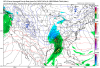
That thin triangle of light grey/white is directly over my house. Fml

Still tons of warm advection and very strong deep-layer veering in these soundings from RDU-GSO. RDU-CLT rain-snow line is likely at best very generous given what the GFS is showing verbatim
View attachment 62294

This should be far enough South for your area but I still think folks SE of RDU are out on this one.
Wow. Metro ATL in play on that map. The trends are...interesting.
Yep looking bad . Icon cut as well2nd system going to be a cutter. Goes from suppression to cutter. Lol Thanks gfs. Us in the western areas just can't win. LolView attachment 62298
Meh, not worried about 2 garbage models this far out making a 400-500 mile shift of the low in one run. Euro has our back..Yep looking bad . Icon cut as well
The ukmet does.Play by play incoming: “The ensembles don’t really support the OP.”
What model is thatWow. Metro ATL in play on that map. The trends are...interesting.