It seems a good chuck is!This might be snow, about to find out shortly View attachment 61945View attachment 61946

It seems a good chuck is!This might be snow, about to find out shortly View attachment 61945View attachment 61946
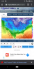
It doesn’t look amped enough.This could be interesting as well, phasing systems getting stuck under the block in the NE View attachment 61947
Yeah could get sheared outIt doesn’t look amped enough.
Nice table setter if we can get some true arctic air the next two weeks after that..It seems a good chuck is!
View attachment 61949


By MA you mean mountain areas right? LolMid Atlantic weenies will rejoice. Last second nw trend will bring us yet more cold rain from this. Bleh
Mid AtlanticBy MA you mean mountain areas right? Lol
Eric’s just salty Fayetteville doesn’t have a chance.By MA you mean mountain areas right? Lol
")
Yeah there’s a cozy spot waiting back in Charlotte that increases chances by like 1000% hahaEric’s just salty Fayetteville doesn’t have a chance.
KU usually happens when the nao starts to break down and trend positive, most models depict this evolution occurring just prior to mid month

Is this mostly rainParallel GFS FTW!! ?
View attachment 61956
HuhIs this mostly rain


Is this mostly rain
what about the frame before that one I thought this one was the regular gfs
My goodness That may be worse than the icon and hrrr combinedParallel GFS FTW!! ?
View attachment 61956

Time to break out the skis! Sugar mountain it is!Final snowfall map:


Siberia and it’s cold bias lolllllIt looks like the CMC figured out how to tap into Siberia.
View attachment 61960
View attachment 61961
View attachment 61962

We've had an active pattern. We just have to wait until the heart of winter. Mid January. Oh wait lolMight not be the coldest pattern but it’s certainly an active one. That alone should provide at least a smidge of optimism.


The new DGEXParallel GFS FTW!! ?
View attachment 61956
That’s only good for Brick, we tossGive me this track. Yes yes and yes View attachment 61965


 here was a sounding close to my place


It’s not like probabilities are that high anyways.GEFS/GFS looking kinda solo right now, problem is, there more realistic View attachment 61972View attachment 61973View attachment 61974

Yeah it’s not that good looking at single ENS members, I guess better than last run thoughIt’s not like probabilities are that high anyways.
View attachment 61975