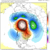
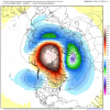
Good Question! From what I've read from HM, the leading cause of this pattern is the Ural Blocking and the Aleutian low caused by the +EAMT really have no correlation in regards to Enso. However, if you do add the filter of La Nina, these are your best analogs: "1973, 1974, 1975, 1988, 1995, 2000, 2005 and 2011." Not 2010, because I believe it had a fairly different look in the pacific.
1973- Gave us the major Wilmington Christmas storm and a total NC event.
1974- Mostly a dud except for one storm in December 1973
1975- Not too much that year, except for one CAD NC storm
1988- We got our big dog that year.
2000- Epic January, NC got their Big Dog.
2005- Relatively a dud except for a storm that I think a lot of the board got an event.
2011- Similar deal to 2005
Really mostly hits, although there were some misses. The -NAO's during those winters in the middle of the winter was fairly transient (One week-long), but did produce some fairly good storms.


