LickWx
Member
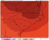
How disappointingNever really movedView attachment 68228
How disappointingNever really movedView attachment 68228

This is not a central SC storm.Wow still too warm for central SC need a stronger cold push.


At this point in time, it certainly looks unlikely that central SC will experience anything more than a cold rain. However, there does exist a non-zero chance that should be considered. why? (not in order by importance)This is not a central SC storm.

Although I think the GEFS/GFS will cave, I’d wait until they doShouldn’t we have a thread for weekend system?
Only made it to 21 today?Never really movedView attachment 68228
 ️
️
Probably tomorrow afternoon if the 0z and 12z hold or improve.Shouldn’t we have a thread for weekend system?
So now we need the Gfs on board but when the Gfs shows us a signifigant winter storm we question if it’s valid .. that’s a funny observation but it holds true it’s just that bad of a model ??Although I think the GEFS/GFS will cave, I’d wait until they do

So now we need the Gfs on board but when the Gfs shows us a signifigant winter storm we question if it’s valid .. that’s a funny observation but it holds true it’s just that bad of a model ??
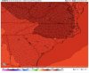
Mid-teens in CLT metro with single digits in VA and wedge building to keep pushing in the lower dewpoints. Hard to not be excited about that look.Woof @SD ,single digits in this bih, euro looked even more stout View attachment 68267
That’s why I’m not worried about the borderline temps the models are showing at this range. Single digit dews to our north and teens well into the upstate, and HP building in more and more every run. That screams some kind of winter weather, likely ice, but I could definitely see our temps continue to decrease another 3-7 degrees as we get closer on the globals.Mid-teens in CLT metro with single digits in VA and wedge building to keep pushing in the lower dewpoints. Hard to not be excited about that look.
That's what I'm talking about. What's the euro got for the high SaturdayWoof @SD ,single digits in this bih, euro looked even more stout View attachment 68267
Doesn’t go out that far but it’s trending colder on temps Saturday morning which probably translates to laterThat's what I'm talking about. What's the euro got for the high Saturday

Very good point, assuming there’s enough that there is still some snow cover lying around on Sunday, that would be a huge help. Snow on snow is so rare around here.Btw if we get even a few inches of snow cover from the first system, that helps ^^^^
I'd like to see the 1030 isobar making it's way inWant to continue to see that wedge get pushed further and further south west.
Not really, it's about the same, just a little different. It went down by about 0.3"Looks like the EPS backed off


It looks generally the same to me. H5 looks better with more ridging out west behind it. The wedge generally stayed about the same as did the temps.Looks like the EPS backed off
Confluence was a little bit East but yeah it wasn’t a trend to really worry about at allIt looks generally the same to me. H5 looks better with more ridging out west behind it. The wedge generally stayed about the same as did the temps.
Bruh. So Asheville in the 70s and we aren’t . Smh we are severely overdue , this is a once in a lifetime treat for those who aren’t fans or warm winter days . Give me the first half of Jan 2005 again. Would be more tolerable if I had some seasonably mild days but it looks solidly 6-7 degrees below average next 10 if not more .71 today at the AVL airport. Looking downright cold on Thursday though.