• Hello, please take a minute to check out our awesome content, contributed by the wonderful members of our community. We hope you'll add your own thoughts and opinions by making a free account!

Pattern January 2021 - Joyless January

I have a theory that’s I’ve been pondering on for a while due to climate change. Where all of the interstate corridors moved north. Used to be I40 would have almost sure fire winter weather week in and week out. The I85 corridor from the Piedmont through the upstate through Georgia would usually get 2-4 winter storms that usually had at least one big dog. And the I20 corridor would get 1-2 storm potentials a year. Now it seems like the I40 corridor is the new I85 and I85 is the new I20 and I20 might just see a winter storm every 5 or so years. If we can’t score with the amount of positives on our side during peak climo, this is just going to further push my idea that our traditional winter weather transition zones are moving further north.
 
I was just looking at the last frame compared to the same time of the 12z run. It's about 5-6 degrees warmer in most places

Sent from my Pixel 3 using Tapatalk
That’s because precip isnt falling yet, this system is driven off dynamical cooling, this run in fact would have maybe been good given the timing it was moving in E334AB2A-E504-4FE3-9FDB-B7FE57DFAC05.png19C6F5B6-6B2E-47EE-AAB5-C153DB3E163B.png
 
That’s because precip isnt falling yet, this system is driven off dynamical cooling, this run in fact would have maybe been good given the timing it was moving in View attachment 62157View attachment 62158

Don't really like the fact that we're also having to rely on dynamical cooling to push us down to freezing in light of how much warm advection there's gonna be. It would be one thing if we actually had the cold air in place prior to precip arrival.
 
EPS mean is screaming at folks in the mid-atlantic imo. This looks like cold rain for much of NC outside the mtns with a few last second NW tweaks to the frontogenetically-induced band of snow in the wrap around CCB. Maybe we get some flurries but that would be a win in this setup

Sheesh...I mean someone is going to get under a sub 1000mb low while heights crash, whether that’s NE NC or DCA we don’t know yet, but it’s worth watching. We’re very much in the game, RDU north and NE. Can’t really discount anything at this juncture. But I admittedly live for setups like this that tend to over perform.
 
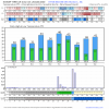
The GFS is extremely impressive with the upcoming warming percentilewise, especially at 70-100 mb. This shows 90N to 60N average temps reaching near record highs of 218 K for mid Jan at the 100 mb level of the atmosphere near midmonth vs normals near 210 K (there is a lag for the peak to hit at 100 mb vs higher up, where it is about to peak already at say, 2mb). Warming at that level is almost never near the magnitude that occurs much higher up. The 218 K would be near the normal for early April!

1609711077599.png
 
Back
Top