packfan98
Moderator
Did you know that practically all of Europe is further north than us in the SE? London has approximately the same Latitude as Saskatoon in Canada.At least Europe will get some snow. They never get snow or cold *womp*
Did you know that practically all of Europe is further north than us in the SE? London has approximately the same Latitude as Saskatoon in Canada.At least Europe will get some snow. They never get snow or cold *womp*
Boy that sure is trending the wrong way. Hard. Getting worse out in time.


Sent from my iPhone using Tapatalk
CFS still looking really good for all of Feb and really March. Week by week, days 1-7 are ugly, and then it looks good every week after. Can't imagine it has even a shot at being right...but we'll see soon enough. Wonder how the JMA is doing?
It was there but drastically came West inside 72 hours, yes.If we keep seeing euro trending, GFS trying.... there might be some crazy NAM runs. Someone please correct me, but the 2014 event, (I know different setup) wasn’t that like didn’t shoe up until 72 hours out?
ok, ty. 18z GFS is a bit west again early in the run.It was there but drastically came West inside 72 hours, yes.

Baby steps? LolGFS definitely going in the right direction at least w/ our vort max over Missouri.
View attachment 31344


Euro still better.

Sent from my iPhone using Tapatalk
Yes, I do, it's possible it could get brutally cold!Does anyone actually see this happening!? Would be nice!


Take a blend?

Do you mind explaining to me why we want this feature to tilt more negatively?If it cuts off, as it has been trending, and comes in stronger, wouldn't be surprised to see that increase with the ull. I just need it to tilt sooner to pull that slp back NW. Wouldn't it be something if y'all could score from the ull and coastal folks from the slp?
Sent from my SM-G950U using Tapatalk
Rapid cyclogenesis closer to the coast, basically a negative tilt would help that low form closer to the coast and get precip further NW but more important is where that occurs, if it does occur. Offshore native tilt not gonna do any of us any good, for my backyard if it were to do that around Atlanta I'd be in good shape for you would have to be a little bit further South West I'm afraid.Do you mind explaining to me why we want this feature to tilt more negatively?
Its oh so close. This hurts, in a good winter someone gets a foot, this year just sadnessRapid cyclogenesis closer to the coast, basically a negative tilt would help that low form closer to the coast and get precip further NW but more important is where that occurs, if it does occur. Offshore native tilt not gonna do any of us any good, for my backyard if it were to do that around Atlanta I'd be in good shape for you would have to be a little bit further South West I'm afraid.
Sent from my SM-G950U using Tapatalk
It's also indicative of a very vigorous s/w, that's why some models are showing some precip with the ull itselfDo you mind explaining to me why we want this feature to tilt more negatively?

Its oh so close. This hurts, in a good winter someone gets a foot, this year just sadness
Same here, really want to see how consolidated the energy is in the northern plains around 12z MondayI will watch it till Sunday night or Monday morning and if the models havent improved then oh well nothing lost because I'm not suppose to get anything anyways. The ones that really hurt are the ones that jackpot me 48 hours out only to shift NW and crush the triad.
Same here, really want to see how consolidated the energy is in the northern plains around 12z Monday


That low will not producce snowThe 12z CFS shows that late week system winding up with some wrap around snow. Just to let the one's that don't know, the CFS has a much lower resolution (56km) so it's not going to be as accurate as some of the other models. To add to this, on the 18z GEFS mean, it's still showing that the low would remain in the southern stream. If that deeper cold air wraps in behind the low, we could see snow early as next weekend in the southeast lol. I'm also still watching the last week for this month and into February for a winter storm. Exciting times ahead I'd say!
View attachment 31349
View attachment 31350
You can see the 540 trying to dig down north and northwest of the low as the low is down in the Gulf on the GEFS mean. But, as the low tracks along the Eastern coast, the 540 is knocking on the TN state line.
View attachment 31351
850mb temps from the GEFS mean
View attachment 31352
You are correct, not for us......Not as long as it is in that spot. Too much down-sloping.That low will not producce snow
18z Euro:
Some of the GEFS members were interesting wrapping it up so quickly the cold air swings in fast enough for NC and SC for some good thumping backside snow ... probably just noise but interestingYou are correct, not for us......Not as long as it is in that spot. Too much down-sloping.
18z Euro:

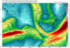
Unfortunately the weathermodels site lags on the precip type maps for the 6 and 18z Euro (it's still only out to hour 39), but here is the 3 hr total precip map and the 700mb RH:
The reason you aren't seeing more moisture until it digs to the coast and goes neutral/ negative, if that the Gulf is totally cut off.
I suspect if it went beyond 90 hours there might be a more westerly solution than 12z, but hard to say since it looks similar.
@LoganElliott40
depends on where you're at. I think Charlotte needs it to drop in and start to tilt further west.
18z Euro: