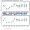
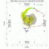
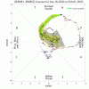
So I know this is probably Nothing, but something doesn’t add up. Ie NAM probably wrong but notice the 2m thermal difference as this moves into GA. There has to be something falling, maybe just virga, but then an island of below freezing temps in SE GA!?Soooo the last few frames of the NAM.....
-
Hello, please take a minute to check out our awesome content, contributed by the wonderful members of our community. We hope you'll add your own thoughts and opinions by making a free account!
You are using an out of date browser. It may not display this or other websites correctly.
You should upgrade or use an alternative browser.
You should upgrade or use an alternative browser.
Pattern January 2020 - Operation Thaw Alaska
- Thread starter KyloG
- Start date
I was coming here to post this, I'm sure it's not coming back but I'd be willing to bet we get one good pull us back in run from the NAM. I mean this is soooo closeSoooo the last few frames of the NAM.....

Sent from my SM-G950U using Tapatalk
Don’t let the NAM do it to you guys! It’s still too positively tilted to work.I was coming here to post this, I'm sure it's not coming back but I'd be willing to bet we get one good pull us back in run from the NAM. I mean this is soooo close
Sent from my SM-G950U using Tapatalk
Jon
Member
I was coming here to post this, I'm sure it's not coming back but I'd be willing to bet we get one good pull us back in run from the NAM. I mean this is soooo close
Sent from my SM-G950U using Tapatalk
If no other modeling is on it I would venture to guess this is the Nam bias of over amping shortwaves. I was more confident when the euro was on its side a few days ago but it looks like we won’t even squeak out flurries on the coast. That’s sad.
Sent from my iPhone using Tapatalk
Agreed but it's gone from way too positively tilted to just to positively tilted... Lol. I'd rather look at this then the inevitable torch waiting in the wingsDon’t let the NAM do it to you guys! It’s still too positively tilted to work.
Sent from my SM-G950U using Tapatalk
Its closed at h7 and h85 too and the flow is southeast or east at those levels with moisture coming inland. Its probably too late verbatim but if other models have that look at 84 hrs its workable especially along and east of 95Agreed but it's gone from way too positively tilted to just to positively tilted... Lol. I'd rather look at this then the inevitable torch waiting in the wings
Sent from my SM-G950U using Tapatalk
NBAcentel
Member
Pants bursting winter!
Low solar activity + modoki El Nino must = blocking galore! Maybe we haven't sloshed the tub enough.
View attachment 31379
View attachment 31380
Love that look south of Alaska ?? it’s gonna come back sooner or later along with the -PNA, I mean it’s a pattern that has been very dominant
L
Logan Is An Idiot 01
Guest
I wouldn't even say a torch is coming. I'd say we have a couple storms in the next 2 weeks that bring warm air for a day or two, then when the storm moves out the temperature drops again. Cold and dry warm and wet. Theme of southern Winters.
MichaelJ
Member
GSO has no measurable reported snowfall so far for 2019-20 winter, but winter is far from over. February will likely see some (law of averages) and March is also possible. This area HAS been totally shutout out in regards to snowfall in the past however. The winters of 1922-23, 1924-25, 1927-28, 1944-45, 1949-50, 1952-53, 1990-91 and 1999-2000 recorded 0.0 snow for the winters. This does not mean we did not get some ice those years (as we most likely did) but snowless years can and will happen from time to time. As you would expect, all years with the exception of 1944-45 were well above normal temp wise but 1944-45 was actually BN for the winter average. I guess my message here is that, while fairly rare, snowless winters here are not unprecedented.
Webberweather53
Meteorologist
Webberweather53
Meteorologist
GSO has no measurable reported snowfall so far for 2019-20 winter, but winter is far from over. February will likely see some (law of averages) and March is also possible. This area HAS been totally shutout out in regards to snowfall in the past however. The winters of 1922-23, 1924-25, 1927-28, 1944-45, 1949-50, 1952-53, 1990-91 and 1999-2000 recorded 0.0 snow for the winters. This does not mean we did not get some ice those years (as we most likely did) but snowless years can and will happen from time to time. As you would expect, all years with the exception of 1944-45 were well above normal temp wise but 1944-45 was actually BN for the winter average. I guess my message here is that, while fairly rare, snowless winters here are not unprecedented.
1922-23, 1924-25, & 1927-28 were not shutouts in GSO.
GSO snowfall data is unreliable before 1930, there some are egregious reporting errors in the SERCC NOWData that I've taken note of & recorded in my winter storm reconstruction.
NBAcentel
Member
Gotta realize Cold phases of the MJO aren’t gonna start doing much as we head into the more later parts of winter as the do in early/mid winter
Maybe a slight cool down in there but 10 days AN isn't exactly cold and dry, warm and wet imho... that's borderline torch.I wouldn't even say a torch is coming. I'd say we have a couple storms in the next 2 weeks that bring warm air for a day or two, then when the storm moves out the temperature drops again. Cold and dry warm and wet. Theme of southern Winters.

Yeah, 12Z run slightly worse but was trending better through 0Z (1st 3 maps of loop). Still too far out and too close to NC OB and even NE FL for me to totally give up as still just far out enough for that good trend to resume. And only thing to watch for wintry in SE anytime soon. But odds low (10%?).
Regardless, some nice cold days early to mid week coming.
L
Logan Is An Idiot 01
Guest
The high temperatures aren't too warm. But the lows are disappointing for middle of January standardsMaybe a slight cool down in there but 10 days AN isn't exactly cold and dry, warm and wet imho... that's borderline torch.
View attachment 31385
Webberweather53
Meteorologist
Yeah, 12Z run slightly worse but was trending better through 0Z (1st 3 maps of loop). Still too far out and too close to NC OB and even NE FL for me to totally give up as still just far out enough for that good trend to resume. And only thing to watch for wintry in SE anytime soon. But odds low (10%?).
Regardless, some nice cold days early to mid week coming.
Well no, none of the maps have trended better, every single run in this animation (even thru 0z) has shown a weaker & more positively tilted trough axis.
Well no, none of the maps have trended better, every single run in this animation (even thru 0z) has shown a weaker & more positively tilted trough axis.
So have you 100% given up already even for the coast?
Shaggy
Member
Yeah, 12Z run slightly worse but was trending better through 0Z (1st 3 maps of loop). Still too far out and too close to NC OB and even NE FL for me to totally give up as still just far out enough for that good trend to resume. And only thing to watch for wintry in SE anytime soon. But odds low (10%?).
Regardless, some nice cold days early to mid week coming.
I was slightly hopeful for this to turn into something for us but so far the models arent buying. I've seen plenty of large changes inside 48 to 72 hours. Cant even begin to tell you the number of times I've had storms suddenly shift west in that time frame and snatch victory from us coastal guys.
I'll watch another 36 hours. Perhaps this is the models losing the storm(even though there was never really a storm persay) like they do in the 4 to 7 day range sometimes. Maybe we will see the models slowly trend back to their closer almost there runs as we get inside 72 hours.
Doubt it though.
GFS already closed at HR54 heading south
Webberweather53
Meteorologist
So have you 100% given up already even for the coast?
I've nearly thrown in the towel already. At most a 5-10% chance this comes back.
L
Logan Is An Idiot 01
Guest
As much as I hate to say this because I cannot stand the Farmers almanac but they have been spot-on for the southeast so far this winter
Webberweather53
Meteorologist
As much as I hate to say this because I cannot stand the Farmers almanac but they have been spot-on for the southeast so far this winter
No.
GFS already closed at HR54 heading south
Yeah, looks to me like 12Z GFS is actually slight improvement at H5 vs 6Z though it still almost definitely won’t be good enough. Still too early to give all clear on this yet imo. Like Webb says, still 5-10% chance.
Webberweather53
Meteorologist
As a contractor I can tell you we have not went a year where we didn't put out salt or ice melt in a very long time. We have had several storms in February looking back at our records especially between feb 10-15 and again 22nd through 27th. 2009 on March 1st winston got 8 inches on a friday and couldn't find a snow flake on Monday. The last week of February in 2009 was in 60s. Snowed march 1st and went to 70s over the weekend. Was melting underneath it about as fast as we could plow it. So no winter not over but could be to. Unfortunately ground temps are creeping up pretty good to.GSO has no measurable reported snowfall so far for 2019-20 winter, but winter is far from over. February will likely see some (law of averages) and March is also possible. This area HAS been totally shutout out in regards to snowfall in the past however. The winters of 1922-23, 1924-25, 1927-28, 1944-45, 1949-50, 1952-53, 1990-91 and 1999-2000 recorded 0.0 snow for the winters. This does not mean we did not get some ice those years (as we most likely did) but snowless years can and will happen from time to time. As you would expect, all years with the exception of 1944-45 were well above normal temp wise but 1944-45 was actually BN for the winter average. I guess my message here is that, while fairly rare, snowless winters here are not unprecedented.
NBAcentel
Member
Owari da
Nomanslandva
Member
33/20 but bone dry. Also, look at the storm track at the end of the ICON. How does that happen in lat Jan with no snow in the mountains? Just sad.
Webberweather53
Meteorologist
I will say that RH levels were higher this run.Yeah, looks to me like 12Z GFS is actually slight improvement at H5 vs 6Z though it still almost definitely won’t be good enough. Still too early to give all clear on this yet imo. Like Webb says, still 5-10% chance.
Also the MVP is still looking way negative ... which means the MJO means nothing .. we’re heading into good phases to get snow but then it doesn’t matter cause MVP is so low that the phases don’t matter ... at least if we go back to warm phases those won’t matter either so now we have to start looking at other things that are going to help us out
Webberweather53
Meteorologist
I see everyone is having fun this morning. Friendly reminder yadda yadda you guys get it
Webberweather53
Meteorologist
NBAcentel
Member
Just when you thought the long-range couldn't get any uglier...
If this generally verifies, we're probably punting until at least mid-February
The clock is ticking on this winter & we're about to run out of time.
View attachment 31397
View attachment 31398
Just in time for fab feb, when Dixie alley events starting working with more instability Again as we head out the deepest part of winter
I saw that the thing that the MVP is still negative and so the mjo phases don’t really matter in that case and have basically no effect on the weather here until that MVP goes positiveJust when you thought the long-range couldn't get any uglier...
If this generally verifies, we're probably punting until at least mid-February
The clock is ticking on this winter & we're about to run out of time.
View attachment 31397
View attachment 31398
NBAcentel
Member
It’s sorta the opposite of what your saying, even with phases in 7-8, it won’t really matter, phase 5-6 will still likely mean warmth, especially phase 5I saw that the thing that the MVP is still negative and so the mjo phases don’t really matter in that case and have basically no effect on the weather here until that MVP goes positive
Storm5
Member
12z euro has some extremely light and scattered snow showers in miss ala and Georgia on Tuesday .
Sent from my iPhone using Tapatalk
Sent from my iPhone using Tapatalk
ForsythSnow
Moderator
Again, can we keep the banter-eque and whamby posts in the proper threads? It's not that hard to do.


