I like the Op GFS doing Op GFS things, even if it's hour 384.

Seems like the focus here on those members are the deep southHere ya go
I like the Op GFS doing Op GFS things, even if it's hour 384.
Completely agree on all points. I think there is a preponderance of evidence to support the idea that the pattern is changing to a more wintry one. I will feel better when the change moves much closer in and when the Ops and ensembles are in sync.Appreciate the 384hr Op, especially from you. That's a solid look with the primary NH PV lobe pinched in to Hudson Bay, ridging in the Gulf of Alaska would likely retrograde NW based on a Beaufort Sea connection. As I am sure you know, this is single computer simulation, well outside of it's useful range, and still lacks maturation of algorithms and the hardware that runs it compared to foreign based on verification . I'd be eyeing continuity of ops around 168 to their Ens mean / hand-off for D7-10, particularly in Canada, anything after D10 is a crap shoot even with the means, especially during pattern changes. I do agree the odds of a sig pattern change with Winter finally arriving in the East are increasing after 1/20, likely MA and north initially, with SE in play after 1/26.
Great to see you here man. Always enjoy your analysis!!!Here it comes.. the first wave after the 50/50 is established that the ensembles have been harping on. The STJ is juiced up!
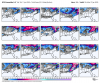
18z GFS

Completely agree on all points. I think there is a preponderance of evidence to support the idea that the pattern is changing to a more wintry one. I will feel better when the change moves much closer in and when the Ops and ensembles are in sync.
The same can be said for the Charlotte area. It use to seem that we would see a major freezing rain event every 1-2 years, but the last freezing rain only event that I can remember with widespread 1/4 inch or greater in the metro area was 2005. There have been a few forecasted since then, but have usually ended up being predominantly sleet.Growing up in Georgia, we definitely had a lot more ice storms in past decades then we do now. Of course that could change again. This decade could be a lot more different then 2010-2019
Here it comes.. the first wave after the 50/50 is established that the ensembles have been harping on. The STJ is juiced up!
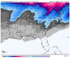
18z GFS
")

It is highly unlikely (but not impossible) to have two storms back to back, only drawback is that the sky has to have time to heal. I seem to remember 2 storms back to back in 1979 or 1980 but my memory ain't what she used to be.
I can deal with a torch these next few days knowing that winter is coming back.
He can speak for himself but I thought he was being facetious
The GEFS & EPS have generally trended towards the seasonally adjusted MJO analog composite (via Paul Roundy) w/ increasing -NAO being shown just after Jan 20th.
View attachment 30371
View attachment 30372
This composite looks awesome well into early-mid February.
We can certainly hope this pattern change actually sticks this time. One thing to consider going forward is that +IOD forcing at this time of the year (unlike earlier in winter) is actually conducive for more frequent troughiness & cold in the E US during February & March due to seasonal changes in the E hem monsoon circulation & mid-latitude jet.
View attachment 30373
Thanks. I thinks it's been about 15 years since I was just a member on a weather board.
I can deal with a torch these next few days knowing that winter is coming back.


Might get a weenie run in the next few frames. Definitely big changes vs the last few runs of the gfs.


Wave gets too strung out. Ingredients are there, just needs a stronger wave to phase with the 50/50 low.Falls apart as it goes East. But dang it has me pumped up. I bet there will be some nice hits on the gefs tonight. View attachment 30429
That’s why I said maybe ... lol ?Incoming!?!?!
Meh...
Sent from my iPhone using Tapatalk
Just one run of many... Wouldn’t set my hopes and dreams one run that is 10 days out...Bone chilling cold, system goes poof, cold retreats out of Eastern U.S. Storm roars our way. Life in the South hoping for snow.


If the shortwave over Texas is a little faster and/or the high pressure digs a little further southwest then look out! Definitely a look we can work with at this range.Wave gets too strung out. Ingredients are there, just needs a stronger wave to phase with the 50/50 low.
Sent from my iPhone using Tapatalk
Just one run of many... Wouldn’t set my hopes and dreams one run that is 10 days out...
Most of the time that's how it goes unfortunately, but sometimes we get lucky and "cash" in. Luckily the time window is still beyond 200 hours so expect to see many other scenarios. A winter storm is still in the pending status. At this point, it's still meh.Bone chilling cold, system goes poof, cold retreats out of Eastern U.S. Storm roars our way. Life in the South hoping for snow.
We had 2 storms within 7-10 days a few years back. I will have to look up when as I remember transmission came out while plowing. We had to get it replaced quick as another one came.? We had 4 in 12 days in 2000