I’ve honestly only been looking at MSLP the last 10-12 days and it has been low pressure dominated which gives me pause. I’d love to see a 1040 drop down with a low pressure lull before I get too hopefulIt's quasi-zonal. But you have a split stream. Cold high pressure sliding by up north and Disturbances in the southern jet to the south. It's honestly not a bad look and not too far away from a really good look. Will it trend well from here or revert back to the ridge of doom look?
-
Hello, please take a minute to check out our awesome content, contributed by the wonderful members of our community. We hope you'll add your own thoughts and opinions by making a free account!
You are using an out of date browser. It may not display this or other websites correctly.
You should upgrade or use an alternative browser.
You should upgrade or use an alternative browser.
Pattern January 2020 - Operation Thaw Alaska
- Thread starter KyloG
- Start date
Webberweather53
Meteorologist
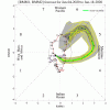
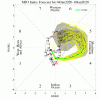
Pattern will make an attempt to turn around ~Jan 25-30 or about the last week of January and this time potentially linger into February. This experimental MJO and extratropical forecast product from Dr Roundy at SUNY-Albany generally shows this. Notice it even picks up on the attenuation of the MJO once it exits the Maritime Continent
http://www.atmos.albany.edu/facstaff/roundy/waves/rmmcyc/indexmjo.html
http://www.atmos.albany.edu/facstaff/roundy/waves/rmmcyc/indexmjo.html
Last edited:
NBAcentel
Member
NoSnowATL
Member
I don’t like it but I do like that it’s going as planned. At this rate we could be in 7/8 per Euro by end of the month or early Feb. bottom line if this happens we should have a 2 week window in February.

Sent from my iPhone using Tapatalk
I don’t like it but I do like that it’s going as planned. At this rate we could be in 7/8 per Euro by end of the month or early Feb. bottom line if this happens we should have a 2 week window in February.
Sent from my iPhone using Tapatalk
GEFS really pushes it through 4/5 into 6.
We still have a consolidated trop/strat PV to deal with.

NoSnowATL
Member
GEFS really pushes it through 4/5 into 6.
We still have a consolidated trop/strat PV to deal with.
View attachment 29638

Yea I hope it looks more like this. I don’t like that loop look.
Sent from my iPhone using Tapatalk
NoSnowATL
Member
What’s your gut feeling going into February?
Sent from my iPhone using Tapatalk
What’s your gut feeling going into February?
Sent from my iPhone using Tapatalk
Personally I think we see a sustained period of BN temps in the east/SE as we end Jan into Feb. I think we have a chance the last 5 weeks of met winter could be BN. Probably more hope than anything but that's how I feel. The consolidated trop PV does concern me though.
I signed up here last Feb. So since then there has been 0 reasons to be optimistic. So I've earned myself a reputation for being negative. Which I have been most of the last decade with winter here. But if we ever get a decent pattern I can and will be optimistic.What’s your gut feeling going into February?
Sent from my iPhone using Tapatalk
But my gut feeling is we don't see that in Feb this year either. Many years in this hobby has taught me a hostile Pac doesnt give up much, and Atlantic help is not likely based on recent years. This pattern is as bad as it gets. I don't know if it'll snow or not. We may can time a trough swinging through. But I seriously doubt a large northern hemisphere pattern change is likely until March when it's too late.
Good lord we’re really going to have to watch out for the severe weather threats over the next couple weeks .. looking quite vigorous on the Gfs this afternoon
D
Deleted member 1449
Guest
BHS1975
Member
Why not
Sent from my SM-G975U using Tapatalk
Yes. Roxboro will somehow find a way to squeak out 9” before winter is over
BufordWX
Member
If the long range Euro is anything to go by we may not have winter weather to talk about around here, but severe weather could make a roaring appearance by next weekend and early the following week. 12z Euro has what looks to be back to back severe weather events with one on the 11th-12th and another on the 13th-14th. Could be something to watch but way to far out there still.
NoSnowATL
Member
If the long range Euro is anything to go by we may not have winter weather to talk about around here, but severe weather could make a roaring appearance by next weekend and early the following week. 12z Euro has what looks to be back to back severe weather events with one on the 11th-12th and another on the 13th-14th. Could be something to watch but way to far out there still.
Yea that time period looks interesting. Someone in the SE might see a small outbreak or bigger.
Sent from my iPhone using Tapatalk
MichaelJ
Member
Until we can get the MJO to get into phases 1,2 and 8, it will be tough for the SE to get winter weather. There are some signs it will get into at least 6 before collapsing and whether it can sneak into these phases is questionable at this time
Don't forget about phase 7. Great phase for snow this time of year.Until we can get the MJO to get into phases 1,2 and 8, it will be tough for the SE to get winter weather. There are some signs it will get into at least 6 before collapsing and whether it can sneak into these phases is questionable at this time
NBAcentel
Member
Very typical pattern for severe weather with ejecting troughs/ULLs with that -PNA and a flexing SE ridge
Gfs also is in agreement .. I have a feeling a very big system is on the horizon.. when u have that much of a clash between temperatures you get massive fronts and big low pressures in general terms ... the fact that we have such a clash this far into winter means an extreme temperature gradient from 70s (southeast) to temperatures way below freezing in the Midwest ... temperature gradients in the winter usually are not this great because usually the norther branch is very dominant so temperature gradients are usually not this extensive .. will be interesting to see how models continue to see this pattern outYea that time period looks interesting. Someone in the SE might see a small outbreak or bigger.
Sent from my iPhone using Tapatalk
Also the end of the euro although still bad .. it is better looking than the Gfs I would say at the same time frame .. euro wants to continue to build some ridging poleward and even looks to want to bring a Greenland block into play possibly if the model could run further out ... we may have to wait a while but I do believe the pattern will cave to a more favorable one for cold and stormy for the south east .. patience is going to be the key here .. in the mean time we have a lot to track with severe weather the next couple weeks
While blocking is very minimal, the GEPS (CMC ensembles) get rid of the trough on the west coast.View attachment 29650View attachment 29651
EPS weakens pac ridge. Hate posting day 15 ensemble runs but it’s what we got right now. Ph6 pattern


D
Deleted member 418
Guest
Maybe my calendar is wrong but it says winter ends on March 19th........ why are we saying it’s over on January 4th? Again maybe my calendar is wrong
Thats not as bad as what we've been seeing. The Pac ridge needs to take a hike and the Scandinavian block needs to build into Greenland.EPS weakens pac ridge. Hate posting day 15 ensemble runs but it’s what we got right now. Ph6 pattern
View attachment 29653View attachment 29654
pcbjr
Member
No ... your calendar is correct ... but I'll be the 1st to admit, I was wrong ... maybe ... with the caveat there's 27 more days to go ...Maybe my calendar is wrong but it says winter ends on March 19th........ why are we saying it’s over on January 4th? Again maybe my calendar is wrong
D
Deleted member 418
Guest
Yep. 27 days to go in January. 75 days till winter is officially over. I wish people just take a deep breath and know there’s more to this life than whether or not it gets cold and snowsNo ... your calendar is correct ... but I'll be the 1st to admit, I was wrong ... maybe ... with the caveat there's 27 more days to go ...
pcbjr
Member
Yes ... and I was the one back in October touting a warm December and a cold January ... but the deep breath and more than weather are sage ...Yep. 27 days to go in January. 75 days till winter is officially over. I wish people just take a deep breath and know there’s more to this life than whether or not it gets cold and snows
D
Deleted member 418
Guest
Understood but I’ve been lurking and it seems to me that people here are acting like the world will end if it doesn’t get cold or snow.Yes ... and I was the one back in October touting a warm December and a cold January ... but the deep breath and more than weather are sage ...
Maybe my calendar is wrong but it says winter ends on March 19th........ why are we saying it’s over on January 4th? Again maybe my calendar is wrong
Unless you live in the upper south you’re winter is basically over after February. Meteorological winter, meaning the cold weather season is December through February. The only thing significant about March 19th-20th is the man made definition of the Spring equinox.
D
Deleted member 418
Guest
Lol. OkayUnless you live in the upper south you’re winter is basically over after February. Meteorological winter, meaning the cold weather season is December through February. The only thing significant about March 19th-20th is the man made definition of the Spring equinox.
NoSnowATL
Member
Lol. Okay
So much for lurking.... you fit right in. Welcome!
Sent from my iPhone using Tapatalk
LickWx
Member
Exactly ! Our Florida folks have only ever seen snow on tv yet the world hasn’t ended for them. I think?Understood but I’ve been lurking and it seems to me that people here are acting like the world will end if it doesn’t get cold or snow.
NoSnowATL
Member
Exactly ! Our Florida folks have only ever seen snow on tv yet the world hasn’t ended for them. I think?
It’s Florida. It’s the end of the world everyday. Just google flordia news! Or ask Phil .

Sent from my iPhone using Tapatalk
Rosie
Member
Saw snow in W Palm Beach 1977?Exactly ! Our Florida folks have only ever seen snow on tv yet the world hasn’t ended for them. I think?
ForsythSnow
Moderator
I can report sleet here finally.


