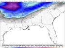
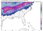
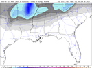
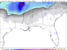
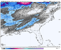
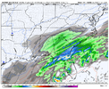
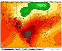
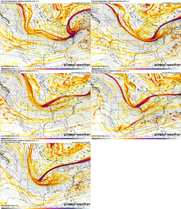
I'll gladly take a 93 dumped 19in here. 96 was good too had a lot of sleet on top of a good foot of snow best sleding of my life but hurt like hell lol93, ATL folks would be happy
-
Hello, please take a minute to check out our awesome content, contributed by the wonderful members of our community. We hope you'll add your own thoughts and opinions by making a free account!
You are using an out of date browser. It may not display this or other websites correctly.
You should upgrade or use an alternative browser.
You should upgrade or use an alternative browser.
Wintry January 14-16th storm potential.
- Thread starter TheBatman
- Start date
Brent
Member
TV met just said a huge storm is possible now
Pilotwx
Member
Well if its 96 or 93 mountains and foothills in NC. SC. and VA and just east of there to I-85 will get a lot of snow BUT no run shows the mountains or foothills getting in on the fun. Closer to 85 then yes. maybe a semi -Carolina Crusher
NWMSGuy
Member
Ohh I don't know I'm just going off a post earlier that said 96 was a top analog on chips. This is a west of apps storm imo. Except for areas further east who may see redevelopment. Even then it will be very light little to no accumulation.Well if its 96 or 93 mountains and foothills in NC. SC. and VA and just east of there to I-85 will get a lot of snow BUT no run shows the mountains or foothills getting in on the fun. Closer to 85 then yes. maybe a semi -Carolina Crusher
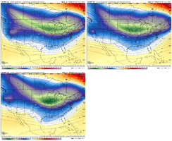
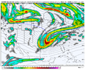
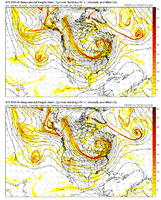
Have you also noticed at H5 that the models are retro-grading the features a bit. As you, and others have pointed out, things are not as progressive as the progressive models want them to be...this is FAR from set in stone IMO00z GEFS definitely trending like the op the past couple runs.
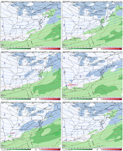
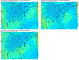
View attachment 141327
View attachment 141331
NBAcentel
Member
Welcome sir. First message I see. Here’s to hoping there’s plenty moreGfs and gefs clearly trended toward the euro soulution. Still massive changes happening at 500mb even with the euro. I think cad favored areas have a chance at a winter storm
Sent from my SM-A236U using Tapatalk
I am honestly hedging my bets on this....but, new UKIE shows it very well...GFS tries, and the
EURO and EPS and somewhat the GEFS is also seeing this...I "think" this is our "caboose" and should end the pattern (temp) after driving down the west and rolling into the east. I think this one will be the one to really watch for as the pattern starts to breakdown after that.
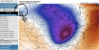
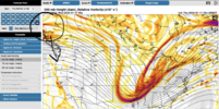
EURO and EPS and somewhat the GEFS is also seeing this...I "think" this is our "caboose" and should end the pattern (temp) after driving down the west and rolling into the east. I think this one will be the one to really watch for as the pattern starts to breakdown after that.


Yes. There are some pretty drastic changes occurring as energy is moving onshore. There are a ton of moving parts with this one - highly possible we still see a drastic change one way or another.Have you also noticed at H5 that the models are retro-grading the features a bit. As you, and others have pointed out, things are not as progressive as the progressive models want them to be...this is FAR from set in stone IMO
NBAcentel
Member
NBAcentel
Member
NBAcentel
Member
SnowwxAtl
Member
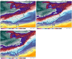
You can see the wedgeThis is a woof trend. View attachment 141346
NBAcentel
Member
Not necessarily the wedge, but we’re strengthening the prior northern stream trough and sinking it south, which is allowing the antecedent airmass to become much colder and drier prior to the stormYou can see the wedge
NBAcentel
Member
NBAcentel
Member
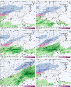
Euro was so close to something bigger wrt the energy
SnowwxAtl
Member
Fro, weenie question and mods move to other thread if need be, but why the hole over ATL?Euro was so close to something bigger wrt the energy
Because the Apps are blocking the original northern stream energy, the coastal low doesn't phase/mature until it gets further in latitude around NC.Fro, weenie question and mods move to other thread if need be, but why the hole over ATL?
SnowwxAtl
Member
So we need it to phrase early...gotcha...late bloomersBecause the Apps are blocking the original northern stream energy, the coastal low doesn't phase/mature until it gets further in latitude around NC.
Yeah, once the NW ridge gets replaced with a pesky low, the wave can't tilt negative and and mature. The models want to sharpen the wave around the Ohio Valley and form a coastal low off the Mid-Atlantic, leaving the energy in the south to shear out. If we can get more ridging out west, the energy-centered by the Gulf can mature, and more quickly develop a coastal low.So we need it to phrase early...gotcha...late bloomers
The 18z Euro Control did that, the 00z Euro unfortunately said it was a blip.
SnowwxAtl
Member
We needed the Euro to pull a CMC by digging out westYeah, once the NW ridge gets replaced with a pesky low, the wave can't tilt negative and and mature. The models want to sharpen the wave around the Ohio Valley and form a coastal low off the Mid-Atlantic, leaving the energy in the south to shear out. If we can get more ridging out west, the energy-centered by the Gulf can mature, and more quickly develop a coastal low.
The 18z Euro Control did that, the 00z Euro unfortunately said it was a blip.
The CMC runs into the same problem the Euro does. It doesn't matter how much the wave digs if the low in the NW stops the wave from maturing.We needed the Euro to pull a CMC by digging out west
SnowwxAtl
Member
Gotcha...thank youThe CMC runs into the same problem the Euro does. It doesn't matter how much the wave digs if the low in the NW stops the wave from maturing.
NBAcentel
Member
Yeah. We’re improving the northern stream for cold out ahead, but stuff out west is getting discombobulated by the shortwave entering B.C.
NWMSGuy
Member
NWMSGuy
Member
Brent
Member
Cary_Snow95
Member
Is it just me or does it seem like the off hour Euro always shows a change that usually never carries to the next on cycle run. At least it seems that way
- Joined
- Jan 23, 2021
- Messages
- 4,595
- Reaction score
- 15,183
- Location
- Lebanon Township, Durham County NC
Control was about to turn the corner and be a big event, especially for the carolinas and va.
JLL1973
Member
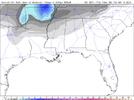
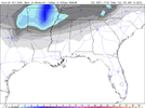
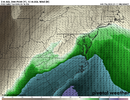
Looks like all models have increased snow amounts overnightSnow Totals on the 06Z GFS have increased since the 0Z run. View attachment 141355
ENCSnowdawg
Member
Trending more south and east?Looks like all models have increased snow amounts overnight
rburrel2
Member
That control run is an absolute perfect, best case scenario for those of us east of the Apps.
Cary_Snow95
Member
Someone correct me if I’m wrong but is that evolution similar to January of 2018

