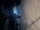
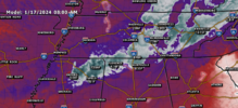
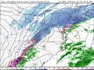
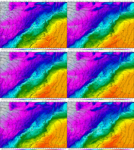
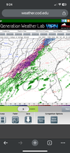
The cold air comes in quickly, then it seems like the moisture starts to get squeezed out.Drizzle / light rain at times in bluff Park 33°.
-
Hello, please take a minute to check out our awesome content, contributed by the wonderful members of our community. We hope you'll add your own thoughts and opinions by making a free account!
You are using an out of date browser. It may not display this or other websites correctly.
You should upgrade or use an alternative browser.
You should upgrade or use an alternative browser.
Wintry January 14-16th storm potential.
- Thread starter TheBatman
- Start date
SAME HERE. I HONESTLY BELIEVE THAT THEY ARE UNDERESTIMATING THE MOISTURE IN THE AIR AND IT SEEMS IT MAY BE UPTICKINGLooking at those saturated low levels on the soundings makes me think freezing drizzle/light showers are gonna be a big problem. The models may be underestimating that aspect. That light stuff will accrue like gangbusters in these mid-upper 20s.
LukeBarrette
im north of 90% of people on here so yeah
Meteorology Student
Member
2024 Supporter
2017-2023 Supporter
Some sleet mixing in now2.5 here in Blacksburg. Snow not quite done here. 3 inches in range
campamy
Member
NP! We saw snow earlier and areas are still white-ish, but ended up with just slush and wet. 20 miles away is a winter wonderland ?Thanks for that update, crazy you're so close to that much snow, but stuck with rain.
OHnoSnow
Member
24 with freezing rain in nw alabama. Hopefully it’s less than a 1/4 of an inch .
Where in Alabama? Its 18 in Huntsville and hasn't been 24 since maybe 6 am.24 with freezing rain in nw alabama. Hopefully it’s less than a 1/4 of an inch .
Impressive cold deep into the Gulf Coast!
OHnoSnow
Member
Walker countyWhere in Alabama? Its 18 in Huntsville and hasn't been 24 since maybe 6 am.
Pilotwx
Member
I'm reporting as safe here in the N. Foothills safe from all winter weather. 0.00 ground report
PARSONBROWN
Member
Walker county
lusting4Adusting
Member
This warm nose should have it's own horror movie, it will not die. It's 19° just outside Huntsville and it's been sleeting for 24 hours. Sheer Insanity
JLL1973
Member
What does it show
Flotown
Member
yeah im happy with my 4.5!!Ended up with 7 inches of powdery snow. What a storm it was. I’m happy with this winter.
PainWhat does it show
ColdCoreLow
Member
Attachments
NBAcentel
Member
So these hrrr runs across the NC Piedmont
- Joined
- Jan 23, 2021
- Messages
- 4,596
- Reaction score
- 15,184
- Location
- Lebanon Township, Durham County NC
Marion County alabama emergency management has deemed all roads impassable
SimeonNC
Member
What about them? They seem pretty rainy from what I've seenSo these hrrr runs across the NC Piedmont
NBAcentel
Member
Just out curiosity… how much has piled up? If you got a couple inches, that’s gonna be hard to meltThis warm nose should have it's own horror movie, it will not die. It's 19° just outside Huntsville and it's been sleeting for 24 hours. Sheer Insanity
NBAcentel
Member
SimeonNC
Member
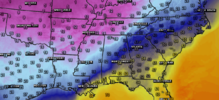
Interesting, a late bloomer CAD setup.
Branch
Member
All I’ve heard are local mets calling for light drizzle, brief mix and around 33 for Atl.
Well I’m already down to 39 which is a few degrees cooler than what I was forecast for right now.
NBAcentel
Member
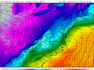
Most of our areas are already way colder than modeled currently Vs cams thanks to clearing skies, also a stiff NE breeze. 35F here. Might be some spotty freezing drizzle (hrrr has some now this run) if we can keep the weak NE breeze going with weak CAAInteresting, a late bloomer CAD setup.
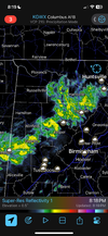
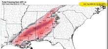
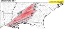
Radar looking pretty concerning for Alabama as the freezing one sinks south and that's all primarily freezing rain
Shadypines33
Member
We're still having intermittent sleet showers in Madison. I have never seen such a prolonged sleet event. This is crazy. It's been going on since 5am.
- Joined
- Jan 23, 2021
- Messages
- 4,596
- Reaction score
- 15,184
- Location
- Lebanon Township, Durham County NC
My biggest concern is that it seems to be concentrated in the black belt. That area is exceedingly poor and full of pines that’ll snap like matchsticks.Radar looking pretty concerning for Alabama as the freezing one sinks south and that's all primarily freezing rain
It wants to spill over but we suck so bad down here we’ll probably even mess it up for Roxboro on this one
accu35
Member
Lots of low level moisture not being picked up by radar. If you want ground truth, I am the truth!
SITTING HERE WATCHING TRAFFIC CAM AND THERE ARE DUMBASSES TRYING TO DRIVE OVER THE TENNESSEE RIVER BRIDGE IN NORTH ALABAMA
NBAcentel
Member
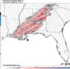
Need to batten down the hatches. Look for a strong smell of pine trees in the morningView attachment 142597
I’ve notice some models are showing a heavy band as this Heads east later tonight. This is getting interesting very fast

