The algorithm isnt picking up on ZR right now on on whats out thereYou got one for ice
-
Hello, please take a minute to check out our awesome content, contributed by the wonderful members of our community. We hope you'll add your own thoughts and opinions by making a free account!
You are using an out of date browser. It may not display this or other websites correctly.
You should upgrade or use an alternative browser.
You should upgrade or use an alternative browser.
Wintry January 14-16th storm potential.
- Thread starter TheBatman
- Start date
ghost1
Member
I’d say Jackson TN is the place to beOn the road to Meridianville, AL. Which is north of Huntsville. Close to the AL/TN state line. Got a buddy that lives there so a free place to stay. Worried about mixing though and wondering if I should go further north
Brent
Member
Well we're done here... No surprises. Around an inch probably. Ever since the models lost the big snowstorm on Friday this was pretty close to the predictions. Just not much moisture to work with in this arctic air. 


Nerman
Member
I think Chat gets over 3 inches.I agree with David Glenn. I don’t see it.
Stormlover
Member
Baron model. The dark purple line is half a foot plus 
Last edited:
Warnings (darker purple) advisories (not as dark purple)
accu35
Member
One would think with a low in the northern gulf there will be much more precipitation to work with. Models could be underestimating this moisture. Could be more snow/ice at go time
olhausen
Member
18z gfs playing catch up with the NAM?
12z

18z

12z
18z
Flotown
Member
Still setting up a line near the Tennessee River here in north Alabama
this model crazy or pretty good?Baron model. The dark purple line is half a foot View attachment 142309
Triplephase93
Member
Yep
EMTime
Member
Unless something changes, from what I see on the radar, it looks to be tupelo north on the heaviest amounts.
Brent
Member
One would think with a low in the northern gulf there will be much more precipitation to work with. Models could be underestimating this moisture. Could be more snow/ice at go time
To be fair we didn't have much moisture here either. It only snowed about 3 hours at most. Arctic air kind of sucks in that regard
ChattaVOL
Member
Chattanooga is going to be a game time decision 
When does the euro run again?
Sent from my iPhone using Tapatalk

When does the euro run again?
Sent from my iPhone using Tapatalk
Storm5
Member
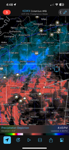
Anyone have the 18z rgem zr /IP map
Stormlover
Member
It' has done very well at times, even beating other models.this model crazy or pretty good?
Chattownsnow
Member
Chattanooga is going to be a game time decision
When does the euro run again?
Sent from my iPhone using Tapatalk
I mean it looks to me like modeming is shifting slightly north putting us in Chattanooga with less snow but it’s not a huge shift so far. I think we see something but I don’t think Nooga itself sees more than 2 inches. Northern burbs probably do better. We will see

Sent from my iPhone using Tapatalk


Triplephase93
Member
Agree. We won’t see the high ratios others do to the west. The heavy band is def north of here on almost every hi res model tooI mean it looks to me like modeming is shifting slightly north putting us in Chattanooga with less snow but it’s not a huge shift so far. I think we see something but I don’t think Nooga itself sees more than 2 inches. Northern burbs probably do better. We will see
Sent from my iPhone using Tapatalk
Need that model to drop south just a littleBaron model. The dark purple line is half a foot plus View attachment 142309
Iceagewhereartthou
Member
You successfully photographed the NC/SC state line!
Where will this be? lol
Storm5
Member
LukeBarrette
im north of 90% of people on here so yeah
Meteorology Student
Member
2024 Supporter
2017-2023 Supporter
Already 30 degrees here in Blacksburg which RGEM had us with 37 by this point. That explains why it shows rain at a couple points in the day tomorrow. I expect it to be wrong on that front now! Should be a nearly all snow event here.
18z RGEM showed nothing but rain here tomorrow. I noticed most all 18z models runs ticked north just enough to about take me completely out of the snow. lol 47 here atmAlready 30 degrees here in Blacksburg which RGEM had us with 37 by this point. That explains why it shows rain at a couple points in the day tomorrow. I expect it to be wrong on that front now! Should be a nearly all snow event here.
severestorm
Member
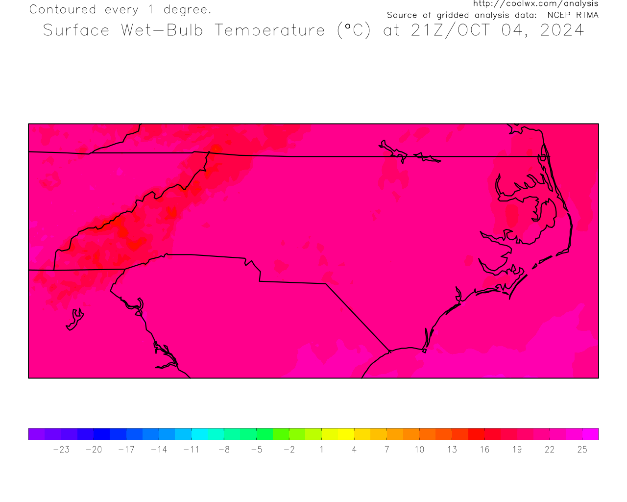
Current wet bulb
accu35
Member
Your right, I guess I’m wish castingTo be fair we didn't have much moisture here either. It only snowed about 3 hours at most. Arctic air kind of sucks in that regard
W
WSW
Guest
Nice cold air for the moisture to override. KIAD at the bottom right. 32/3

accu35
Member
Ryan Hall Y’all said expect a long train of winter weather for a long duration for Al/MS.
JLL1973
Member
olhausen
Member
Sitting at 20.3 degrees moments before the first flakes fall. That’s rare around these parts.

Stormlover
Member
Memphis NWS shows 6 to 8 into nw ala 
bud006
Member
Sounds like NWS Atlanta expanding the alerts in Georgia a bit: Update from @NWSAtlanta.... "Given the latest guidance, the Advisory and WSW have been expanded. The Winter Storm Warning now includes Whitfield, Murray, and Fannin Counties. The Advisory now includes Cherokee, Dawson, Lumpkin, and White counties." - From Atlanta News First meteorologist Cutter Martin’s Twitter feed.
Looks like FFC added a few more counties to each category.

chattagirl
Member
Just got this weather alert on my phone from news channel 3 in Chatt

Sent from my iPhone using Tapatalk

Sent from my iPhone using Tapatalk
I haven’t really been looking at any models in depth but I’m not seeing it. It is cooling off pretty quickly now though. Maybe they’re worried about drizzle and low to mid 20s.
accu35
Member
That’s great newsJust got this weather alert on my phone from news channel 3 in Chatt
Sent from my iPhone using Tapatalk
Yeah, its more Monday night into Tuesday morning. If the models are to be believed, our area and southeast will be 50 to 60 tomorrow afternoon.I haven’t really been looking at any models in depth but I’m not seeing it. It is cooling off pretty quickly. Maybe they’re worried about drizzle and low to mid 20s.
WeatherGirl205
Member
Made it to Huntsville. Started sleeting in the last 20 minutes.
NewnanWetather
Member
The concern is ice. Not a lot of ice maps being posted. BAm I missing something here? I’ve considered my area to pretty much be out of this since Thursday- curious as to what the logic is for this
I have been watching all day they are adding more as ice models come in It started 5 counties away from me and now it's just Carroll county from me. Something FFC is famous for.I haven’t really been looking at any models in depth but I’m not seeing it. It is cooling off pretty quickly now though. Maybe they’re worried about drizzle and low to mid 20s.
Ultimaparadox
Member
Starting to sleet here in NW Huntsville,
Drizzle Snizzle
Member
Wow the cold air sure is taking its sweet time isnt it ?Yeah, its more Monday night into Tuesday morning. If the models are to be believed, our area and southeast will be 50 to 60 tomorrow afternoon.