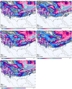
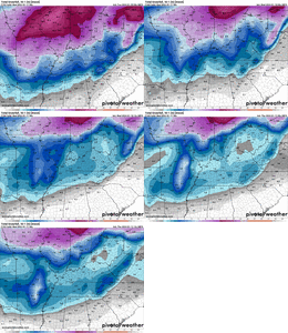
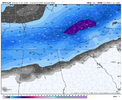
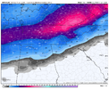
My favorite new model what ever it is!what on earth is spire weather. is this the cricket wireless of numeral weather prediction models?
word of caution here, i've noticed ice can be more prevalent than you think in situations where the LP is elongated/banana shaped (which I think we will see here)
-
Hello, please take a minute to check out our awesome content, contributed by the wonderful members of our community. We hope you'll add your own thoughts and opinions by making a free account!
You are using an out of date browser. It may not display this or other websites correctly.
You should upgrade or use an alternative browser.
You should upgrade or use an alternative browser.
Wintry January 14-16th storm potential.
- Thread starter TheBatman
- Start date
Stormlover
Member
sleet and freezing rainwhat on earth is spire weather. is this the cricket wireless of numeral weather prediction models?
word of caution here, i've noticed ice can be more prevalent than you think in situations where the LP is elongated/banana shaped (which I think we will see here)
f


severestorm
Member
iGRXY
Member
NWMSGuy
Member
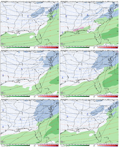
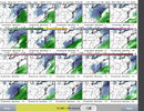
Looks like all GEFS members are talking winter weather in some form.
CNCsnwfan1210
Member
Ridge on the west coast trending stronger too, good trend for sure.
Sent from my SM-A136U1 using Tapatalk
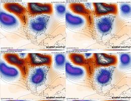
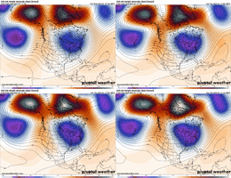
Had a busy morning at work so I’m just now getting a chance to look at closer at this morning’s models. The biggest and probably most important trend on the GFS I’m seeing is the Greenland block is building in better over Baffin Bay. This is helping to push that vortex further se and not right on Hudson Bay… as Fro mentioned yesterday doing that is giving us a better cold push out ahead of the wave. Also as much as we’ve been used to the NW trend for so many years, since late fall this has been the year of the southeast trend… every system seems be trending further SE the last few days… let’s hope that continues.
- Joined
- Jan 5, 2017
- Messages
- 3,769
- Reaction score
- 5,966
The snow mean over Atlanta is still really pathetic, though, so hopefully things continue to trend better. Most members show snow even in to GA, if they have precipitation at all.Looks like all GEFS members are talking winter weather in some form.
Stormlover
Member
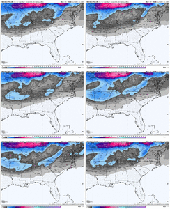
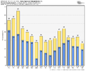
Again, that 10:1 is way low
A good number of members showing something now too not just one or two skewing the mean. Get that 2" mean a little closer and I'll start to get excited (plus the Euro jump on board, that would help)
Those amounts in general would be way low given the setup even at 10:1.Again, that 10:1 is way low
how are 850s trending on the ensembles run to run?
I would caution you on buying into really high ratios here in the south. Just my experience that anything more than 12-13:1 is very uncommon outside the higher elevations. Even the January 1988 storm had mostly 11-12:1 ratios in areas that were predominantly snow and with temperatures in the upper teens and lower 20s.Again, that 10:1 is way low
Nice find Kylo. Can see the Greenland Block really pressing the heights south there
I'd like to see this W Canada ridge rollover here and give us more positive trough tilt there over the midwest

Can see it here on the Euro C run

Stormlover
Member
Not in these setups with massive arctic air in place. GFS has 22:1 and 23:1 here in north ala during the main partI would caution you on buying into really high ratios here in the south. Just my experience that anything more than 12-13:1 is very uncommon outside the higher elevations. Even the January 1988 storm had mostly 11-12:1 ratios in areas that were predominantly snow and with temperatures in the upper teens and lower 20s.
Mahomeless
Member
I remember quite a few events where we've had well over 15:1 ratios here in Alabama. Arctic air has a much easier time influencing us than it does east of the Apps.Not in these setups with massive arctic air in place. GFS has 22:1 and 23:1 here in north ala during the main part
LukeBarrette
im north of 90% of people on here so yeah
Meteorology Student
Member
2024 Supporter
2017-2023 Supporter
Dude there are some bangers in there @Rain ColdView attachment 141419
Definitely some good possibilities here, Member 16 bomb
- Joined
- Jan 23, 2021
- Messages
- 4,596
- Reaction score
- 15,184
- Location
- Lebanon Township, Durham County NC
NWMSGuy
Member
How were you able to gather this detail? Would be interested to know the ratios during the main part for Northwest MS.Not in these setups with massive arctic air in place. GFS has 22:1 and 23:1 here in north ala during the main part
Stormlover
Member
6z for tupelo, up to 17:1 and 28:1 ratios https://meteor.geol.iastate.edu/~ckarsten/cobb/cobb.php?model=gfsm&site=ktupHow were you able to gather this detail? Would be interested to know the ratios during the main part for Northwest MS.
Brent
Member
Short term trends are slightly good for our areas, but longer term trends have not been great. Its tough to understand what's good for our areas of the SE with the overwhelming number of posts being about whats good for the carolinas. Leads to false excitement sometimes because the posters aren't clear about what area they are referring to.are there any western or mid south people left in here? Curios about our side of the mountain.
Stormlover
Member
Trends have been good today for usShort term trends are slightly good for our areas, but longer term trends have not been great. Its tough to understand what's good for our areas of the SE with the overwhelming number of posts being about whats good for the carolinas. Leads to false excitement sometimes because the posters aren't clear about what area they are referring to.
That was a crazy GFS run. There's too much going on right now. All in the Grand Webb Plan
Even without snow this could be a memorable stretch.
NWMSGuy
Member
Thanks!6z for tupelo, up to 17:1 and 28:1 ratios https://meteor.geol.iastate.edu/~ckarsten/cobb/cobb.php?model=gfsm&site=ktup
- Joined
- Jan 2, 2017
- Messages
- 1,566
- Reaction score
- 4,279
Yea I get the feeling there will be some major changes after tomorrow's system pushes through. Putting us in a weekend frenzy of model watching and hopefully all-aboards not cliff diving.That was a crazy GFS run. There's too much going on right now. All in the Grand Webb Plan
olhausen
Member
This is why I didn’t get down when the lower totals were popping up yesterday. Temps here will be in the low 20s and lower during the entire event. When adding kuchera I haven’t seen a model run with less than 3 inches. The cold air is going to squeeze every last drop of moisture out the atmosphere. Super high ratios!Spire . And the ratio will be well more than the 10:1 is shows
Iceagewhereartthou
Member
Overall, some good trends with the stronger block and the better cold confuence, BUT we need to see that tend continue. This could potentially turn into a good system for many but it could also become a nothing burger at this range. Still not much for the SC peeps yet. We might still end up sitting on the bleachers but maybe we can at least get an invite to the dance?
iGRXY
Member
rburrel2
Member
Just going off those changes the cold push should be better out in front.
olhausen
Member
Low as in longitude or amounts?Again, that 10:1 is way low
Just going off those changes the cold push should be better out in front.

iGRXY
Member

