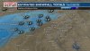
HSV AFD at 358 this morning
Very light precip is beginning to spread NE into parts of the cntrl
TN Valley this early Mon morning. So far this precip has been a mix
of light rain/snow in a few spots. A drier layer remains in place
between H85-H7, although latest radar trends suggest this layer is
beginning to saturate. This oncoming wintry precip continues to be
associated with an upper low/trough axis gradually moving ewd into
the ARKLATEX region coupled with a sfc wave beginning to traverse
east across the NW Gulf.
Latest model suites are fairly consistent with the ongoing forecast,
as additional light wintry precip out of east cntrl MS continues to
spread into much of the area heading into the morning hrs, while the
upper low lifts NE into the lower MS Valley/Mid South areas. As the
air column continues to saturate, the location of the upper trough
may allow for some weak snow banding into portions of NW AL, as
dynamic lift becomes slightly better enhanced. However, the heavier
bands may remain more in east cntrl NE/MS into west cntrl AL. Cooler
air though wrapping around the backside of the sfc low to the SW/S
will still translate into some light accumulations across much of
the mid TN Valley, especially for locations along/west of I-65. Total
accumulations still look to range from a dusting to a half inch,
with perhaps a few spots receiving some locally higher amounts up to
an inch where any of this banding occurs. However, fairly low QPF
does not result in better confidence where any of these slightly
higher bands may develop.
As temps gradually warm more into the mid/upper 30s later today and
the upper low/trough axis lifts closer to the mid TN Valley, precip
may become more light rain than snow this afternoon, although a light
wintry mix may linger in some of the higher elevations. Precip will
then begin to taper off from the west late this afternoon, as the
upper trough pattern begins to weaken and the sfc low approaches the
NE Gulf.

")