Shadypines33
Member
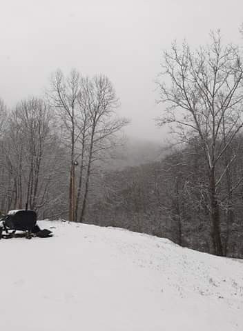
 Madison, AL it's still coming down pretty steadily, but the flakes are getting smaller and it's starting to melt.Madison, AL it's still coming down pretty steadily, but the flakes are getting smaller and it's starting to melt.
Beating an extremely dead horse here, but this storm is yet another great example of why you gotta respect overrunning & warm advection
Most models completely whiffed on this over Alabama and were way too dry because they underplayed both, GFS being one of the biggest offenders.
View attachment 64958
none here in Red Bank.. But I can look up 1000 ft and see the snow line clearly. Crazy how nice this might have been with a night time passage.just flipped to snow here (Harrison Bay) near Chattanooga / 36.1 degrees
exactly, I have about an inch and heavy snow falling nowWow!! Huntsville wants to wait till it happens to issue anything. Lol. View attachment 64908


It’s holding at 33 on county line and like you said really coming down at the moment.This is turning out pretty much as the modeling has shown for the past five days for my area. Up to 35 in central Huntsville. Big pretty flakes falling now, but no accumulations.
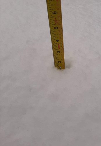
Quarter sized flakes on Mowbray Mountain at 31 degrees. Approaching a half inch.just flipped to snow here (Harrison Bay) near Chattanooga / 36.1 degrees
Wish I had a car.. would be one of those old timey hike up into snow days.Quarter sized flakes on Mowbray Mountain at 31 degrees. Approaching a half inch.
View attachment 64943
little improvement in 15 minutes, just nice to look at
same here. i was trying to upload a iphone pic but says file to biga little over an inch,trying to post pics but says too file too big...lol
Select the pic and underneath it you'll see "Actual size". Click on that and choose a file that's smaller.same here. i was trying to upload a iphone pic but says file to big
Post them as a thumbnaila little over an inch,trying to post pics but says too file too big...lol
 This is just an example of a thumbnail Picture for those having problems posting. Snow is obviously not anything to do with this system. It’s actually somewhere in Ohio around Christmas 2020
Same here. I was driving through Dallas earlier and had some very melted flakes mixing in under the heavier areas. This is probably like the last two where you need 2500 - 3000 feet in elevation in our neck of the woods.Got under a slightly heavier return and saw snow mixing in with the rain. Temp is 41 too.
Looks like it was some light ip mixed with rain. I’ll take it though@Ethan80963 anything in this ? View attachment 64972
 it's interesting to see the area out by Cisco and Stephenville again bullseyed just like the last storm while most of DFW was high and dry. This also confirms the sharp gradient I saw below Dallas coming back yesterday
.jpg")
wow...Snowing hard here again
Yes to North Alabama but Idk about at University of AlabamaI'm extremely happy for our Mid-South posters (I grew up in Memphis)
Did central/north-central AL receive any snow? Any snow on the Univ of AL campus?
Yes, over 3 inches in west central ala..two inches from moulton to athens to fayetteville...I'm extremely happy for our Mid-South posters (I grew up in Memphis)
Did central/north-central AL receive any snow? Any snow on the Univ of AL campus?