not sure how eventful it will be here in the upstate of SC but all county schools are closed and that late afternoon line looks pretty uniform
-
Hello, please take a minute to check out our awesome content, contributed by the wonderful members of our community. We hope you'll add your own thoughts and opinions by making a free account!
You are using an out of date browser. It may not display this or other websites correctly.
You should upgrade or use an alternative browser.
You should upgrade or use an alternative browser.
Severe Jan 8-11 2024 System Severe
- Thread starter SD
- Start date
The potential is there with individual cells to produce some sporadic intense winds no doubt. Will it live up to it's potential, we’ll know soon enough, but better safe than sorryThis made me go through the hrrr since I don't have the 3k until its done. There are lots of random 70-95mph gusts on the more tame hrrr from mobile to CLT then over to VA Beach
iGRXY
Member
The 4”+ of rainfall and 20-30 mph sustained/40+mph gusts here really has me worried. We’ve gotten significant rainfall the last few weeks that comes every 3-5 days and has dropped at least an inch minimum everytime here. That with the combination of hills/mountains and abundance of creeks, streams, and rivers for runoff and creating flood prone areas has me worried near myself. The severe weather is an after thought in my head right now in mby. The rainfall alone is crazy to see not being driven by a tropical system. I expect numerous power outages and down trees around here.
Yeah for sure. I always whack off about 50% from those wind maps and that usually gets you down to the upper range of reality.I was referencing the 70's mph in the triangle.
lol. These are my babies. I enjoy putting them up for my kids but I will say I don’t love doing it as much as I once did. It’s a lot of work and then when it comes time to put them up we’re usually in a soaker of a rain pattern and you can never get everything dried out long enough to put up.wife got on you about getting that work done huh?
Maybe the folks in charge of that should do something about making it more accurate if it's off that much.Yeah for sure. I always whack off about 50% from those wind maps and that usually gets you down to the upper range of reality.
severestorm
Member
NAM's getting ready to be thrown in the garbage already. NCEP is replacing it. Would suck to loose power without snow and just a cold wind.Maybe the folks in charge of that should do something about making it more accurate if it's off that much.
It's really not "off" that much but is showing the potential with the setup. If an area gets enough instability and a has enough updraft to tap the raging winds just a few hundred feet above the surface, then a brief gust at those speeds is highly possible. It's not a widespread sustained wind mapMaybe the folks in charge of that should do something about making it more accurate if it's off that much.
It's also at 33 ft and a pws on a 4ft dowel rod isn't going to be closeIt's really not "off" that much but is showing the potential with the setup. If an area gets enough instability and a has enough updraft to tap the raging winds just a few hundred feet above the surface, then a brief gust at those speeds is highly possible. It's not a widespread sustained wind map
Yep. I won’t be able to make it but hopefully I’m still on the email listState doing a balloon launch tomorrow?
It's pvc. And do you know why they use 10m? Why not 15 or 8 or some other number? I know it's not really possible to forecast ground speed because of terrain. But I don't remember why the official height is set to 10m.It's also at 33 ft and a pws on a 4ft dowel rod isn't going to be close
Pouring and 44 here. Doesn’t exactly scream storms.32/30 currently, just like you draw it up the night before a severe outbreak lol
Does yours flex in the wind? I think the 33ft is a WMO standard thing no idea why it was selected thoughIt's pvc. And do you know why they use 10m? Why not 15 or 8 or some other number? I know it's not really possible to forecast ground speed because of terrain. But I don't remember why the official height is set to 10m.
Yeah it does a little. Mine is never going to be dead on balls accurate but it'll be in the ballpark....of ground truth, I mean.Does yours flex in the wind? I think the 33ft is a WMO standard thing no idea why it was selected though
Yeah I'd rather just measure 5-8 feet too or put it at about 1 ft to help my lows in winterYeah it does a little. Mine is never going to be dead on balls accurate but it'll be in the ballpark....of ground truth, I mean.
Stormsfury
Member
We've barely gotten into prime time.
Saw a strong rotating cell earlier NW of Mobile, AL and the best parameters haven't even made it onshore there yet...

Saw a strong rotating cell earlier NW of Mobile, AL and the best parameters haven't even made it onshore there yet...
Spent the last hour in the dark taking down my flagpole Christmas tree and outdoor inflatables because I’d like to use them next year. The tree would get sideways in 15’ish mph sustained winds so I figured I might lose her tomorrow. I need a drink
Thanks for the reminder. Going out now to bring my 5 by 7 American flag off of the front porch. Can’t have her hit the ground. ????
Here are some of the highest gusts I could find going hour by hour on the 3k. 
Here the 0z 3K gust loop, gets crazy in eastern NC tomorrow evening
View attachment 010824.mp4
View attachment 010824.mp4
The 4”+ of rainfall and 20-30 mph sustained/40+mph gusts here really has me worried. We’ve gotten significant rainfall the last few weeks that comes every 3-5 days and has dropped at least an inch minimum everytime here. That with the combination of hills/mountains and abundance of creeks, streams, and rivers for runoff and creating flood prone areas has me worried near myself. The severe weather is an after thought in my head right now in mby. The rainfall alone is crazy to see not being driven by a tropical system. I expect numerous power outages and down trees around here.
Can‘t agree more. Poop ton of recent rain and high winds even without the severe concern me. Perhaps, @NCSNOW or @packfan98 can weigh in on Triad impacts? Please….
Jimmy and Shettly can you smell it?+sn
- Joined
- Jan 5, 2017
- Messages
- 3,800
- Reaction score
- 6,048
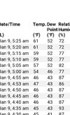
Heavy rain and 40.6 here. Wind is not too high, less than 10 mph.Pouring and 44 here. Doesn’t exactly scream storms.
Stormsfury
Member
Long duration tornado watch, just under a PDS category...

I keep mine at 6’. Much harder to keep the bird ---- off at 33’.Yeah I'd rather just measure 5-8 feet too or put it at about 1 ft to help my lows in winter
dsaur
Member
Looks like sleet in Dahlonega, so maybe some rare sleetnadoes. Keep your eyes peeled. Much more rare than thundersnow. 41.2 here and dripping. A not so rare dry patch. Did have a tree snap off and blast my chainlink fence in the winds this morning. Fun with chainsaw time this afternoon.Heavy rain and 40.6 here. Wind is not too high, less than 10 mph.
Tony, you would love that! Happy New Year buddy.Looks like sleet in Dahlonega, so maybe some rare sleetnadoes. Keep your eyes peeled. Much more rare than thundersnow. 41.2 here and dripping. A not so rare dry patch. Did have a tree snap off and blast my chainlink fence in the winds this morning. Fun with chainsaw time this afternoon.
dsaur
Member
Thanks, pal....I bet pellets at 125 would hurt, lol. My point forecast for tomorrow is 62, and that brings the real spinners into the fore, and kind of leaves the sleetnadoes to mythology. But if my theory of fewer storms upping the ante for historical ones when they do hit...maybe sleetnado could really be a thing. Historic for sure, lol.
NWS ATL checking in with update:
Severe Threat:
Very impressive parameter space looks to set up over the CWA during
the early morning hours and into the afternoon on Tuesday. Strong
WAA overnight will allow for two not so great things - the first, it
will keep the boundary layer well mixed, likely preventing any
nocturnal inversion from setting up, and second, will likely help
break down our CAD/wedge in place. Normally I would say the wedge
will win out, but with a 80+ kt jet at 850mb overspreading the
region, that will aid greatly in mixing it out. That being said, the
best winds in that won`t arrive until the morning hours as the line
begins pushing through, so it may take a bit of time for the warm
sector to lift through the CWA. The current SPC outlook reflects
this nicely, showing biggest risks from Columbus to Macon and then
pushing north.
The wind threat will likely be the biggest risk right out. With the
very strong kinematics, mixing down big winds in the strongest
storms won`t take much in the way of instability. QLCS tornadoes
will likely be in play, especially given fish hook look to the
hodographs which give tremendous SRH values of 200-400 m2/s2. The
big question mark is the instability. This has potential to be a
classic HSLC event, but the ability to be fully surface based will
likely be dependent on how quickly and how strong the WAA occurs.
This creates uncertainty in the northern extent, and certainly won`t
rule out seeing some severe weather as far north as the metro if
WAA really gets moving.
SnowwxAtl
Member
This is old from earlier todayNWS ATL checking in with update:
Severe Threat:
Very impressive parameter space looks to set up over the CWA during
the early morning hours and into the afternoon on Tuesday. Strong
WAA overnight will allow for two not so great things - the first, it
will keep the boundary layer well mixed, likely preventing any
nocturnal inversion from setting up, and second, will likely help
break down our CAD/wedge in place. Normally I would say the wedge
will win out, but with a 80+ kt jet at 850mb overspreading the
region, that will aid greatly in mixing it out. That being said, the
best winds in that won`t arrive until the morning hours as the line
begins pushing through, so it may take a bit of time for the warm
sector to lift through the CWA. The current SPC outlook reflects
this nicely, showing biggest risks from Columbus to Macon and then
pushing north.
The wind threat will likely be the biggest risk right out. With the
very strong kinematics, mixing down big winds in the strongest
storms won`t take much in the way of instability. QLCS tornadoes
will likely be in play, especially given fish hook look to the
hodographs which give tremendous SRH values of 200-400 m2/s2. The
big question mark is the instability. This has potential to be a
classic HSLC event, but the ability to be fully surface based will
likely be dependent on how quickly and how strong the WAA occurs.
This creates uncertainty in the northern extent, and certainly won`t
rule out seeing some severe weather as far north as the metro if
WAA really gets moving.
yeah, their 3:21pm update remains unchanged per the 8:20PM update.
"
.UPDATE...
Issued at 820 PM EST Mon Jan 8 2024
Light rain showers currently extend into the CWA from Macon to ATL
and south. No lightning is currently present, however
precipitation coverage will continue to increase through the
overnight hours. Otherwise no significant adjustments to the short
term outlook.
&&"
What does the red represent here?

SnowwxAtl
Member
Wow wow wow Gust to 56 mph! Geesh!

If anyone wants to follow along with power outages tonight/tomorrow here’s the link

 poweroutage.us
Alabama up to 35k without power
United States Power Outage Map
PowerOutage.us is an ongoing project created to track, record, and aggregate power outages across the United States.
Alabama up to 35k without power
Euro has a 66mph just in Atlanta tomorrow morning. Don’t think that will verify but who knows
accu35
Member
I just had a 70 mph wind gust.
SnowwxAtl
Member
Wow!!! You're okay?I just had a 70 mph wind gust.
RisingFawnGA
Member
Multiple trees down in my driveway and property, wind has been no joke last night/early AM.
Shaggy
Member
PDS Tornado Warning north of 30a