-
Hello, please take a minute to check out our awesome content, contributed by the wonderful members of our community. We hope you'll add your own thoughts and opinions by making a free account!
You are using an out of date browser. It may not display this or other websites correctly.
You should upgrade or use an alternative browser.
You should upgrade or use an alternative browser.
Severe Jan 8-11 2024 System Severe
- Thread starter SD
- Start date
Was a tint of sarcasm in my comment ?Maybe....GFS seems more realistic
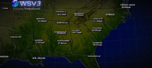
View attachment 140677
View attachment 010824.mp4
3k kind of creeps me out with how the line loses a little integrity and gets more cellular along and east of US1. Not sure if that's it becoming cellular or if that's it weakening. Something to watch tomorrow
3k kind of creeps me out with how the line loses a little integrity and gets more cellular along and east of US1. Not sure if that's it becoming cellular or if that's it weakening. Something to watch tomorrow
Sorry hard to tell at this place anymoreWas a tint of sarcasm in my comment ?
I've not been concerned for my area counting on the wedge to win out as is usual. Now, I'm not quite so sure.Peachtree NWS update:
Severe Threat:
Very impressive parameter space looks to set up over the CWA during
the early morning hours and into the afternoon on Tuesday. Strong
WAA overnight will allow for two not so great things - the first, it
will keep the boundary layer well mixed, likely preventing any
nocturnal inversion from setting up, and second, will likely help
break down our CAD/wedge in place. Normally I would say the wedge
will win out, but with a 80+ kt jet at 850mb overspreading the
region, that will aid greatly in mixing it out. That being said, the
best winds in that won`t arrive until the morning hours as the line
begins pushing through, so it may take a bit of time for the warm
sector to lift through the CWA. The current SPC outlook reflects
this nicely, showing biggest risks from Columbus to Macon and then
pushing north.
The wind threat will likely be the biggest risk right out. With the
very strong kinematics, mixing down big winds in the strongest
storms won`t take much in the way of instability. QLCS tornadoes
will likely be in play, especially given fish hook look to the
hodographs which give tremendous SRH values of 200-400 m2/s2. The
big question mark is the instability. This has potential to be a
classic HSLC event, but the ability to be fully surface based will
likely be dependent on how quickly and how strong the WAA occurs.
This creates uncertainty in the northern extent, and certainly won`t
rule out seeing some severe weather as far north as the metro if
WAA really gets moving.
Stormsfury
Member
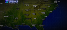
I think it could be a little both. Might have some breaks on there but there's so much SRH that any segment/break offs could spin off.View attachment 140680
3k kind of creeps me out with how the line loses a little integrity and gets more cellular along and east of US1. Not sure if that's it becoming cellular or if that's it weakening. Something to watch tomorrow
SnowwxAtl
Member
Me too! I can take the rain but the wind is scaring me like crazy. I am hoping the wedge can say strong!I've not been concerned for my area counting on the wedge to win out as is usual. Now, I'm not quite so sure.
26.7 gust here already, very early in this game, was kinda hoping that the shadow of the mountain would offer some protection like the NAM showed….
Fountainguy97
Member
The wind roar outside is extreme.. even inside at times it's hard to hear anything else. Jet engine just parked over your house. Not much notable mixing down. Few gusts to 30mph but peak is hours away.
I was helping beat the dead horse.....any whoSorry hard to tell at this place anymore
The 3k does almost look like the line breaks up and becomes more cellular. Not comparing at all but almost reminds me of how the line did with April 2011 outbreak. Seems I recall models showing that but I could be way off
While I never bet against the wedge, this set up has the look and feel of one that it gets pushed out easier than most. We will seeI've not been concerned for my area counting on the wedge to win out as is usual. Now, I'm not quite so sure.
Darklordsuperstorm
Member
0z hrrr is interesting in the convective side around here it just poofs away
Sure nuff, dang that complicates a forecast. Residual cool stable airmass weakening line?0z hrrr is interesting in the convective side around here it just poofs away
BHS1975
Member
Sure nuff, dang that complicates a forecast. Residual cool stable airmass weakening line?
Better hope so.

Sent from my iPhone using Tapatalk
Even with limited convection 0z HRRR still has 40-50 mph gust
Stormsfury
Member
Meager Cape... Even isn't very high down here with all the discrete cells in the Charleston region.. highest I saw was 573 j/kg... Whereas the rest of the mesoscales are 1000 j/kg and higher.0z hrrr is interesting in the convective side around here it just poofs away
We might have to consult a big brain on this one. The run is more unstable vs 18z so maybe it's something to do with that initial blob moving out of SC? That seems too simple and unlikely to choke out the incoming line. Might be some weird gravity wave, meso low stuff going onSure nuff, dang that complicates a forecast. Residual cool stable airmass weakening line?
Gotta love how the hrrr is always playing catch up on convectionMeager Cape... Even isn't very high down here with all the discrete cells in the Charleston region.. highest I saw was 573 j/kg... Whereas the rest of the mesoscales are 1000 j/kg and higher.
BHS1975
Member
We might have to consult a big brain on this one. The run is more unstable vs 18z so maybe it's something to do with that initial blob moving out of SC? That seems too simple and unlikely to choke out the incoming line. Might be some weird gravity wave, meso low stuff going on
Tornado threat went up so maybe more backing from mesolow.
Sent from my iPhone using Tapatalk
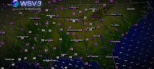
BULLCHIT ,, NE @ 3mph..Current Gusts View attachment 140683
BHS1975
Member
HRRR showing sustained at 30kts.
Sent from my iPhone using Tapatalk
Sent from my iPhone using Tapatalk
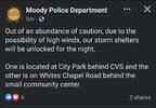
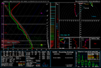
1026 0-3km bruhLol the 3k View attachment 140689
Darklordsuperstorm
Member
Everything is going to try to rotate tomorrow apparently1026 0-3km bruh
Have fun radar ops. Could be several brief spinups simultaneouslyEverything is going to try to rotate tomorrow apparently
State doing a balloon launch tomorrow?Have fun radar ops. Could be several brief spinups simultaneously
NoSnowJoe
Member
32/30 currently, just like you draw it up the night before a severe outbreak lol
severestorm
Member
Spent the last hour in the dark taking down my flagpole Christmas tree and outdoor inflatables because I’d like to use them next year. The tree would get sideways in 15’ish mph sustained winds so I figured I might lose her tomorrow. I need a drink
Hopefully a few gusts near 40 won't take down a lot of trees and stuff.
This made me go through the hrrr since I don't have the 3k until its done. There are lots of random 70-95mph gusts from Mobile to CLT then over to VA Beach
severestorm
Member
I was referencing the 70's mph in the triangle.Hopefully a few gusts near 40 won't take down a lot of trees and stuff.
wife got on you about getting that work done huh?Spent the last hour in the dark taking down my flagpole Christmas tree and outdoor inflatables because I’d like to use them next year. The tree would get sideways in 15’ish mph sustained winds so I figured I might lose her tomorrow. I need a drink

