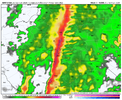
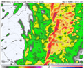
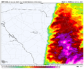
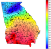
Wonder if the wind is just delayed or will it be denied? Maybe the rain this morning will help us out and keep things stabilized for later today.46/46 here. Wind SE 6 G 10. NAM had 40 mph gusts already. Lol
-
Hello, please take a minute to check out our awesome content, contributed by the wonderful members of our community. We hope you'll add your own thoughts and opinions by making a free account!
You are using an out of date browser. It may not display this or other websites correctly.
You should upgrade or use an alternative browser.
You should upgrade or use an alternative browser.
Severe Jan 8-11 2024 System Severe
- Thread starter SD
- Start date
?Lol, I am close to CAE and the wind gusts are starting to blow everything around....
I guess everyone else around CAE has a wind cover.
Forevertothee
Member
GSP
As of 655 am EST Tuesday: Our event is well underway at this hour,
with precip covering nearly the entire forecast area. The table has
been set for a busy day. We have a number of problems to discuss,
so let`s get right to it.
Changes for this update include an expansion of thunder to cover
most of the area east of the mtns right away this morning. Elevated
instability was doing the trick across north GA early this morning
and that trend has continued into northeast GA and the western
Upstate. The main severe threat still appears to be this afternoon,
however. A new Wind Advisory was issued for the mountains to take
care of the very strong wind gusts on the cold advection side
of the system after it departs tonight. There is a gap of time
during which the wind will be in a lull. The wind picks up again
from the west during the mid/late evening and will continue from
that direction into Wednesday morning.
Otherwise...the best precip rates have been over the southerly
upslope areas of northeast GA/western Upstate SC/southern mtns
of NC, more or less where we expected early in the event, with
amounts starting to add up. This was soaking down the area and
priming it for problems later on this morning when even heavier
rain seen upstream over north GA and eastern AL gets here thru
late morning. The latest QPF from WPC has come down just a bit, as
have the 6hr prob matched mean precip on the 00Z run of the HREF,
but what remains is still more than adequate to support keeping the
Flood Watch intact. We could contemplate putting Graham and Swain
in there as well, but at this point it is probably academic. The
lower Piedmont of SC/Lakelands remains out of the Watch, but that
still looks ok. No changes to the Flood Watch.
As for the Winter Weather Advisory, there may still be a few
isolated pockets of near freezing temps close to the Blue Ridge
Escarpment north of I-40, but the continued gradual warming across
the nrn mountains/foothills should have taken care of what`s left
in very short order. Thus, we will let the Advisory go on schedule.
As for the Wind situation, it has been somewhat underwhelming
thus far as the strongest winds have been riding up over the
very shallow stable layer across the mtns. However, the higher
peaks are gradually encountering the stronger winds and the gusts
have been creeping upward. Think we are still on track early this
morning. Guidance suggests we will start to mix deeply enough over
the lower Piedmont starting around 15Z to bring frequent wind gusts
of 40-45kt or so down to the ground. The wind gust potential should
then spread northward thru the rest of the morning and into the
afternoon as we uncover more of the fcst area. Guidance suggest
the winds will persist into tonight. More on that later.
The other primary concern is the severe thunderstorm potential. Only
minor changes were made to the new Day 1 Outlook from SPC and that
seems reasonable. Clearly the potential looks better to our S and E
this afternoon and evening, but we still have a good shot at severe
storms. The synoptic scale models bring a plume of low sfc-based
CAPE of 300-500 J/kg across the area along/SE of I-85 from late
morning thru late afternoon ahead of the sfc front, to go along
with what looks like very strong shear. The pattern resembles many
high shear/low CAPE severe weather episodes we have seen over the
years, with a dry punch coming in behind a very strongly forced sfc
boundary. The CAMs in the 00Z HREF do not disappoint, with most
showing some updraft helicity streaks over the area from AND to
GSP to HKY and points east...basically where the plume of weak CAPE
would reach. This checks just about all the boxes for a severe wind
producing squall line across that area, with occasional brief/weak
tornadoes where the line breaks or where embedded meso-vortices
persist. Such brief tornadic circulations are notoriously difficult
to warn with much lead time. Expect part of the area will end up in
some sort of SVR/TOR Watch at some point this afternoon, so be on
the lookout for that. The severe weather threat/additional flooding
threat will end from the west with the passage of the main front.
Tonight, with the front to the east, colder air will move in that
should change any remaining precip over the mtns over to snow
showers thru the mid/late evening. The flow looks unconventional
as it veers from SW to W overnight, but there is enough moisture
that is deep enough into the dendritic growth zone such that
snow showers are a good bet. The westerly flow favors parts of
the Smokies, in particular western Graham County. We may need
to consider a small Winter Weather Advisory depending on how the
forecast trend goes today.
Wind will continue to be a problem tonight, particularly over
the mtns as the cold advection flow takes hold. Guidance has
strong wind gusts persisting through Wednesday morning, so a Wind
Advisory will be issued/extended across the higher terrain through
18Z Wednesday. East of the mtns, it will also be blustery, but
not to the extent that an Advisory is warranted, but this could
also change.
Wedge,Cad boundary in NC is west of lumberton, probably getting to fayeteville soon, dont think its made it to SD, RWI airport yet. Im at 42 degrees,Lumberton 52
Ron Burgundy
Member
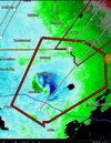
For a brief moment there I was under a tornado warning at 44/42. There’s something you don’t experience every day. ?
NBAcentel
Member
We know the wind gust maps are always overdone, no argument there, it's well established. However, latest run of 3k NAM showed a potential peak wind gust of 37 mph in Wake around 9:00 am and RDU has reported a 30 mph gust, so not too far off actually.46/46 here. Wind SE 6 G 10. NAM had 40 mph gusts already. Lol
- Joined
- Jan 5, 2017
- Messages
- 3,770
- Reaction score
- 5,969
I chased that tornado up the southwest side of Atlanta. It looks like it did some minor damage to cars and trucks at I-285 and I-85 near the airport. I probably should have pulled over, but man I wanted to see it!For a brief moment there I was under a tornado warning at 44/42. There’s something you don’t experience every day. ?
Boom
Next I think people are going u get lulled into thinking this is a bust through the first half of the day tomorrow as the residual rain and wedge will keep wind pretty tame once the WF passes that unlocks the potential for the more extreme wind gusts
The wind here is coming down with the heavier showers and rising temps.
Just give it time before cancelling the event.
Just give it time before cancelling the event.
vsublazer
Member
- Joined
- Jan 5, 2017
- Messages
- 3,770
- Reaction score
- 5,969
My temp is dropping at the house. Dropped 3 degrees in an hour. Not sure why...checking latest HRRR for reasons. Down to 50 now under heavy rain. The best I can tell is that the mesocyclone that drove through (that possibly had a tornado) brought a heavy down burst of colder temps aloft and also brought the winds around from the northwest sooner than otherwise would have happened. I may have reached my high for today of 52.7, though I bet we bounce up a bit once the rain slacks off and before the cold air moves in.
Last edited:
- Joined
- Jan 23, 2021
- Messages
- 4,602
- Reaction score
- 15,197
- Location
- Lebanon Township, Durham County NC
ENCSnowdawg
Member
Hello everyone. I'm expecting wind gusts up to 55mph for my area in Eastern NC. Potential up to 70+mph towards the coast. Hope everyone stay safe
Tarheelwx
Member
Dead calm and 43.3 here in Colfax NC, about 4 miles west of GSO.
TW
TW
It’s still around 45 where I am after the main line of storms have progressed east. Temperatures haven’t really budged that much since last night.My temp is dropping at the house. Dropped 3 degrees in an hour. Not sure why...checking latest HRRR for reasons. Down to 50 now under heavy rain.
coldspringsfarm
Member
yep just moderate rain here just NW of Winston SalemDead calm and 43.3 here in Colfax NC, about 4 miles west of GSO.
TW
ryanardo
Member
This could definitely one for the books for this time of year, don't know why yall are canceling the event, all the dynamics are coming together here for cae, give it time
Ron Burgundy
Member
Wow - didn’t think it had touched down. It was only an active warning for a few minutes.I chased that tornado up the southwest side of Atlanta. It looks like it did some minor damage to cars and trucks at I-285 and I-85 near the airport. I probably should have pulled over, but man I wanted to see it!
Wedge wins again.It’s still around 45 where I am after the main line of storms have progressed east. Temperatures haven’t really budged that much since last night.
HugeSnowStick
Member
I don’t think it was predicted for the wedge to not win in Atlanta. This was never a severe event for atl or gsp.
I’m headed to Myrtle
I’m headed to Myrtle
ENCSnowdawg
Member
Albany, GA per NWS current observation showing winds 44 sustain, gust 70mph
- Joined
- Jan 5, 2017
- Messages
- 3,770
- Reaction score
- 5,969
We will have to wait for confirmation from KFFC. I saw a flat bed truck that lost it's container, another rig missing it's front cowling (not sure how that happened?) many cars pulled over and emergency crews. My guess is just high winds from the elevated circulation or an EF0.Wow - didn’t think it had touched down. It was only an active warning for a few minutes.
Yeah we definitely aren't keeping power if this is a preview well before the main event gets here. Good night
True. I was just saying it moved the stronger winds in during the very early AM hours with widespread gusts well into the 40s by now. But I was thinking of the 0z run too, since that's the last one I looked at. The 6z has mid-upper 40s now, approaching 50 across the area by 11 and then mid/upper 50s to 60+ from 1:00 until the squall line moves through. It's still doing that break apart thing as it gets into the Triangle with the squall line too.We know the wind gust maps are always overdone, no argument there, it's well established. However, latest run of 3k NAM showed a potential peak wind gust of 37 mph in Wake around 9:00 am and RDU has reported a 30 mph gust, so not too far off actually.
Either way, it is going to get windy later. The wind advisory mentions gradient gusts to 50 now, so that's up from yesterday. Those widespread multi-hour 50+ gusts will probably verify as 30-40, with some random spikes over, which is still very impressive and enough to move things around in the yard pretty efficiently.
I was supposed to be at 50 for this time according to TWC but am at 45. I also have for tonight "a shower or wet snow possible" in the details. Wutttt? LOL!
It's a little breezy here but nothing out of the ordinary. however, it's been a deluge with over 3" so far. Just got to the office and the drains are all pretty much overflowing onto the roads.
- Joined
- Jan 5, 2017
- Messages
- 3,770
- Reaction score
- 5,969
All of the short range models were indicating that the wedge would hold for Atlanta north. I'm not sure why KFFC backed down and started to doubt it would. That one storm near Palmetto was very odd.Wedge wins again.
HugeSnowStick
Member
Yes, it was supposed to be scoured out by the low level jet, per the disco last evening from KFFC.I don’t think it was predicted for the wedge to not win in Atlanta. This was never a severe event for atl or gsp.
I’m headed to Myrtle
vsublazer
Member
Can confirm weather is starting to get bad in South Georgia. Mom lives in Cordele, GA and she said between the lightning and wind it’s nerve wracking. It’s a good thing that school down there cancelled for today.
accu35
Member
Yeah we good here just got roughWow!!! You're okay?
- Joined
- Jan 5, 2017
- Messages
- 3,770
- Reaction score
- 5,969
I'm at 3.31" for the event! Temp down to 50.4 but winds are gusty from the northwest.
vsublazer
Member
62 in Marion
EastmanGAWX
Member
I live about 50 miles east of Cordele and there's been sporadic power outages and scattered down trees just from the wind/storms last night. The atmospheric conditions outside almost make one think that a tropical storm was coming through the area.Can confirm weather is starting to get bad in South Georgia. Mom lives in Cordele, GA and she said between the lightning and wind it’s nerve wracking. It’s a good thing that school down there cancelled for today.
SnowwxAtl
Member
Wedge held strong! 49.4 and rain. Light winds.
You're right.. I went from 50 to 48. As far as that tornado, it was fake news...lol I stayed in my bed when I heard it and saw 50 degrees. I am near airport. LolMy temp is dropping at the house. Dropped 3 degrees in an hour. Not sure why...checking latest HRRR for reasons. Down to 50 now under heavy rain. The best I can tell is that the mesocyclone that drove through (that possibly had a tornado) brought a heavy down burst of colder temps aloft and also brought the winds around from the northwest sooner than otherwise would have happened. I may have reached my high for today of 52.7, though I bet we bounce up a bit once the rain slacks off and before the cold air moves in.
vsublazer
Member
She said it was very much like Hurricane Michael vibes to her.I live about 50 miles east of Cordele and there's been sporadic power outages and scattered down trees just from the wind/storms last night. The atmospheric conditions outside almost make one think that a tropical storm was coming through the area.

