• Hello, please take a minute to check out our awesome content, contributed by the wonderful members of our community. We hope you'll add your own thoughts and opinions by making a free account!

Severe Jan 8-11 2024 System Severe

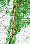
RAH seems kind of meh. I mean, they talk about wind gusts in to the 40s and a conditional risk of stronger gusts with the squall line later, but their language doesn't seem all that concerning for stronger background gusts.

.SHORT TERM /TUESDAY THROUGH TUESDAY NIGHT/...
As of 400 PM Monday...

There has been little change in overall forecast rationale for this
period, though with continued uncertainties surrounding to what
degree the boundary layer can destabilize and support conditional
probabilities of risks for both pre-frontal gradient wind and severe
convection.

A progressive mid/upper-level cyclone, now crossing the TX/OK
panhandles, will have reached swrn MO by the start of the period,
then continue to deepen while migrating newd to the lwr Great Lakes
by 12Z Wed. An initially positive tilt shortwave trough trailing the
cyclone will assume neutral to slight negative tilt while pivoting
from the lwr MS Valley to the srn Middle Atlantic coast. Strong
dynamics and kinematics will precede the cyclone and contribute to
both strong forcing for ascent and extreme shear over the Carolinas,
particularly during the afternoon and evening.

At the surface, a parent cyclone will deepen and occlude as it
follows migrates across the Great Lakes, following a similar path as
the deeper-layer cyclone. Meanwhile, a secondary frontal wave
initially invof srn AL, near a quadruple point of both a wedge front
along the periphery of the retreating in-situ CAD regime, and a
maritime warm front that will spread from the nrn GOM and South
Atlantic coastal region inland across srn through ern GA and the ern
Carolinas, will deepen while tracking over nrn GA and the Carolina
and srn Middle Atlantic Piedmont through Tue evening, then across
the coastal Middle Atlantic and srn New England Tue night.

Periods of rain and drizzle, amid CAD and surface stability early
Tue, will become increasingly heavy and convective, as the wedge
front rapidly retreats nwwd, immediately preceding the quadruple
point across the Carolinas through Tue evening. Despite the
associated strong low-level theta-e advection ahead of this wave,
with surface temperatures and dewpoints likely to increase into the
upr 50s/lwr 60s on average, generally weak lapse rates from the
surface through the mid-levels continue to lend uncertainty
regarding the degree of gradient wind gust potential and high-shear
low-CAPE severe weather risk in cntl NC. Further concerns center
around how quickly upstream convection will move ewd, probably in an
initially weakening state as it encounters the aforementioned
lingering stability over cntl NC, which would further subdue warm
sector destabilization prior to when the otherwise richest theta-e
air/near surface destabilization would arrive ahead of the secondary
frontal wave.

There remains the potential for sufficient boundary layer mixing
ahead of the secondary wave that would allow for surface wind gusts
of 30-40 kts, locally higher to materialize during the late
afternoon through evening, especially over the srn
Piedmont/Sandhills/srn-cntl Coastal Plain. A QLCS and line-embedded
mesovortices will then pose the greatest threat of heavy rain and a
conditional risk of damaging surface wind gusts/isolated tornadoes
as it moves across cntl NC most likely from mid-afternoon through
mid-evening. There also remains some, lesser potential for discrete
mini supercell development preceding the QLCS and across the ern
Carolinas during that time.

Showers/isolated storms will end from west to east overnight Tue,
with storm total rainfall likely to range from 1.5 - 3", highest
over the Piedmont, and the majority of which will fall within
convection Tue afternoon-evening. Urban and poor drainage flooding
may result, and a Flood Watch has been issued for the Piedmont and
wrn Sandhills, in the overlapping footprint of both the highest
predicted rain and lowest Flash Flood Guidance values. A secondary
surge of swly winds and gusts into the 30s kts will likely follow in
CAA and pressure rises overnight; and an extension of the Wind
Advisory should be strongly considered as timing gets to within the
1st to 2nd period issuance time. That CAA will also cause
temperatures to cool mostly into the 40s, except some upr 30s
possible over the wrn Piedmont, by Wed morning.
Just getting ready for the winter weather and starting conservative and then changing as it goes if needed. ;)
 
Wilmington

BOTTOM LINE UP FRONT: A STRONG COLD FRONTAL SYSTEM WILL BRING
A SEVERE WEATHER OUTBREAK TO NORTHEAST SOUTH CAROLINA AND
SOUTHEAST NORTH CAROLINA. STRAIGHT LINE WINDS AND TORNADOES ARE
THE BIGGEST HAZARDS IN PLAY. DISCRETE SUPERCELLS AHEAD OF THE
MAIN SQUALL LINE ARE POSSIBLE EARLY TUESDAY AFTERNOON, WHERE A
FEW STRONG TORNADOES MAY OCCUR. THE SQUALL LINE ITSELF MAY ALSO
HAVE TORNADOES EMBEDDED WITHIN IT. STRONG GRADIENT WINDS MAY
PRODUCE GUSTS UP TO AND ABOVE 50-60 MPH, ESPECIALLY ALONG THE
COAST AND OFFSHORE. WINDS FROM TORNADOES OR OTHER SEVERE
SHOWERS MAY EXCEED THESE SPEEDS.*

Alright, Tuesday. The upper low moves a bit slower than I expect,
but regardless, it starts to turn more northeasterly, flirting with
the Great Lakes region by Tuesday evening. The surface low follows a
similar path. Base of the trough doesn`t really dig any further
south, but it doesn`t need to. What is more apparent is that the LLJ
really starts dropping down into the 925-850mb layers by late
Tuesday morning. At the same time, this is when the trough aloft
starts becoming even more negatively tilted, introducing powerful
positive vorticity advection. High temperatures shoot up into the
upper 60s, with some spots reaching 70. Juicy dewpoints continue to
escalate into the low-to-mid 60s, certainly a muggy day for January.

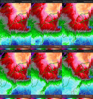
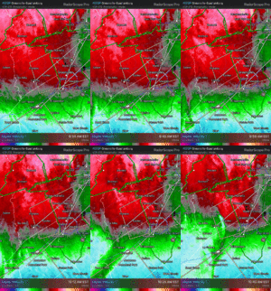
To the mesoscale we go. We start with shear and helicity, which
are easily the most impressive features of this setup. Multiple
models agree in recording 60-70kts of shear in the 0-3 km and
0-6 km layers, with 50-55 kts in the 0-1 km layer. The helicity
is also extremely high, coming in at 400-700 m2/s2 in the 0-3 km
layer, and 300-500 m2/s2 in the 0-1 km layer. Instability has
been the main question, although forecast guidance is coming
together that some level of surface-based CAPE will be present,
despite relatively warm temperatures in the mid- levels. Some of
the high-resolution guidance is more bullish on the instability,
but with the cloud cover, modest lapse rates, ample rain ahead
ahead of the main severe window, and mild capping aloft, there
are some doubts. Regardless, it doesn`t really matter, with
nearly all other severe weather ingredients in ample amounts.
It won`t take much instability for severe winds aloft (which
aren`t really that "aloft") to mix down to the surface.
Likewise, the shear spells out a favorable environment for
tornadoes.

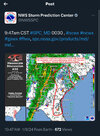
SPC has the entire area in an "Enhanced Risk" (threat
level 3/5) for severe weather. Even more eye-popping is that we
are in the "hatched" area for both the tornado and severe wind
outlooks.
 
After originally going with a half day the school system.has.came back and cancelled.for the entire day.
 
RAH seems kind of meh. I mean, they talk about wind gusts in to the 40s and a conditional risk of stronger gusts with the squall line later, but their language doesn't seem all that concerning for stronger background gusts.

.SHORT TERM /TUESDAY THROUGH TUESDAY NIGHT/...
As of 400 PM Monday...

There has been little change in overall forecast rationale for this
period, though with continued uncertainties surrounding to what
degree the boundary layer can destabilize and support conditional
probabilities of risks for both pre-frontal gradient wind and severe
convection.

A progressive mid/upper-level cyclone, now crossing the TX/OK
panhandles, will have reached swrn MO by the start of the period,
then continue to deepen while migrating newd to the lwr Great Lakes
by 12Z Wed. An initially positive tilt shortwave trough trailing the
cyclone will assume neutral to slight negative tilt while pivoting
from the lwr MS Valley to the srn Middle Atlantic coast. Strong
dynamics and kinematics will precede the cyclone and contribute to
both strong forcing for ascent and extreme shear over the Carolinas,
particularly during the afternoon and evening.

At the surface, a parent cyclone will deepen and occlude as it
follows migrates across the Great Lakes, following a similar path as
the deeper-layer cyclone. Meanwhile, a secondary frontal wave
initially invof srn AL, near a quadruple point of both a wedge front
along the periphery of the retreating in-situ CAD regime, and a
maritime warm front that will spread from the nrn GOM and South
Atlantic coastal region inland across srn through ern GA and the ern
Carolinas, will deepen while tracking over nrn GA and the Carolina
and srn Middle Atlantic Piedmont through Tue evening, then across
the coastal Middle Atlantic and srn New England Tue night.

Periods of rain and drizzle, amid CAD and surface stability early
Tue, will become increasingly heavy and convective, as the wedge
front rapidly retreats nwwd, immediately preceding the quadruple
point across the Carolinas through Tue evening. Despite the
associated strong low-level theta-e advection ahead of this wave,
with surface temperatures and dewpoints likely to increase into the
upr 50s/lwr 60s on average, generally weak lapse rates from the
surface through the mid-levels continue to lend uncertainty
regarding the degree of gradient wind gust potential and high-shear
low-CAPE severe weather risk in cntl NC. Further concerns center
around how quickly upstream convection will move ewd, probably in an
initially weakening state as it encounters the aforementioned
lingering stability over cntl NC, which would further subdue warm
sector destabilization prior to when the otherwise richest theta-e
air/near surface destabilization would arrive ahead of the secondary
frontal wave.

There remains the potential for sufficient boundary layer mixing
ahead of the secondary wave that would allow for surface wind gusts
of 30-40 kts, locally higher to materialize during the late
afternoon through evening, especially over the srn
Piedmont/Sandhills/srn-cntl Coastal Plain. A QLCS and line-embedded
mesovortices will then pose the greatest threat of heavy rain and a
conditional risk of damaging surface wind gusts/isolated tornadoes
as it moves across cntl NC most likely from mid-afternoon through
mid-evening. There also remains some, lesser potential for discrete
mini supercell development preceding the QLCS and across the ern
Carolinas during that time.

Showers/isolated storms will end from west to east overnight Tue,
with storm total rainfall likely to range from 1.5 - 3", highest
over the Piedmont, and the majority of which will fall within
convection Tue afternoon-evening. Urban and poor drainage flooding
may result, and a Flood Watch has been issued for the Piedmont and
wrn Sandhills, in the overlapping footprint of both the highest
predicted rain and lowest Flash Flood Guidance values. A secondary
surge of swly winds and gusts into the 30s kts will likely follow in
CAA and pressure rises overnight; and an extension of the Wind
Advisory should be strongly considered as timing gets to within the
1st to 2nd period issuance time. That CAA will also cause
temperatures to cool mostly into the 40s, except some upr 30s
possible over the wrn Piedmont, by Wed morning.
30-40 kt gust seems about right honestly, I feel they're spot on.
 
Berkeley, Dorchester, and Charleston Counties have canceled in person classes for K-12, eLearning/Online classes.

Various mesoscales FV3 1KM, NAM 3KM, WRF-ARW and WRF-ARW2 all show SBCAPES ranging from 1000-1300 j/kg, MLCAPE from 700-1100 j/kg, and MUCAPE in the 1000-1400 j/kg for the Charleston Quad-County region.

Won't be surprised to see a pocket of moderate risk issued for Tuesday... Trends tonight downstream will be very important to see on what the Carolinas can expect Tuesday.
 
Mobile AFD is insane.
Yeah its a doozy. Long. Very long, but detailed and worth the read.

No mincing words here, our concerns for the overnight period
tonight is serious. A incredibly impactful system has begun across
our area and conditions will rapidly deteriorate throughout the
night. The potential for significant severe appears likely across
most of the area including the potential for several significant
tornadoes (EF-2+) and damaging winds in excess of 70 mph. While
the current severe risk is at an enhanced, the ceiling of this
environment could easily support a more significant severe threat
and only minor confidence questions are holding back from higher
severe probs. Nonetheless, these confidences may not improve until
we see the white of its eyes and this event needs to be treated
seriously. On top of significant severe, intense wind gusts of 50
to 60 mph, minor to moderate coastal flooding and extremely high
surf will all be possible overnight tonight. Coastal and wind
impacts will likely be on the higher end for non-tropical systems
for the Mobile area.

I`ll keep the synoptics short here as by this point its about
small scale things and impacts. I think we all understand by this
point there`s a rather strong system moving through.

Severe Threat...The makings of a significant severe thunderstorm
threat looks likely tonight and into Tuesday morning. An intense
low level jet will usher plenty of warm air and rich Gulf moisture
into the area with temperatures/dew points rising nearly 20
degrees over the next 18 hours. These factors will likely have no
issue working instability inland across our area as the marine
boundary lifts northward. All the high resolution guidance
continues to have around 1000 J/KG of MLCape making its way to the
highway 84 corridor with some guidance hinting at near 2000 J/KG
near the I-10 corridor. On top of the instability the shear will
be absolutely insane with 0-1 KM SRH values in the warm sector
hovering around the 500 to 700 m2/s2 and with no surprise,
forecast soundings continue to indicate very significant low level
curvature. Intense jet dynamics in the right entrance region of
the upper jet will likely lead to widespread convective coverage
beginning around midnight, likely overcoming the intense shear
allowing for storms to rapidly organize. This event will go from 0
to 100 very quickly as the upper jet moves in and the intense low
level jet increases. Rain will likely begin well before the
severe weather arrives and things will likely go from showers and
a few elevated thunderstorms to numerous severe storms in a couple
hours. DO NOT LET YOUR GUARD DOWN BEFORE MIDNIGHT.

Expect two possibly three rounds of severe weather to be possible
with rounds two and three capable of significant severe. The first
of three rounds is a little more conditional as the marine
boundary moves inland. Given the shear environment, relatively low
freezing level heights and deep EL`s, elevated storms would be
possible with some hail probably around 1 inch in diameter. This
will likely occur prior to midnight and in the grand scheme of
things this threat is a mole hill compared to the mountain ahead.

The second round is when things will begin to rapidly go downhill
as the clock strikes midnight (or around that time). Recent high
res-guidance continues to uptrend in the possibility of a few
discrete to semi-discrete supercells developing along a confluence
band ahead of the main line as the marine boundary lifts north
shortly around midnight or just after. Given the shear environment
and the boundary, this environment would be more than supportive
of strong tornadoes and if these cells truly are able to take full
advantage of the environment then the ceiling may be higher. The
big question for higher end potential is can these storms sustain
themselves with a lot of cell interactions, intense shear, modest
but quickly increasing instability and stay within the optimal
boundary spot to remain tornado producers. Unfortunately, some of
our strongest tornadoes locally have occurred in environments
along these marine boundaries and warm fronts when they are able
to sustain themselves within the optimal boundary mode. While we
are still unsure about this potential, the high impact nature of
this period warrants great concern and if confidence continues to
increase this would likely be the driving force into any potential
severe upgrades heading into the evening.

Then final punch will arrives shortly after round two in the 2 am
to 8am timeframe in the form of a rather strong QLCS. This heavily
forced squall line will only intensify as the upper jet
overspreads and the LLJ increases. The combination of strong
kinematics and low level instability with 0- 3km cape values
likely approaching 100k/kg or more will support strong vertical
stretching in a incredibly rich vorticity environment. This
environment will truly peak east of I-65 across the western
Florida Panhandle and into south central Alabama. Based off recent
research this environment will be primed for QLCS tornadoes and
given the upper echelon shear environment, strong QLCS tornadoes
(EF-2+) could be possible. Along with the tornadoes, strong
damaging winds will also be likely with wind gusts in excess of 70
mph given 850 and 925 mb winds will already be high. This has the
potential to be a rather intense severe event occurring
overnight. Be sure to continue to stay updated and have multiple
ways to receive warnings that are battery operated and charged as
power may go out well before severe thunderstorms arrive.

Wind Impacts...An extremely tight pressure gradient will develop
over the area through tonight as the surface low pressure drops
into the upper 980s. This will result in very windy conditions.
Winds have already been gusting to 30 mph across the area this
afternoon and are expected to increase into the evening. Winds
well offshore have continued to climb with gusts to near 55 mph
already. These winds will steadily move towards the coast this
evening. A high end Wind Advisory has been issued for much of the
area for wind gusts of 40-50 mph. Winds will be even higher along
the coast with gusts up to 60 mph possible late tonight and early
Tuesday morning as a powerful low level jet pushes into the area.
A rather rare High Wind Warning has been issued for these coastal
areas. The compounding impacts of increased winds and ongoing
rainfall to saturate the soil will make trees and power lines more
susceptible to being blown over outside of any thunderstorms.
Because of this, power outages will be possible well before any
severe thunderstorms arrive so it is very important to have
multiple ways to receive warnings overnight. Be sure to charge
battery powered methods of receiving warnings before going to bed
and be sure to secure loose items outside.

Beach/Coastal Hazards....Very strong onshore flow will result in
dangerous rip currents and extremely high surf conditions at all
area beaches. Surf heights of 10 to 15 feet are expected and will
likely lead to beach erosion and coastal overwash along flood
prone barrier islands. A High risk of Rip Currents is in effect
through early this week and a High Surf Warning remains in effect
through Wednesday morning. On top of the intense wave action,
strong and persistent low level winds will push water inland
leading to coastal flooding. The current forecast supports solid
coastal flooding with coastal flood warning conditions potentially
occurring within Mobile Bay. Given that these strong low level
jet scenarios tend to over perform with coastal flooding, we went
ahead and upgraded Mobile Bay to a Coastal Flood Warning. Expect
potentially moderate coastal flooding across most of the barrier
islands and Mobile Bay.

Heavy Rainfall... PWATS will steadily climb in advance of the
system with values approaching the climatological maximum for
this time of year. This moisture combined with better instability
will result in some heavier rain rates this afternoon and
overnight. Storms will be capable of producing heavy rainfall in a
short period of time, but given the progressive nature and the
fact that we are still in a drought, there is still low confidence
in significant flooding impacts. Most areas will likely see 2-4
inches of rainfall now through Tuesday with some areas potentially
picking up 6 inches in this time frame. A localized advisory or
warning cannot be ruled out.

This is about as serious as it gets across our area with respects
to impacts. Please remain weather aware tonight and have an
emergency plan in place. Be sure to have a way to receive warnings
that will wake you up and quickly go to your safe place. Prep
your safe place now as power outages might make things difficult
tonight. Trust us we do not want to be issuing tornado warnings at
4 am either and hopefully things find a way to pan out to the
better. We will be right here with you through the night!
 
Someone dig the maps up for this event Jan 8th 1995....146 gust at Seymour Johnson, 120 New Bern

There was a strong CAD in place with that system and a significant ice storm for the western Piedmont and foothills. When the wedge eroded, it eroded fast though. CLT went from upper 20s with freezing rain to low 50s and thunderstorms in a matter of a couple hours overnight
 
Back
Top