Yeah this is why you would really want to weaken the parent if you could. Either way I'm getting some vibes of the last ice storm that kind of pooped outLol I dunno if we want to trend stronger with low level cold/sfc temps now looking at it, 925s are baking for areas that are seeing ice, this wouldn’t even be sleet, just ZR, oof View attachment 68890
-
Hello, please take a minute to check out our awesome content, contributed by the wonderful members of our community. We hope you'll add your own thoughts and opinions by making a free account!
You are using an out of date browser. It may not display this or other websites correctly.
You should upgrade or use an alternative browser.
You should upgrade or use an alternative browser.
Wintry Jan 30-Feb 2 2021 ❄️ Potential
- Thread starter SD
- Start date
NBAcentel
Member
Selling like lebron in the 4th quarter with the ball and 4 seconds left 

ICON was also 3-4 degrees colder for the CAD areas.
iGRXY
Member
RGEM was way colder as well
We are getting real close to winning Saturday night into Sunday morningView attachment 68887View attachment 68888
Gotta get that thing to dig further south and exit around ILM to HAT

That look screams 'Ice Ice Baby' for the southern Piedmont, the Upstate of SC, and NE GA.
Yeah, I love snow but I tell you, sleet has the staying power that snow just doesn't have.
Dewpoint Dan
Member
I love snow with sleet on top. I think that helps preserve the snow longer.Yeah, I love snow but I tell you, sleet has the staying power that snow just doesn't have.
A lot awesomer if you shift it south about 2 counties.
Cad Wedge NC
Member
I agree...A oor awesomer if you shift it south about 2 counties.
Dunkman
Member
Yeah, I love snow but I tell you, sleet has the staying power that snow just doesn't have.
I remember we had 6+ inches of sleet in a storm maybe 6-7 years ago. We had like a close to 2 foot drift on the back porch where it slid down the roof and accumulated. I thought that thing was going to last until summer. It survived weeks and weeks.
AKA , the finger! Usually 12 hours ahead of scheduleExactly what I was thinking, imo WAA/700mb FGEN ramming into confluence like that argues for forcing for ascent >> some sort of band of precipitation
Dewpoint Dan
Member
Get ready to be building that snowpack this weekend ! You may have snow on the ground until April !AKA , the finger! Usually 12 hours ahead of schedule
GSO and the I-85 corridor needs to watch this one very closely for significant icing potential. RDU may have a shot at a light glaze of onset ice if precip moves in earlier than forecast.
I’m hoping to pack 6-12” on too! The Euro has that, GFS 5-8”Get ready to be building that snowpack this weekend ! You may have snow on the ground until April !
SimeonNC
Member
Honestly the RGEM looks pretty good in terms of where the frozen precip will be, assuming trends continue. The amounts are probably way overdone but that's normal.
D
Deleted member 1449
Guest
I doubt sleet will be that dominant, but I would prefer it to freezing rain.
SimeonNC
Member
Even the NAM has CLT at 33 when the heaviest precip starts to fall, if things keep trending cooler then even CLT might need to watch out
NBAcentel
Member
Hmmm, if we can overcome those dry Low levels and shift our S/W a tad bit further south, that would help quite a bit more 


iGRXY
Member
Remember that precip will likely come a few hours earlier like it always does and most of us will likely be pretty below freezing at that time
SimeonNC
Member
A weird difference between the NAM and the RGEM is that when the heaviest precip starts, NAM and RGEM are pretty similar but the REGEM has CLT dropping to below freezing while the NAM has temps rise a bit.
NBAcentel
Member
Hmmm, if we can overcome those dry Low levels and shift our S/W a tad bit further south, that would help quite a bit more View attachment 68900View attachment 68901View attachment 68902
oh and btw, if we do indeed break out some precipitation early on, that would already develop and get the CAD dome going which mean less scouring of CAD from the Sly flow in the low levels Early on in the game. a 50-100 mile shift south with a tick more confluence makes a big difference here, but if we go the other way we have December’s setup all over again
iGRXY
Member
If and that’s a big if, the RGEM was correct on the temps, those totals it’s spitting out would likely be in the range of there. You get temps in the mid 20’s and pretty much anything that falls will accumulate or accrual.
L
Logan Is An Idiot 02
Guest
RGEM has a cold bias. Nam over rgem any day of the weekA weird difference between the NAM and the RGEM is that when the heaviest precip starts, NAM and RGEM are pretty similar but the REGEM has CLT dropping to below freezing while the NAM has temps rise a bit.
L
Logan Is An Idiot 02
Guest
The RGEM won't even be close. It had like an inch of ice for the system in December and it was 34 and rainIf and that’s a big if, the RGEM was correct on the temps, those totals it’s spitting out would likely be in the range of there. You get temps in the mid 20’s and pretty much anything that falls will accumulate or accrual.
NBAcentel
Member
It’s very close to the NAM btw, although I think it’s to cold at 925, but these runs start becoming really important tomorrow, I don’t buy this much ice this far south yetThe RGEM won't even be close. It had like an inch of ice for the system in December and it was 34 and rain


MichaelJ
Member
1. Ice Ice Baby, NO THANKS
2. It is important to remember how BAD the models have been in predicting winter weather so far
YO, if the LOW can't give us SNOW, then please just GO.
2. It is important to remember how BAD the models have been in predicting winter weather so far
YO, if the LOW can't give us SNOW, then please just GO.
Snow_chaser
Member
Lol Johnny Cash style. One piece at a time.You are going to nickel and dime your way to half a foot ?
iGRXY
Member
To go off this. If we do get precip to move in faster by 3 hours then you’re definitely looking the CAD dome in and it’s going to be hell trying to erode it. Seen too many times even short range modes eroding CAD way way too fast.Remember that precip will likely come a few hours earlier like it always does and most of us will likely be pretty below freezing at that time
NBAcentel
Member
18z Euro took a baby step towards the NAM w/ more confluence aloft at H5, still ice mainly confined north of I-40, but notice stronger confluence aloft/more west = colder and effectively pushes our S/W south a tad 
NBAcentel
Member
That little difference to our NE makes a big difference 
One thing just to point out, it's not always accurate to say this or that model has a warm or cold bias. Much of that is situational. It may be that the "cold biased" Rgem is actually closer to reality than the other models, for example.
NBAcentel
Member
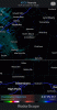
Ideally for a big CAD region NC winter storm/ice storm you want that confluence in the NE around the red line and Shortwave around that X 
LukeBarrette
im north of 90% of people on here so yeah
Meteorology Student
Member
2024 Supporter
2017-2023 Supporter
iGRXY
Member
One thing to note is the last storm trended further and further south. The last 3 runs of the NAM have also trended further and further south with the vort so it’ll be interesting to see if we continue that with the next run.Ideally for a big CAD region NC winter storm/ice storm you want that confluence in the NE around the red line and Shortwave around that X View attachment 68920
B
Brick Tamland
Guest
One thing to note is the last storm trended further and further south. The last 3 runs of the NAM have also trended further and further south with the vort so it’ll be interesting to see if we continue that with the next run.
Yes, like I said that has been the trend this week.
Nomanslandva
Member
That was hauling a$$.Unrelated but what the hell was that.
Not liking these Southeast trends for Freezing Rain. I like my power. ")
Anyway, the Operational vs. the Parallel.
Operational

Parallel

Anyway, the Operational vs. the Parallel.
Operational
Parallel
