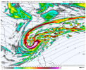
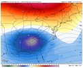
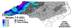
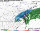
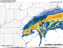
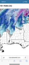
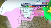
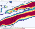
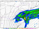
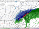
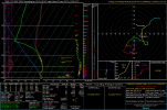
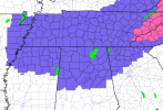
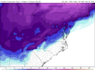
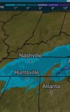
I ensured that it will hit near you ARCC. I made reservations in Gatlinburg then check the forecast 45 minutes later to see it looking better for us here in Central Alabama.
-
Hello, please take a minute to check out our awesome content, contributed by the wonderful members of our community. We hope you'll add your own thoughts and opinions by making a free account!
You are using an out of date browser. It may not display this or other websites correctly.
You should upgrade or use an alternative browser.
You should upgrade or use an alternative browser.
Wintry Jan 2-4 2022 Winter Weather Event/Obs
- Thread starter SD
- Start date
Showmeyourtds
Member
I bet that would be a great spot with the way this seems to be changing. Do they still have a lodge up there?Yeah Cheaha. Im resisting the urge.
Is that metro Atlanta in play...1 inch in my yard I will take!Lol never fails to turn into a NCLT/SCLT gradient View attachment 101098View attachment 101099
LovingGulfLows
Member
- Joined
- Jan 5, 2017
- Messages
- 1,499
- Reaction score
- 4,100
I think for much of the ATL metro, it's no longer a matter of if signficant wraparound moisture makes it to us rather than how fast the temps can crash before the moisture leaves the area.
Agreed. I could see some areas being in for a surprise out of this setup. It’ll be fun to watch it as it evolves regardless.It doesn't feel like our areas get this kind of set up very often...a poleward TROWAL in the deep south is rare. I think someone in AL is going to get a massive surprise.
000
FXUS62 KFFC 021508
AFDFFC
Area Forecast Discussion
National Weather Service Peachtree City GA
1008 AM EST Sun Jan 2 2022
...Winter Weather Advisory expanded into Bartow, Cherokee, Polk,
Paulding and Haralson Counties...
.UPDATE...
Updated 12Z model guidance has shown more aggression with snow
accumulations in NW Georgia, with trends suggesting a
stronger/sharper shortwave transitioning through the area on the
backside of the cold frontal system aided by an intensifying jet
streak to the north hinting at a potential for this winter event to
overperform. The strength of a developing near-surface low
pressure in the area will define how intense the wrap-around
precip will be across NW Georgia. While this is not typically the
winter weather setup we see in the forecast area, and keeping in
mind the record warmth we`ve had in the region for the last week
and beyond. Some guidance has hinted at a potential TROWEL
development which could boost snowfall totals in the area.
Confidence is still low at this time, but a factor to consider as
we begin to move forward through this event.
Thiem
National Weather Service
Yeah me too I'm just a few miles to the Southwest of you and I'm at the edge of the snow line modernweenieYeah Cheaha. Im resisting the urge.
ForsythSnow
Moderator
And run by run it seems to be increasing those odds that it drops faster or the rates are heavier in the back from what I can tell. We'll know better when we see how AL performs tbh later tonight.I think for much of the ATL metro, it's no longer a matter of if signficant wraparound moisture makes it to us rather than how fast the temps can crash before the moisture leaves the area.
I think so, but I rarely go up there anymore. Way overpriced, especially when you have a big family.I bet that would be a great spot with the way this seems to be changing. Do they still have a lodge up there?
Ron Burgundy
Member
Yeh, that slight SW jog and deeper low on the latest HRRR could be huge for us I-20 folks. Down to where 20-30 miles on the low track will make or break us. As usual…I think for much of the ATL metro, it's no longer a matter of if signficant wraparound moisture makes it to us rather than how fast the temps can crash before the moisture leaves the area.
Would love to continue to see trends of a rapidly strengthening low and to slowwww down.
NBAcentel
Member
LovingGulfLows
Member
- Joined
- Jan 5, 2017
- Messages
- 1,499
- Reaction score
- 4,100
Yeh, that slight SW jog and deeper low on the latest HRRR could be huge for us I-20 folks. Down to where 20-30 miles on the low track will make or break us. As usual…
Seriously, just give me 30-40 more miles SW and me and almost the entire metro would definitely see flakes and maybe accumulating snow.
I have a feeling that the WWA would move South East including more metro Atlanta counties later on today.Yeh, that slight SW jog and deeper low on the latest HRRR could be huge for us I-20 folks. Down to where 20-30 miles on the low track will make or break us. As usual…
That’s been my main concern as well. We (N. GA) can’t afford any delay in CAA feeding in from the west.I think for much of the ATL metro, it's no longer a matter of if signficant wraparound moisture makes it to us rather than how fast the temps can crash before the moisture leaves the area.
Ron Burgundy
Member
Ok, I just took an interweb crash course on what a TROWAL event is. Gotta say I like the sound of it! ?Agreed. I could see some areas being in for a surprise out of this setup. It’ll be fun to watch it as it evolves regardless.
000
FXUS62 KFFC 021508
AFDFFC
Area Forecast Discussion
National Weather Service Peachtree City GA
1008 AM EST Sun Jan 2 2022
...Winter Weather Advisory expanded into Bartow, Cherokee, Polk,
Paulding and Haralson Counties...
.UPDATE...
Updated 12Z model guidance has shown more aggression with snow
accumulations in NW Georgia, with trends suggesting a
stronger/sharper shortwave transitioning through the area on the
backside of the cold frontal system aided by an intensifying jet
streak to the north hinting at a potential for this winter event to
overperform. The strength of a developing near-surface low
pressure in the area will define how intense the wrap-around
precip will be across NW Georgia. While this is not typically the
winter weather setup we see in the forecast area, and keeping in
mind the record warmth we`ve had in the region for the last week
and beyond. Some guidance has hinted at a potential TROWEL
development which could boost snowfall totals in the area.
Confidence is still low at this time, but a factor to consider as
we begin to move forward through this event.
Thiem
National Weather Service
forecast.weather.gov
TROWAL is used to describe a "tongue" of relatively warm/moist air aloft that wraps around to the north and west of a mature cyclone. Areas of intense lift and frontogenesis are commonly associated with TROWALs, and they are favoured regions for heavy and/or prolonged precipitation. During a winter storm, the heaviest snowfall amounts frequently occur along and north of the TROWAL axis.
NBAcentel
Member
Atlanta can do well with cold! There’s nothing to block it from flooding in!I think for much of the ATL metro, it's no longer a matter of if signficant wraparound moisture makes it to us rather than how fast the temps can crash before the moisture leaves the area.
HSVweather
Member
View attachment 101121Forest City, AR and maybe roads becoming slick with the red/orange on the map?
Nice to see it sticking to those surfaces in the middle of the day.
Prestige Worldwide
Member
NBAcentel
Member
Stormlover
Member
Pack up and go, closer to the state line the betterSo torn on what I want to do. Haven’t seen snow in Chapel Hill in quite a while but have the option to spend a few days in Boone..
Dewpoint Dan
Member
Easy choice. Go to Boone. No guarantee you will get another opportunity like this for this winter.So torn on what I want to do. Haven’t seen snow in Chapel Hill in quite a while but have the option to spend a few days in Boone..
NBAcentel
Member
Lookout mountain does hinder it somewhat but we should do well with this set up. Anything to get the skunk off at this point will do.yeah it's not like Charlotte with all the mountains they have to the west. What's gonna keep the cold air from reaching Atlanta ?!
HSVweather
Member
I hoping this system starts to over-perform to the west. Time to start watching radar and observations.
Snownut
Member
I'm just wondering due to the lack of Cold air to support snow in the Upstate, if those areas could see sleet? I'm speaking of North of 85. Below there I think has no chance at anything frozen.
Sent from my SM-A526U using Tapatalk
Sent from my SM-A526U using Tapatalk
Always with cold air funneling from the west up and over the apps there are issues with getting that air down the mountain to meet the moisture. It’s tough being directly on the Lee side during a setup like this. There’s always a bit of a skip. The coldness of the air is irrelevant.I'm just wondering due to the lack of Cold air to support snow in the Upstate, if those areas could see sleet? I'm speaking of North of 85. Below there I think has no chance at anything frozen.
Sent from my SM-A526U using Tapatalk
Dewpoint Dan
Member
ChattaVOL
Member
I’m gonna have a great view from the 20th floor in Cherokee!
Getting home tomorrow to Chattanooga will be interesting.
Getting home tomorrow to Chattanooga will be interesting.
Dewpoint Dan
Member
I'm looking forward to seeing all the pictures of snow in the mountains. I hope someone gets a foot!
Snownut
Member
I understand that but I've seen many times in upstate ULL bring the cold. Even though not cold enough for snow it could be just cold enough for sleet.Always with cold air funneling from the west up and over the apps there are issues with getting that air down the mountain to meet the moisture. It’s tough being directly on the Lee side during a setup like this. There’s always a bit of a skip. The coldness of the air is irrelevant.
Sent from my SM-A526U using Tapatalk
Stormlover
Member
10 to 11 tonight, a two inch band in one hour from huntsville to birmingham


Stephenb888
Member
We used to get snow atleast once or twice a year. I’m not sure what it takes now. Even when the cold is in place then we are always part of the warm nose.I understand that but I've seen many times in upstate ULL bring the cold. Even though not cold enough for snow it could be just cold enough for sleet.
Sent from my SM-A526U using Tapatalk
Kinda surprised our temp and dp has dropped a couple degrees the past few hrs considering we’re still getting a light SW wind. 61/58
ChattaVOL
Member
Serf plumes double for Chattanooga. Was around 1.3 now 2.8…

