Enough with the dumb post. Next one I see will get a timeout.
-
Hello, please take a minute to check out our awesome content, contributed by the wonderful members of our community. We hope you'll add your own thoughts and opinions by making a free account!
You are using an out of date browser. It may not display this or other websites correctly.
You should upgrade or use an alternative browser.
You should upgrade or use an alternative browser.
Wintry Jan 2-4 2022 Winter Weather Event/Obs
- Thread starter SD
- Start date
Be safe! And arrive earlyI’ve been watching this one from the shadows, these last few runs are going to make me have a heart attack.. I’m camping out tomorrow night at 2800 ft hopefully we will get a quicker changeover!
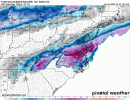
For those chasing, this is a monster dry slot ripping through the southern coastal plain, sloppy, convective in nature, mature, punch the mid level triple point by about 20-30 miles NW. it does happen overnight, I stand by 990 off the VA Capes.
Last edited:
Iceagewhereartthou
Member
It really is too bad this isn't tracking about 300 miles further South. That would put about eveyone 1-20 and North in the game.Tomorrow we are going to really see this thing slow down to the point where this becomes an event to remember for all of us.
Avalanche
Member
Curious where that axis will be that gets the front end snow and stays through the deformation exiting.
Curious where that axis will be that gets the front end snow and stays through the deformation exiting.
CLT to DOV, RIC in particular, snow level crashes pretty rapidly below 1000 feet, 2500 feet is solid through the mountains, and it goes to snow at the coast in NE NC, and north of there heavily.
Avalanche
Member
But in some of those locations it begins as rain, Id like to know who gets front end snow and remains throughout duration. Id think Roanoke area gets front end and gets the deformation. Sure it will be heavier on east, but you lose some to "crashing the column"CLT to DOV, RIC in particular, snow level crashes pretty rapidly below 1000 feet, 2500 feet is solid through the mountains, and it goes to snow at the coast in NE NC, and north of there heavily.
JLL1973
Member
I’d be shocked if memphis didn’t at least issue a winter weather advisory in the early morning hours
Storm5
Member
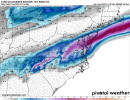
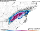
00z euro

Sent from my iPhone using Tapatalk

Sent from my iPhone using Tapatalk
ajr
Member
Thoughts on good chasing locations? Thinking about getting a place to stay for a few days around Sugar mountain
0z euro will make North Carolina happier. View attachment 100997
Yes it does…. I live just south of I-85 in the Triad. We love to thread the needle on all these winter storms it seems like.
Sent from my iPhone using Tapatalk
SimeonNC
Member
the 6z HRRR should run soon, curious to see what it does
SimeonNC
Member
I stand corrected, it's running now and honestly through hour 15 I can't tell much of a difference between the 00z and the 06z. Other than more precip in South Carolina at hr 15.
SimeonNC
Member
The low is further North compared to 00z, welp.
Edit: I stand corrected, at hour 20 on the 6z the low is further south compared to the same time at 0z. Sorry for the misinformation lol.
Edit: I stand corrected, at hour 20 on the 6z the low is further south compared to the same time at 0z. Sorry for the misinformation lol.
SimeonNC
Member
Western/Middle TN and North MS and AL are getting clobbered with snow.
SimeonNC
Member
More snow over North AL than the previous run and TN keeps getting clobbered.
SimeonNC
Member
Yep, the HRRR is more amped and has more precip.
SimeonNC
Member
The low seems to be moving slower too.
Snowman63
Member
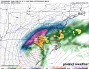
The 6Z RAP.


SimeonNC
Member
Okay...the new NAM seems less amped than the HRRR lol.
SimeonNC
Member
It's even less amped than the previous run seemingly, there's way less precip.
SimeonNC
Member
Nevermind, there it goes.
SimeonNC
Member
MS is getting clobbered with snow.
SimeonNC
Member
The 3k NAM is getting interesting, precip is sticking around longer.
ChattaVOL
Member
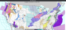
...WINTER WEATHER ADVISORY IN EFFECT FROM 8 PM EST /7 PM CST/THIS EVENING TO 8 AM EST /7 AM CST/ MONDAY...
* WHAT...Snow expected. Total snow accumulations of up to two inches.
* WHERE...Portions of east Tennessee.
* WHEN...From 8 PM EST /7 PM CST/ this evening to 8 AM EST /7 AM CST/ Monday.
* IMPACTS...Plan on slippery road conditions. The hazardous conditions could impact the morning commute. PRECAUTIONARY/PREPAREDNESS ACTIONS... Slow down and use caution while traveling. The latest road conditions for the state you are calling from can be obtained by calling 5 1 1. &&
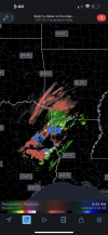
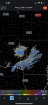
Fort Smith AR radar is starting to blossom east.
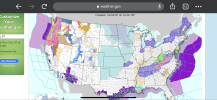
URGENT - WINTER WEATHER MESSAGE
National Weather Service Greenville-Spartanburg SC
423 AM EST Sun Jan 2 2022
NCZ053-021730-
/O.NEW.KGSP.WS.W.0001.220103T0300Z-220103T1700Z/
Buncombe-
Including the city of Asheville
423 AM EST Sun Jan 2 2022
...WINTER STORM WARNING IN EFFECT FROM 10 PM THIS EVENING TO NOON
EST MONDAY...
* WHAT...Heavy snow expected. Total snow accumulations of 2 to 3
inches across Asheville and vicinity, with amounts up to 5
inches at the highest elevations. Winds gusting as high as 40
mph.
* WHERE...Buncombe County.
* WHEN...From 10 PM this evening to noon EST Monday.
* IMPACTS...Travel could be very difficult. The hazardous
conditions could impact the morning commute.
* ADDITIONAL DETAILS...Rain is expected to change over to snow at
high elevations late this evening, and then down to the valleys
after midnight. A few pockets of brief freezing rain are
possible during the transition, but all the precipitation should
change to snow by the early morning hours. Although the ground
is relatively warm because of the recent warm temperatures, the
snow is expected to fall hard enough to accumulate even on
roads. The snow may linger into the middle part of the morning
along the Tennessee border, but slippery roads may persist
through the remainder of the morning hours, with temperatures
below freezing through noon.
Last edited:
John1122
Member
Stormlover
Member
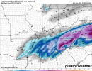
6Z high res NAM


Darklordsuperstorm
Member
BMX should have come down south another row of counties with their advisory
ChattaVOL
Member
Fountainguy97
Member
Ward Cleaver
Member
What the heck?6Z high res NAM
Snownut
Member
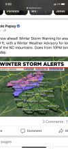
Nicole's The Goat LMAO!! I never said the upstate would go under warnings or Advisories. I just said they would see some Flakes Fly North of 85. And I still believe that.The GOAT has spoken for the Upstate View attachment 101006
Sent from my SM-A526U using Tapatalk
Latest GFS drops over 4 inches in Jefferson county and BHM doesn’t even have the advisory down into Jefferson. I know they can add it and are always conservative to start, but I’ve woken up mad. They will get an egg on the face I hope

