• Hello, please take a minute to check out our awesome content, contributed by the wonderful members of our community. We hope you'll add your own thoughts and opinions by making a free account!

Wintry Jan 2-4 2022 Winter Weather Event/Obs

Good lord that RDPS, sure seems to be a pretty large spread. I sure would like to go back to what the 00z or 06z nam showed, but I’m thinking for mby.
 
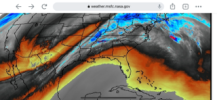
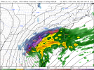
Other then the -NAO and better conditions beforehand with that system last jan, this look with a upper level low reminds me of the system last Jan 7-9th, similar track overall 0483F725-D493-4696-AC97-338A3FE62733.png
 
Other then the -NAO and better conditions beforehand with that system last jan, this look with a upper level low reminds me of the system last Jan 7-9th, similar track overall View attachment 100348
Have mercy. Looks like something that would produce snow in one of our spring months
 
Gfs looks like it’s gonna take a little tick back to reality
 
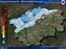
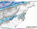
This is what I have. End of the 18z HRRR. Guys this is one of these system we will have to be within 48 hours to see what happens. Just to many moving parts. View attachment 100333
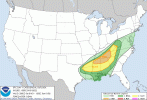
Agreed. The gfs has been giving and taking away all week. Nam has been not great for our area for a whole day now I believe. Euro has been half to just under an inch of snow for the last day. I’d love what the 18z HRRR is showing for sure. Still have plenty of time for changes though so it’ll be fun to track as we head into tomorrow. Maybe after the first round of severe weather the models will have a better handle on things.
 
Other then the -NAO and better conditions beforehand with that system last jan, this look with a upper level low reminds me of the system last Jan 7-9th, similar track overall View attachment 100348
You and I both were close to scoring a nice quick 1-3” event with that system… the deform band got going just a tad too late to crash the column quick enough. Something similar could put eastern CLT metro into play. I wouldn’t expect at this point, but it’s certainly something to watch closer as the NAM comes into better range. As for the SREF… yes it looks nice, but ever since 90% of its members were giving me 8”+ of snow in February 2015 it’s been hard for me to take it seriously
 
GFS looks actually like it’s digging a tad more but less amped, I wonder what that results in
 
Back
Top