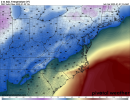
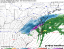
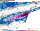
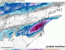
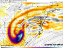
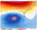
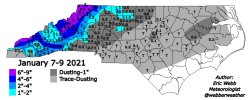
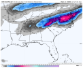
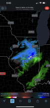
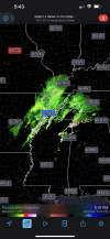
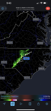
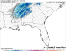
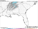
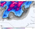
Well they are snowFALL not accumulationsNice to think about and track but ground temps and the speed of the system are two huge negatives for areas to the west . The snow maps are wrong plain and simple
Sent from my iPhone using Tapatalk
-
Hello, please take a minute to check out our awesome content, contributed by the wonderful members of our community. We hope you'll add your own thoughts and opinions by making a free account!
You are using an out of date browser. It may not display this or other websites correctly.
You should upgrade or use an alternative browser.
You should upgrade or use an alternative browser.
Wintry Jan 2-4 2022 Winter Weather Event/Obs
- Thread starter SD
- Start date
SimeonNC
Member
The soundings on the 18z GFS are really close for the CLT metro, especially with a lot of the area being within the 540 line.
NBAcentel
Member
SimeonNC
Member
Yeah at 12z Monday on the GFS, 850s are solidly cold enough for most of NC west of 95, it's mainly a BL temp issue.
Avalanche
Member
For the snowchasers its looking like you need to be stationed near Danville to Charlottesville.
Fountainguy97
Member
Amazing how such small shifts can change things. VA was not in the game a few runs ago.RAP looks better for the north CLT metro/western Piedmont/NW Piedmont into the triad due to the upper level low moving over, more then anywhere else now in NC outside east of the mountains View attachment 100777View attachment 100778View attachment 100780
I'll take my dot of burgundy and run.
NBAcentel
Member
Highway 278 and north storm. I do see a lot people getting issued a winter weather advisory for black ice on bridges and dusting of snow.RAP looks better for the north CLT metro/western Piedmont/NW Piedmont into the triad due to the upper level low moving over, more then anywhere else now in NC outside east of the mountains View attachment 100777View attachment 100778View attachment 100780
ForsythSnow
Moderator
Looks generally better for those further west but not so much for you guys in the Carolinas. Run to run changes seem to still be decently high so taking one run as the end all result is probably not the best idea. I will say that run is the best for those in GA vs the GFS and EURO runs. I guarantee a different image will come out of the 0Z runs until tomorrow morning or afternoon.Even with the rap it’s ticking NW away from a better event for most of NC, it’s sucks but that’s a harsh reality of last minute NW trends, I’m here hoping for something under the ULL at this point View attachment 100782
NBAcentel
Member
SimeonNC
Member
I'm gonna go out on a limb and say that most of NC sees snow falling out of this storm, accumulations if there are any are a whole different story. Given what I've seen on the 18z GFS which seems to be the most egregious when it comes to the NW trend so far, a flizzard is likely unless something goes wrong with the deformation band/ULL.
Blue_Ridge_Escarpment
Member
Since GSP is watching ensemble members for their forecast at this range for some reason, they’ll have to tick up their forecast.The GEFS mean was a large increase.
View attachment 100790
NBAcentel
Member
Yeah unless we NW trend this into the SNE lol, there’s gonna at least be snowflakes on the backside given a more amped solution tugging down CAA, but the slim chances of accumulating snow outside the mountains or N Piedmont which was already low is getting lowerI'm gonna go out on a limb and say that most of NC sees snow falling out of this storm, accumulations if there are any are a whole different story. Given what I've seen on the 18z GFS which seems to be the most egregious when it comes to the NW trend so far, a flizzard is likely unless something goes wrong with the deformation band/ULL.
Storm5
Member
Well they are snowFALL not accumulations
Too bad they aren't used for that purpose . People post them and expect that amount to show up
Sent from my iPhone using Tapatalk
What happened to the imagination. LolToo bad they aren't used for that purpose . People post them and expect that amount to show up
Sent from my iPhone using Tapatalk
- Joined
- Jan 23, 2021
- Messages
- 4,603
- Reaction score
- 15,199
- Location
- Lebanon Township, Durham County NC
That was….strange at best. I understand ensembles up to 4 days out but 48 hours?Since GSP is watching ensemble members for their forecast at this range for some reason, they’ll have to tick up their forecast.
Is there another model with the sfc low asvstrikg and as far NW as the 18z gfs? I didn't see it when I looked really quick. I'll be interested in the 18z euro
LukeBarrette
im north of 90% of people on here so yeah
Meteorology Student
Member
2024 Supporter
2017-2023 Supporter
Rap and RGEM were more NW as wellIs there another model with the sfc low asvstrikg and as far NW as the 18z gfs? I didn't see it when I looked really quick. I'll be interested in the 18z euro
996 over hky?Rap and RGEM were more NW as well
Blue_Ridge_Escarpment
Member
Yeah for real. I wasn’t even taking a dig at GSP overall, just that they’re usually better than that.That was….strange at best. I understand ensembles up to 4 days out but 48 hours?
blueheronNC
Member
Looks like points north of Danville, NC and better yet Lynchburg, NC to see snow on the ground.
Dewpoint Dan
Member
Did you mean Danville and Lynchburg, VA ?Looks like points north of Danville, NC and better yet Lynchburg, NC to see snow on the ground.
LukeBarrette
im north of 90% of people on here so yeah
Meteorology Student
Member
2024 Supporter
2017-2023 Supporter
RGEM and Rap were hovering around 1002 I think996 over hky?
- Joined
- Jan 23, 2021
- Messages
- 4,603
- Reaction score
- 15,199
- Location
- Lebanon Township, Durham County NC
SnowNiner
Member
I think the Atlantic ridge out front will emphasize the nw trend even more. Hate to see WAR but that's usually what we deal with. Helps to Amp the system but when the track is already bad, it makes it worse. This needs to be way south to help clt.
I'm in the high country so hate to say I'm rooting for amped this time.
I'm in the high country so hate to say I'm rooting for amped this time.
Significant forcing on the lee side with BC’s HR RGEM graphic, ^ 2 or 3 different foci with upper lever perturbations noted. Kuchera adds value.
Last edited:
NBAcentel
Member
Can’t wait till the NAM trends towards amplification and goes mid ground where it looks good for us and sucks us in then gets to amped
blueheronNC
Member
Did you mean Danville and Lynchburg, VA ?
No, just my dry as a NAM sounding humor. The only way one gets snow in NC out of the mountains is to claim VA towns as ours.
Yeah… the only time that I can remember accumulating snow in CLT metro with a low track right over head was the ‘93 Superstorm and this obviously isn’t anywhere close to that. I tend to think with this that the dynamics will be strong enough and CAA looks to be right for most of us to see flakes in the air… which is definitely a win given the dumpster fire pattern we’re coming out ofYeah unless we NW trend this into the SNE lol, there’s gonna at least be snowflakes on the backside given a more amped solution tugging down CAA, but the slim chances of accumulating snow outside the mountains or N Piedmont which was already low is getting lower
BC’s graphic, HR RGEM, kudos. Foci is area of interest, note circular patterns around them, this should in some ways congeal, it’s not accurate verbatim, that’s all I am saying. I don’t think we have an 850 track nailed down yet and that’s where we need to start looking. Soundings clearly support a steep crash, really ATL CLT HAT, likely just south of that at the mid levels.
LukeBarrette
im north of 90% of people on here so yeah
Meteorology Student
Member
2024 Supporter
2017-2023 Supporter
Good thing I can claim Roanoke….No, just my dry as a NAM sounding humor. The only way one gets snow in NC out of the mountains is to claim VA towns as ours.
D
Deleted member 1449
Guest
Clown maps are almost always atrocious. How much more now after days-on-end of temps in the 70s and surface temps never reaching freezing during the window of possible snowfall?
Rates can and will overcome, Kernersville is actually a solid spot right now in central NC, Roxboro obviously better, but it’s not really far and along a similar axis given the setup.Clown maps are almost always atrocious. How much more now after days-on-end of temps in the 70s and surface temps never reaching freezing during the window of possible snowfall?
Brent
Member
More numerous tiny flakes now struggling to stay above 20 degrees
Good luck to the east not much moisture here even though we're plenty cold
Good luck to the east not much moisture here even though we're plenty cold
lexxnchloe
Member
Dont give up. Could come back south a bit.
- Joined
- Jan 23, 2021
- Messages
- 4,603
- Reaction score
- 15,199
- Location
- Lebanon Township, Durham County NC
I try to only use the kuchera but it’s still off likely in this scenario.Significant forcing on the lee side with BC’s HR RGEM graphic, ^ 2 or 3 different foci with upper lever perturbations noted. Kuchera adds value.

