That is stunningly beautiful, use to be a ski resort and quite a good one as well, really looks like some big flakes and starting to accumulate, I see a foot here at least..Snowing pretty good Sky Valley
![]()
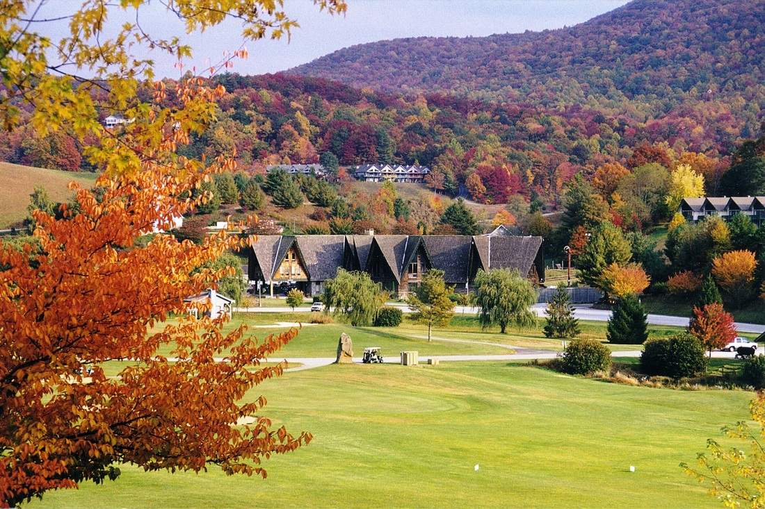
Sky Valley, Georgia - Resort Cams
Located in northern Georgia, this webcam is located at the Sky Valley Country Club golf course and features amazing Smoky Mountain views.www.resortcams.com
I have 44.6 here. My thermometer is proven accurate too.temps seem to be hold pretty well!
Now that’s a face I can trust. Packing my bags and heading home now because Scotty is calling for a mountain dusting.he is also going for around 3” to 6 for most of the mountains and foothills with high elevation! Ice ice View attachment 106040
We better hope so because if we don’t get a at least an inch or so I would be really worried about our ice threat as I think this quickly goes over to freezing rain17z RAP at hour 21 (I'm still hopefully for a couple hours of snow):
View attachment 106044
I bet they will address in the afternoon update in the next couple of hours.For us in North AL, I still don't understand why we're not under a WSWatch if both an advisory & warning is an upgrade from a watch. It makes no sense.
Been at 41-43 all day (42.6 rn) and my dew has been sitting at about freezing all day as well. The HRRR is busting high on the dews that's for sure.My dew point has been hanging at 31-32 all day. A bit under what was modeled
And looks colder too. Greenville SC 23 at 10am tomorrow, Athens GA at 30and 32 at ATL.HRRR absolutely refusing to back down from a front-end thump in NE GA, Upstate and into NC
View attachment 106053
View attachment 106054
@Brent Was this a over performer for you guys out there?
his call map for the mtns is 6-12+he is also going for around 3” to 6 for most of the mountains and foothills with high elevation! Ice ice View attachment 106040
Looking back at the 12z NAM/WRF/RGEM models (h5 maps) it is slightly more SW into TX than those models have it. (19z this afternoon)![]()
Water Vapor Satellite Loop for United States | Tropical Tidbits
United States Water Vapor Satellite Loopwww.tropicaltidbits.com
Is it mean or does this just seem already further west and south of most models?
So if I can tell this right, for my area and those around me, it will be all snow at the start aside from maybe a short drizzle as the rates pick up. Goes to sleet or zr right as the dry slot moves in. As the precip moves back in, we'll go to Sleet then areas outside of the deeper wedge will go to ZR. As the low passes through ATL or south of it, we'll see a rapid changeover to snow with a band that will see some high rates. Where that sets up is unclear but for those who want to see accumulating snow outside the CAD area, that's your best bet. As soon as that low transfers however it'll dry up fast and the storm will be over.
Creeping south&west again. It's going to be a sleepless night.