- Joined
- Jan 23, 2021
- Messages
- 4,596
- Reaction score
- 15,184
- Location
- Lebanon Township, Durham County NC
Ensemble mean would likely imply at least some snow everywhere but Hilton Head.Would this all be snow through northern sc?
Ensemble mean would likely imply at least some snow everywhere but Hilton Head.Would this all be snow through northern sc?
How bizarre. I see souther slider, I see Miller B, I see clipper hybrids. Wtf
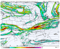
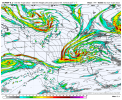
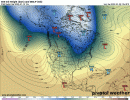
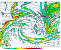
You start talking about enhanced ratios for N NC at some point.EPS mean has this look with 30/upper 20s… beautiful View attachment 103323View attachment 103324View attachment 103325
I see some love for Atlanta though!EPS mean has this look with 30/upper 20s… beautiful View attachment 103323View attachment 103324View attachment 103325View attachment 103326View attachment 103327
You saw it in the ops today too to a degree. I would guess until this hits the roab network late Wednesday into Thursday we aren't going to see 100% agreement. There's a lot of action going on when this comes ashore in the PNW/WCan and even after it starts diving into the US with trailing energy.How bizarre. I see souther slider, I see Miller B, I see clipper hybrids. Wtf
What do you think is most likely?You saw it in the ops today too to a degree. I would guess until this hits the roab network late Wednesday into Thursday we aren't going to see 100% agreement. There's a lot of action going on when this comes ashore in the PNW/WCan and even after it starts diving into the US with trailing energy.
EPS mean has this look with 30/upper 20s… beautiful View attachment 103323View attachment 103324View attachment 103325View attachment 103326View attachment 103327
At the moment I would go with something like the UK/Icon but the euro is concerningWhat do you think is most likely?

That seems almost as classic of a look for a SE snowstorm as you can get

That seems almost as classic of a look for a SE snowstorm as you can get
I'd give ensembles more credence at this range than operational. Op runs are fun to look at and have wild swings esp at 500 which in turn gives us wild clown maps or no snow. Get to Wednesday evening and Thursday and there's a chance the operational starts nailing it down.Correct me if I’m wrong but usually the essambles hold more weight then the operational.
Sent from my iPhone using Tapatalk
This is the dream. Snow is so much better at those temps than at 33 with temperatures in the 70s the day before. I want a street sticker.Snow in the Mid 20s for much of NC north of 40.
This is the dream. Snow is so much better at those temps than at 33 with temperatures in the 70s the day before. I want a street sticker.
Concerning for?At the moment I would go with something like the UK/Icon but the euro is concerning
Webb mentioned this earlier today on twitter. That storm was definitely an overachiever in a lot of the NC Piedmont/Foothills and SC Upstate… lots of locations that were forecasted 1-3” the day before ended up with widespread 4-7”+.
This setup could honestly be better, we have a big low off the Atlantic coast this time which gives us a dry cold feed from the start, what we’re trying to work on the most with this storm is the energy, any little trends can change this from a amped Miller A to a Miller B to a flat wave to a beefy clipper
Get in that range and I'm relying on the short range modelsI'd give ensembles more credence at this range than operational. Op runs are fun to look at and have wild swings esp at 500 which in turn gives us wild clown maps or no snow. Get to Wednesday evening and Thursday and there's a chance the operational starts nailing it down.
Us.Concerning for?


True would still provide snow regardless but definitely not the fun thumping we all want
The 50/50 just can’t lift out to quickly. It’s in a great spot now and has trended stronger. We’ve had many potential events fall apart due to 50/50 lifting out to quick.This setup could honestly be better, we have a big low off the Atlantic coast this time which gives us a dry cold feed from the start, what we’re trying to work on the most with this storm is the energy, any little trends can change this from a amped Miller A to a Miller B to a flat wave to a beefy clipper

The nam has a similar look, looked like it would be flat as well, maybe a little bit better then the euroYes it should as modeled but of you lose the nose of the jet streak much more north what's going to drive your precip?View attachment 103351
View attachment 103352

They'll come around as long as the trends continue. Best in the country imo. Has one of the hardest forecast areas for sure. But with the current spread anything is possible we need that baby to dig!!!GSP sounds so enthused. Mood flakes for Sunday morning it seems.
Given the uncertainty in
the track and timing of the clipper low, PoPs were kept in the
chc range Saturday thru Saturday night, drying out by early Sunday
morning. But the 12z GFS suggests the low may take a little longer
to round the base of the upper trough and result in PoPs lingering
into Sunday. The mountains would likely see most of the preicp
fall as snow, with accums possibly in the advisory range. If
a frontogenesis band could set up in the right place, perhaps
warning-criteria snow accums may fall. But there is still a lot of
uncertainty on this. To add to that, cold air in place east of the
mountains may result in some snow mixing in and/or changing over
before the precip ends early Sunday, mainly form the I-85 corridor
and north. Highs Saturday and Sunday will probably be at least
5-8 deg below normal, but possibly even colder if snow develops
during the day Saturday. Only a slight rebound is expected Sunday,
with reinforcing NWLY flow keeping below normal temps into Monday
Sounds like a typical NWS gsp discussion 5-6 days before a winter stormGSP sounds so enthused. Mood flakes for Sunday morning it seems.
Given the uncertainty in
the track and timing of the clipper low, PoPs were kept in the
chc range Saturday thru Saturday night, drying out by early Sunday
morning. But the 12z GFS suggests the low may take a little longer
to round the base of the upper trough and result in PoPs lingering
into Sunday. The mountains would likely see most of the preicp
fall as snow, with accums possibly in the advisory range. If
a frontogenesis band could set up in the right place, perhaps
warning-criteria snow accums may fall. But there is still a lot of
uncertainty on this. To add to that, cold air in place east of the
mountains may result in some snow mixing in and/or changing over
before the precip ends early Sunday, mainly form the I-85 corridor
and north. Highs Saturday and Sunday will probably be at least
5-8 deg below normal, but possibly even colder if snow develops
during the day Saturday. Only a slight rebound is expected Sunday,
with reinforcing NWLY flow keeping below normal temps into Monday
They are as conservative as they Come when it comes to winter weather which right now they should be I guessGSP sounds so enthused. Mood flakes for Sunday morning it seems.
Given the uncertainty in
the track and timing of the clipper low, PoPs were kept in the
chc range Saturday thru Saturday night, drying out by early Sunday
morning. But the 12z GFS suggests the low may take a little longer
to round the base of the upper trough and result in PoPs lingering
into Sunday. The mountains would likely see most of the preicp
fall as snow, with accums possibly in the advisory range. If
a frontogenesis band could set up in the right place, perhaps
warning-criteria snow accums may fall. But there is still a lot of
uncertainty on this. To add to that, cold air in place east of the
mountains may result in some snow mixing in and/or changing over
before the precip ends early Sunday, mainly form the I-85 corridor
and north. Highs Saturday and Sunday will probably be at least
5-8 deg below normal, but possibly even colder if snow develops
during the day Saturday. Only a slight rebound is expected Sunday,
with reinforcing NWLY flow keeping below normal temps into Monday
Yep and the idea that any forecast office around here would say much more than that 5-6 days out is umm crazy lol.Sounds like a typical NWS gsp discussion 5-6 days before a winter storm
Conservative Rah NWS starting to bite....... dare I say it again #KOD
Forecast confidence decreases by the weekend but is looking
increasingly interesting for potential wintry precipitation. First
of all, recent model runs have trended significantly lower with
temperatures this weekend, in large part due to a stronger and
farther south surface high over SE Canada or the Northeast US, which
would act as a supply of cold air to the region. This high looks to
remain in place as it will be blocked by the aforementioned coastal
low that will be over far eastern Canada by then. Thus went a bit
below NBM for temps and decreased forecast highs to 40s on Saturday
and Sunday, with even upper-30s possible in the north, and lows
Saturday night in the mid-20s to lower-30s. Meanwhile, the 12z runs
of both the ECMWF and GFS have come into better agreement on a
northern-stream wave diving SE from the Midwest on Saturday to off
the coast of South Carolina by early Sunday. Thus have chance POPs
from Saturday into early Sunday, with the best chance of
precipitation on Saturday night. If this more southerly track
occurs, temperatures look cold enough both aloft and at the surface
that frozen precipitation is possible, and introduced rain or snow
to the wx grids during this period. However, models have not shown
run-to-run consistency with this system yet so confidence remains
low. A return to dry weather but continued below-normal temperatures
are expected on Monday.
