NBAcentel
Member
There might be bouts of snow breaking containment today, melting today outside of roads is gonna be hard to come by
Good call Fro! I just had about 30 minutes of lgt snow/flurries wasn't expecting that!There might be bouts of snow breaking containment today, melting today outside of roads is gonna be hard to come by

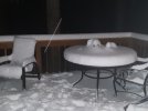
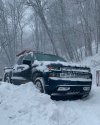
Yep. Just brushed a foot of snow off my truck with basketball shorts on. Do not recommend. She’s howling.Holy wow at these winds!!! Wasn't expecting this...I was about to run to the basement. Howling!! Whistling!!

Wait I have legit flurries flying right now. I don't recall the flizzard warning
")


Unless that very first report is a drift, I doubt it. That’s very close to where my house is, 5” there


Still snowing. What a storm up there. App already canceled classes tommorow. Which never happens20” report in Banner Elk ?
How much snow melted ?Forecast high today 41
Actual high 36...snowpack for the win!
Wow, that’s brutal. I’m like 15 miles from the airport as the crow flies and it was so different here. Love to see my first street sticker in years…RDU airport officially only goes down as a trace for this one.
Reminded me of February 2014 when we got tons of sleet (after initial snow) at like 20 degrees. Wild stuff!Well that was fun. While I can't believe it wasn't snowing at 21, at least it wasn't ice. It was cool that during the entire event, the gutters never ran!! That's unusual, as theirs always some melt, lol.
It's a pile of sleet, and with these temps, it's not going anywhere anytime soon.
On to the next!

This no doubt rivaled 1993 for Avery,watauga,ashe,Alleghany area. As high,if not higher accums, winds etc.I have family in Crumpler and this is one of the more severe blizzard conditions in many years.
I'm sorry if this has been discussed I can't keep up with all these posts in this thread... But did Atlanta airport get measurable snow during this past storm?
I'm sorry if this has been discussed I can't keep up with all these posts in this thread... But did Atlanta airport get measurable snow during this past storm?
Looks like they recorded a trace:I'm sorry if this has been discussed I can't keep up with all these posts in this thread... But did Atlanta airport get measurable snow during this past storm?