Jrips2710
Member
By God that is Macon's music on the Euro Control modernweenie


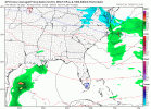
Some monsters in hereView attachment 103673 View attachment 103674
Lol bring it on! Crazy stuff with models right now.By God that is Macon's music on the Euro Control modernweenieView attachment 103670
Yes and GSP seems a bit more bullish in their discussion this morning. Another thing I’m noticing is just how much the temperatures have come down on my local forecast from TWC… they now have my highs both Saturday and Sunday down in the 30s with now 2-6 inches of snow Saturday night and SundayRaleigh, Wilmington, and morehead city all introducing snow into their forecast for the weekend

Goes from high snow amounts (at 0z) to high freezing rain amounts at (6z):Let’s not get too crazy with the low or we’ll just be talking about a lot of disappointed folks in the triangle.


6z GEFS is much further south and less amped than both the 0z run and the 6z GFS.IMO the Gfs OP is way too amped. I do not think we will see that strong of a storm. A mix between the GFS/EURO seems reasonable. Did not like to see the shift northwest in the latest GFS run though.
Sent from my iPhone using Tapatalk
I guess the GFS is another option at this point. But like you said the euro is south so maybe the final outcome is something in between. One thing is certain, we're going to be seeing many different options with each model run during the next couple of days.IMO the Gfs OP is way too amped. I do not think we will see that strong of a storm. A mix between the GFS/EURO seems reasonable. Did not like to see the shift northwest in the latest GFS run though.
Sent from my iPhone using Tapatalk
6z GEFS is much further south and less amped than both the 0z run and the 6z GFS.
Until the 6z GFS, there had been non stop southward shifts by all models. 12z suite will be interesting to see if Ukie and Euro continue shifts south or start to show a more amped system. Looks fun and very plausible we are dealing with a major SE snowstorm, either huge totals (somewhere lol) with an amped up system coming up the coast or a weaker but deep south slider. I'd say Larry isn't completely out of the game just yetI guess the GFS is another option at this point. But like you said the euro is south so maybe the final outcome is something in between. One thing is certain, we're going to be seeing many different options with each model run during the next couple of days.


Check please! So weird to see Kuchera maps this high around here.Kuchera amounts:
View attachment 103677
Yeah it’s really hard to buy into these last 2 amped GFS runs. I would expect once the low hits the ocean to see some quick strengthening with the warm SST’s, but these last two runs have had pressures as low as a category 1 hurricaneIMO the Gfs OP is way too amped. I do not think we will see that strong of a storm. A mix between the GFS/EURO seems reasonable. Did not like to see the shift northwest in the latest GFS run though.
Sent from my iPhone using Tapatalk

You wouldnt happen to have individual panels cause that mean paints a different picture than the op.


On the bright side, a less amped solution would be colder and not have mixing issues. There’s also potential for higher ratios.GEFS actually cut mean QPF here this run. I want to believe in these monster solutions but there’s obviously just not much ensemble support.
Come to papa.The hell ? The 06s gfs track seems Bit extreme to south side . Time will tell
Sent from my iPhone using Tapatalk
I like that the gfs ens mean seems to match closer to the euro and ukie flatter solutions. Tells.me we are sitting as well as we can at 5 daysOn the bright side, a less amped solution would be colder and not have mixing issues. There’s also potential for higher ratios.