-
Hello, please take a minute to check out our awesome content, contributed by the wonderful members of our community. We hope you'll add your own thoughts and opinions by making a free account!
You are using an out of date browser. It may not display this or other websites correctly.
You should upgrade or use an alternative browser.
You should upgrade or use an alternative browser.
Wintry Jan 15-16 Winter Storm Discussion & Obs
- Thread starter SD
- Start date
Stronger high and much further SW
iGRXY
Member
Great Euro run for the southern areas
Great Euro run for the southern areas

Iceagewhereartthou
Member
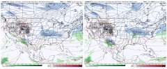
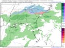
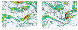
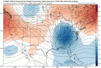
You can totally see the effect of the better placed and strengthening 50/50 low just off the screen of the top right there. Completely builds the high towards New England and our low gets shunted SW. Amazing how much that one ingredient changes the set up.Slight run to run differences on the ??...View attachment 103612
LovingGulfLows
Member
- Joined
- Jan 5, 2017
- Messages
- 1,499
- Reaction score
- 4,100
The surface low is pretty deep in the gulf.
Classic Midlands of SC snow. ATL too, probably.
NBAcentel
Member
iGRXY
Member
85 corridor should love the euro right now. It’s sitting exactly where you want it at this range.
Couple more S shifts , and we’re looking like February’73
This a beautiful look 5 days out ready and prepped for a NW trend inside 84 .. NAM should take care of this one
NBAcentel
Member
Snownut
Member
This couldn't get any better for WNC, NEGA, and upstate. Plenty room with this look for that NW Jog.
Sent from my SM-A526U using Tapatalk
Sent from my SM-A526U using Tapatalk
Let them have their moment..lolThis a beautiful look 5 days out ready and prepped for a NW trend inside 84 .. NAM should take care of this one
Shaggy
Member
If we can keep the low track 50-75 miles offshore its a big hit for many in SC/NC.......up along or on the coast and its mix city with the warm nose.
LovingGulfLows
Member
- Joined
- Jan 5, 2017
- Messages
- 1,499
- Reaction score
- 4,100
Euro/UKMET are further south/suppressed and GFS/CMC are more amped with the wave. I think the runs tonight were great for my backyard.
Agreed!! and the ICON wasn't so iconic!Euro/UKMET are further south/suppressed and GFS/CMC are more amped with the wave. I think the runs tonight were great for my backyard.
LovingGulfLows
Member
- Joined
- Jan 5, 2017
- Messages
- 1,499
- Reaction score
- 4,100
I know the NE/Mid-Atlantic folks are going to be mad at that Euro run yikes.
I would say the storm wave on the CMC is much stronger compared to the Euro....and goes negative tilt, where Euro does notThe CMC and Euro looks very similar to my eyes. Not the same blocking we saw on the GFS so I'm not sure why some are putting the two models in the same camp.
iGRXY
Member
At day 5, yes you love the EURO run. Last place you want to be at day 5 is in the bullseye on the southern end.Earlier UKMET run was a warning shot for NC. Not sure I liked that EURO run.
This thing about to bomb up the Carolina coast?
brendan123
Member
I'm much happier with seeing suppression with cold dry air in the teens IMBY instead of mixing issues; a good look 5 days out
NBAcentel
Member
A blend of the GFS/CMC/EMCF is money for that Conyers to Loganville corridor lol. I like!Euro/UKMET are further south/suppressed and GFS/CMC are more amped with the wave. I think the runs tonight were great for my backyard.
Shaggy
Member
Exactly. At this range the ensemble means are still the most relevant but we want a flat euro/ukie mix if you ask me. Blend that with the amped gfs and cmc and we have a perfect track for everyone.At day 5, yes you love the EURO run. Last place you want to be at day 5 is in the bullseye on the southern end.
NBAcentel
Member
Jrips2710
Member
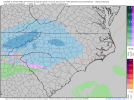
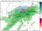
One of the winners on that CMC snow map... Athens, GA... Maybe they'll bring that magic back home
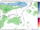
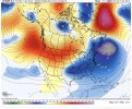
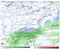
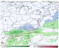
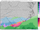
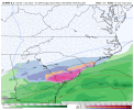
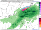
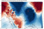
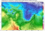
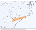
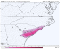
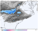
This is exactly how 12/7/17 started out.These trends man…. I haven’t seen trends this good leading up to a event since 2018 View attachment 103661View attachment 103662View attachment 103663
Snowflowxxl
Member
Really like where things are sitting, I think the trend will be our friend
Much colder run so far, would expect a more south look
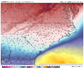
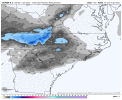
Euro Ens Mean


