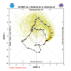
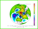
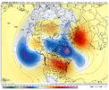
I just looked at the Weekly and Monthly that ran last night and they both still look really good.Apparently the CFS didn't get the message how Fab Feb was gonna be. Getting the vibe the ole canonical Unicorn forecast I've been hearing hyped all winter, is gonna show up like a flat tire here in 2 weeks.
-
Hello, please take a minute to check out our awesome content, contributed by the wonderful members of our community. We hope you'll add your own thoughts and opinions by making a free account!
You are using an out of date browser. It may not display this or other websites correctly.
You should upgrade or use an alternative browser.
You should upgrade or use an alternative browser.
Pattern Jammin January 2024
- Thread starter SD
- Start date
rburrel2
Member
I can think of several examples of similar type "threats" in the day 3-4 range that wound up turning in to a solid 2-3 inch storm here. Many more that didn't pan out, but you can't discount it completely. You miss 100% of the shots you don't take.I'm mildly intrigued with the late week system, one of these has to over perform right? I mean again it's just a slight difference here or there for some east of the apps to see a little snow
Well both the 6z GFS and ICON are continuing the trend of being a bit more moisture east of the mountains and EPS, GEPS, and GEFS moisture has increased as well. Soundings look like they would support snow with enough moisture from I-95 west in NC and back into the SC upstate. It should be noted that more moisture definitely made it into NC this morning than any model predictedI'm mildly intrigued with the late week system, one of these has to over perform right? I mean again it's just a slight difference here or there for some east of the apps to see a little snow
Yeh man you’ll be asleep soon. But don’t worry, we will reel in a big em in the great month of FebruaryGetting very tired of that snow wall around SC. It's getting ridiculous.
Correct. Looked to me like it had a little more moisture in general than 12Z, but still no beueno east of AppsI take it the 0z euro was no bueno for fri/sat system?
ForsythSnow
Moderator
Euro in general was a torchfest for that system. Way warmer than all the other models including the UKMET.
Today gives me a lot higher confidence in Friday. I noticed on 6z gfs it has snow showers popping up in multiple locations, esp down east over a 12 hour span. It and the Icon have been consistent. Should be cold enough, where maybe some can get a trace to accumulate and get on scoreboard.I'm mildly intrigued with the late week system, one of these has to over perform right? I mean again it's just a slight difference here or there for some east of the apps to see a little snow
Dang we in Late February already? Good lawd ?Euro has MJO almost in phase 8 by mid-Feb....hopefully back half of Feb gives us a chance.
View attachment 142440
Not getting my hopes up but Friday’s system has the looks of one of those that can start to bring some surprises once we get 36 hours out. The cold push looks for really good on both the GFS and ICON and it’s actually coming in more from the north instead of the west. Both the models and EPS, GEFS have and uptick in moisture and 850s look good.Today gives me a lot higher confidence in Friday. I noticed on 6z gfs it has snow showers popping up in multiple locations, esp down east over a 12 hour span. It and the Icon have been consistent. Should be cold enough, where maybe some can get a trace to accumulate and get on scoreboard.
Dang we in Lake February already? Good lawd ?
Let's sure as heck hope so...otherwise how is 2024/2025 winter shaping up?
Looking like phase 13 bro so I think we good.Let's sure as heck hope so...otherwise how is 2024/2025 winter shaping up?
Dang just read Alan Huffman update. 60s next week he would not be surprised if some 70s didn’t show up late next week, and as far as cold for February weeklies has warmed for weeks 3/4 so may be mid/late fab Feb before any cold air drops into the US. Fab Feb is a big ? now.
Sent from my iPhone using Tapatalk
Sent from my iPhone using Tapatalk
ForsythSnow
Moderator
At least by the end of the EPS and GEFS, they both agree the western ridge goes up and east trough goes down, but we got that glaring low in the bay. Better than the SER taking hold and staying with how persistent it always is.Going to be some teeth gnashing that after the next few days winter on hiatus until mid-Feb. We have to get ourselves out of this mess to end January, that will take time. So yeah, let's hope/pray by mid-Feb we have a serviceable pattern. ?
View attachment 142444


rburrel2
Member
Ya'll the mjo forecast 3-4 weeks out is basically just as un-reliable as using the 384hr GFS. No reason to panic. It's honestly not even worth looking at that far out.
I know @Webberweather53 said we'd be lucky to squeeze out anything in the Carolinas in Jan. Do you still feel good about Feb? Because, latest I've seen seems to indicate we punt at least until mid-month?
rburrel2
Member
That's not an end of January prog.Going to be some teeth gnashing that after the next few days winter on hiatus until mid-Feb. We have to get ourselves out of this mess to end January, that will take time. So yeah, let's hope/pray by mid-Feb we have a serviceable pattern. ?
View attachment 142444
All 3 global ensembles show us going below normal around January 29/30th. By mid-february we will probably have cycled through another good pattern and heading back to a bad one.
Looking at all the ensembles along with the weeklies, we actually get back into a better pattern fairly quickly after this. Even Webb has mentioned that he expects this milder period to last only a few days. Even in this frame you can see the western ridge starting to go up.Going to be some teeth gnashing that after the next few days winter on hiatus until mid-Feb. We have to get ourselves out of this mess to end January, that will take time. So yeah, let's hope/pray by mid-Feb we have a serviceable pattern. ?
View attachment 142444
rburrel2
Member
Huh?I know @Webberweather53 said we'd be lucky to squeeze out anything in the Carolinas in Jan. Do you still feel good about Feb? Because, latest I've seen seems to indicate we punt at least until mid-month?
Why would you punt until mid-February when this is showing up for January 31st?
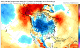
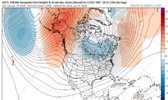
That's not an end of January prog.
All 3 global ensembles show us going below normal around January 29/30th. By mid-february we will probably have cycled through another good pattern and heading back to a bad one.
But like you said day 15+ isn't to be believed. What we do know is the last week of Jan isn't a great pattern unless you like warm/wet. The 2 weeks after that the MJO will be in phase 6-7...is that a good pattern for snow/cold?
rburrel2
Member
Agreed. I'm thinking Feb 1-10th is going to our best chance all winter. Anecdotally, This has also been the best timeframe imby for the last 5 years or so.Looking at all the ensembles along with the weeklies, we actually get back into a better pattern fairly quickly after this. Even Webb has mentioned that he expects this milder period to last only a few days. Even in this frame you can see the western ridge starting to go up.
Agreed. If it doesn't amp out like that in 6/7 at month's end but rather circles a little more tightly we get to 8 much much sooner.Ya'll the mjo forecast 3-4 weeks out is basically just as un-reliable as using the 384hr GFS. No reason to panic. It's honestly not even worth looking at that far out.
I’m not sure where you’re getting mid February from… especially from what Webb has been talking about. There’s really good ensemble agreement that we’re back in a favorable pattern to start the month… basically following the progression he’s talked about since late NovemberI know @Webberweather53 said we'd be lucky to squeeze out anything in the Carolinas in Jan. Do you still feel good about Feb? Because, latest I've seen seems to indicate we punt at least until mid-month?
rburrel2
Member
So the 3-4 week MJO is set in stone, but all 3 major global ensembles aren't to be believed around day 15?But like you said day 15+ isn't to be believed. What we do know is the last week of Jan isn't a great pattern unless you like warm/wet. The 2 weeks after that the MJO will be in phase 6-7...is that a good pattern for snow/cold
Of course anything can happen, but there's no reason to be in the dumps about the first half of February, imo.
I'm not in the dumps...I like warm and wet nino's. Don't you?So the 3-4 week MJO is set in stone, but all 3 major global ensembles aren't to be believed around day 15?
Of course anything can happen, but there's no reason to be in the dumps about the first half of February, imo.
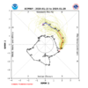
But if you believe day 15-16 global ensemble runs then why don't you believe day 15-16 global ensemble MJO runs?
Today's Euro run so shows amped phase 6 to end Jan....that ain't good.
But I get it, if we want to close our eyes and hope, that sounds fun too.
Last edited:
The mjo has a myriad of solutions with a mean just like most anything else. Most all rotate it around as depicted. Some are more closer to the CoD. It may not take the guided mean route. I doubt it takes one much further out. If anything it will be a tighter rotation, but that prong at month's end is there. Just have to hope not so stark and pointed.So the 3-4 week MJO is set in stone, but all 3 major global ensembles aren't to be believed around day 15?
Of course anything can happen, but there's no reason to be in the dumps about the first half of February, imo.
rburrel2
Member
That literally shows us entering phase 7 on January 27th, if you look at the time it took to go through phase 4,5,6 we would be entering phase 8 around February 2nd or 3rd. What am I missing?I'm not in the dumps...I like warm and wet nino's. Don't you?
But if you believe day 15-16 global ensemble runs then why don't you believe day 15-16 global ensemble MJO runs?
Today's Euro run so shows amped phase 6 to end Jan....that ain't good.
But I get, if we want to close our eyes and hope, that sounds fun too.
View attachment 142454
If you look at depictions from about the 17th/18th out to the 23rd you can see a tighter cluster running just inside the main general forecast area. If it leans more towards that cluster then by the 23rd you see a less amped pattern emerging. So from the 23rd onward projections can be just noise at the moment.I'm not in the dumps...I like warm and wet nino's. Don't you?
But if you believe day 15-16 global ensemble runs then why don't you believe day 15-16 global ensemble MJO runs?
Today's Euro run so shows amped phase 6 to end Jan....that ain't good.
But I get, if we want to close our eyes and hope, that sounds fun too.
View attachment 142454
rburrel2
Member
You're back to looking at the 20-30 day prog again which is meaningless.
iGRXY
Member
We are not going to have to wait until mid February lol. That doesn’t mean it’ll snow but pattern wise? February looks decent all around
Does it really matter what phase the mjo is in anymore? Seriously, theres always an aurgument to handicap any posotive takeaways no matter what phase it is in. I dont even bother with it, it gets tiring. Never forecasted accurately, always an excuse well if we where in such an such pattern, or it was month x this would be good for SE, but because its xyz its not going to net the same result.
Just watch ensembles and use what your eyes show you pattern chasing. When i see a monster ridge going up the west coast up through western canada i get excited. Then fill in the pieces from there.
Now if one wants to dissect what makes that western ridge get so tall, go for it.
MJO chasing to me has become as fruitful as Judah Cohen snowcover chasing in the fall.
The whole mjo talk has stirred up since the 30 day proggs now show it camping out in phase-7 when it could very well make a b-line to phase 8 covering that space in 4 days instead of 14. It's so far out we won't know for a week or two at least
Heelyes
Member
Just take those snow shovels back and we should be back on track ?

