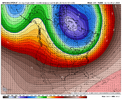
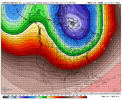
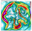
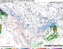
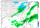
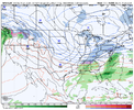
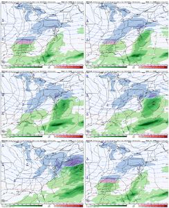
I really like this look ?
Please tell me this is the average and not the total for the entire decade.
Post of the year above IMO! Thanks for posting what I have been thinking as I read posts here for a long long time. I live in the deep south. Central GA. I have lived here for 32 years. We average about 2" of snow per season. That means some years we get a good snow or two. More years that not, we get shut out. If I tally up all of the snow I have received over the last 32 winters and divide by 32, it comes to....really, really close to 2. We are in a snow drought right now. We have been in them before. Usually, the snow drought will end with a few years of above or well above average snowfall. Maybe, this year is the start of that. Only God knows. It does seem like in recent years that the base of troughs have plunged and/or settled more to our west. It also seems that more winter weather has focused west of us where the troughs have been centered. While it is disappointing, I also remember the same thing happening from time to time in the 90's and early 2000s. Bottom line is that I will take where we are right now and what appears to be in front of us for the remainder of the winter with more optimism than the prospects that most winters present. I have lived through many winters where I don't really see much of a possibility of a good pattern or storm to track. If you live in the deep south, love winter weather and are disappointed when you don't get it, you will spent most winters disappointed. This is not a new development.Ive been around a while in NC. You younger guys keep throwing around how great the 80s and 90s where. They werent all some crank them up to be. Yea we had a couple noteworthy artic blast (7 dayish in length) , a big snow jan 88. Really those where the highlights. I can remember way to many Above normal winter days and thinking its never gonna snow anymore. The 70s where stellar and the best decade for winter wx in NC imo was 2000-2010. Espeacilly 2000-2004. In central NC you had the crusher,Historic Catatstrophic ice stirm Dec 2002 and the Feb 28,2004 upper level thundersnow beast( 17 inches here).
Bottom line we are in a slump. They come an go down here because of our location. The rubber band will snap back the other way soon. Always does.
Enjoy it because the arctic air will be here soonWe are making at run at 60 today. 57 at KATL and 55 at KPDK.
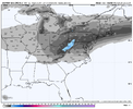
GFS ensembles agree too??This is a NE storm, just in case some were wondering View attachment 142259
This is a NE storm, just in case some were wondering
Personally the GEFS has a bad spot with me considering it had our secondary go up in vapor with this system right now. CMC ens/EC ens look in lockstep right now. Not great when the GEFS is a outlier out of the ensGFS ensembles agree too??
Mostly mid-south to (interior) NESafe to say all winter storms these past few years are:
1- NE Storms
2- Mid-atlantic storms
3-Mid South
I'm just mind blown at our 70's theory that if it snows in Big D or Baton Rouge or Mississippi we goin' get snow. ?
Hang it in it LouvreBack to square 1. Finding the pattern (it’s coming) View attachment 142266View attachment 142267
Couple days either side of 7 days. Wouldn't be too surprised to see the the cold dump to our west first and get a SER reflection to temporarily delay itIght yall, how long do you all think this thaw last? Seems fleeting. Maybe we can salvage the tail end of January. Can’t stand the idea of tossing time away.
"I don't know how much gas the viewers have left in the tank Johnny"Back to square 1. Finding the pattern (it’s coming)
I think they've done a good job so far this year with the pattern at that range. I think the tall PNA ridge is coming and we'll have another window. The MJO is appearing to want to meander in phase 6 but it loses a lot of weight anyway come Feb. Seems like Webbs graph showed even 4 was actually decent in Feb.Back to looking at the multi-hundred-hour maps.
They have actually done a fantastic job. They sniffed out what’s going on right now & they have been showing the thaw coming for several days now.I think they've done a good job so far this year with the pattern at that range. I think the tall PNA ridge is coming and we'll have another window. The MJO is appearing to want to meander in phase 6 but it loses a lot of weight anyway come Feb. Seems like Webbs graph showed even 4 was actually decent in Feb.
I think the positive here is that with the MJO working thru the Pacific and with AAM on the increase, the pattern should be in progressive mode to where it would favor the trough not backing into the west. This is opposite of our current state here in early-mid Jan where we were in retrograde mode. But for sure, you could be correct...the western ridging and amount of incoming Pac Jet is always very sensitive to what is going on in E Asia and with the MJO as you know. A few days ago, I was having concerns over mega Pac Jet extension but that has since backed off some. The ideal scenario would be the AK ridge pattern developing with cold air sent down into the CONUS, then have the Pac Jet extend (but not over-extend) into split flow thereafterCouple days either side of 7 days. Wouldn't be too surprised to see the the cold dump to our west first and get a SER reflection to temporarily delay it
We seriously looking Jan 28-30 as being back out of thaw full steam ahead. Good news is this week will be great,minus no snow as next saturday- sunday should be coldest of year. But we quickly get return flow going early the week of Jan 21. So that 5 to 7 day stretch is no doubt a punted week already. You can write it off and take it to the bank. After that starting Jan 28-29 per the ensembles ,the Fab Feb,build snowpack midwest 1st pattern kicks off. We got 6 weeks till March 10-11. Which 90% of time, is the end of frozen qpf here.Ight yall, how long do you all think this thaw last? Seems fleeting. Maybe we can salvage the tail end of January. Can’t stand the idea of tossing time away.
Triple jet magickHang it in it LouvreView attachment 142269
They always do pretty good LR when you have a strong dominant signal like we have this year with super el nino. Dont know why, but my past expierence observations is this tends to be the case. Now when you dont have a dominant signal, then its like watching wind shield wipers daily.They have actually done a fantastic job. They sniffed out what’s going on right now & they have been showing the thaw coming for several days now.
That’s how the Christmas 2010 storm looked a week out! $$$
Lining up with GEFS now? Wasn't the 0z euro showing a dryslot.That’s how the Christmas 2010 storm looked a week out! $$$
Great look at this lead
This one has repeat of today / tomorrow written all over it. Hard bargain east of the mtnsGreat look at this lead
Yeah but this one on friday looks to miller b is that what the current storm is going to do?This one has repeat of today / tomorrow written all over it. Hard bargain east of the mtns
Yep, the best way for us to get a good snowstorm east of the APPS is a cold high over eastern Canada, Upper midwest (not to far west) or the NNE US allowing for a direct discharge of Arctic air over the far southeastern states and a storm track running over N Fl. Really tough to get arctic air in the SE east of the Apps to be perfectly timed with a La/Tx storm track as a lot of them cut big time. The Mtns will deflect and hold up the cold until it has moderated some more what happens west of the AppsThis one has repeat of today / tomorrow written all over it. Hard bargain east of the mtns
What worries me is the homework you did in studying Jan's Wo snow almost always leads to no or much less than average snow in Feb.I think they've done a good job so far this year with the pattern at that range. I think the tall PNA ridge is coming and we'll have another window. The MJO is appearing to want to meander in phase 6 but it loses a lot of weight anyway come Feb. Seems like Webbs graph showed even 4 was actually decent in Feb.
Not seeing Miller B with Friday. Maybe a model has a low depiction over Bama then if flips over to the coast, but no damming high / Miller B setup to speak ofYeah but this one on friday looks to miller b is that what the current storm is going to do?
Well the good thing is that out of the 4 El Niños that did that since 1950 2 of them went on to produce around 4 inches for the winter which is only slightly below average and would be very welcomed right now. But it's true it doesn't paint the best picture to get a big one and have a great year. There were some way back that did go on to get over average but I don't know if Enso data goes back that far.What worries me is the homework you did in studying Jan's Wo snow almost always leads to no or much less than average snow in Feb.
That made this week so important to just get flurries,
Looking at where we are RN and given what the models r showing this week and the rest of the month is very worrisome.
Hope this is one trend that gets broken this year.
We’ll miss this to suppression than to MA/NEIcon with a novelty event View attachment 142303