• Hello, please take a minute to check out our awesome content, contributed by the wonderful members of our community. We hope you'll add your own thoughts and opinions by making a free account!

Pattern Jammin January 2024

This one has more potential than the Jan 15 wave. Watch this wave entering the SW.. needs to trend stronger, more consolidated, and kick out faster to allow a western ridge to build up. With a trough east of HI that should force a downstream ridge to build over the SW so it's plausible.

That would allow a stronger gulf low to develop. You will see precip breaking out over TX, AR, LA, then really get going when the PJ wave starts dropping in.
Must be legit when Wow makes an appearance
 
Picked up 1.5 yesterday. Sitting plus side of 6.5 for January qpf. On top of 8+ in December.

January temps are 0.5 BN , never got on AN plus side after our recent warm spell. Gonna take a dip by a couple degrees after this weeks cold snap gets calculated in. Dec was plus 2.3 AN.
Start second half winter this week. Hopefully the snow drought gets erased
 
This would be an incredible and historic week for the areas from Northern MS to N Alabama through all of TN if this happens on top on next week's storm. It would be a week of legitimate winter weather, not just relative to southern standards. Hard to watch from the Carolinas and GA; makes it feel too much like Feb 21. But man, surely February gonna be our month!
 
This would be an incredible and historic week for the areas from Northern MS to N Alabama through all of TN if this happens on top on next week's storm. It would be a week of legitimate winter weather, not just relative to southern standards. Hard to watch from the Carolinas and GA; makes it feel too much like Feb 21. But man, surely February gonna be our month!
Painful watching from the I-20 corridor as well. Looking like we could miss out on both opportunities, and usually February is a stretch climate Wise in this area. Been a long time since we’ve had a decent snow in Tuscaloosa.
 
This would be an incredible and historic week for the areas from Northern MS to N Alabama through all of TN if this happens on top on next week's storm. It would be a week of legitimate winter weather, not just relative to southern standards. Hard to watch from the Carolinas and GA; makes it feel too much like Feb 21. But man, surely February gonna be our month!
Not sure what you are talking about. This is nothing like Feb '21. Models look pretty good for us here in the NC foothills.
 
We almost bone dry next 10 days on 12 z Globals east of continental divide. Espeacilly Euro. Has 0 qpf. If you melt down this gfs post its only .25.

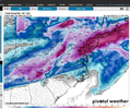
Im posting gfs total 10 day snow map, as thats the ride I need to take. They all have the cold, or enough on hand to get job done. Its gonna be a moisture issue.

As El nino fades out, as is typical in Feb and its influence wanes, many say we are headed back to La nina for next winter. Reason why theres all time mega Hurricane season hype. Anyway the conical ,Feb is the best month of the 3 when having el nino winters, is a true statemet because the pac firehouse lets off the gas flooding NA with maritime air. But theres a catch in that the STJ spigit decreases as well. Next 10 days are a prime
Example. So its never a slam dunk like some may be interpreting.

1705173318899.png
 
View attachment 142104
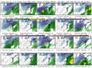
Looks very amped for 1/19 threat??
Listening to Brad P earlier today, he seems to think that this one is going to trend southeast. The last time that I heard him say something like that at this lead was January 2016 and he was right…we’ll see. IDK
 
NCSnow what is your gut telling you about a possible storm next weekend. Cold is there but does it stay western se again
 
Looks cold at Arrowhead I'd like to see -4 once
The coldest I’ve personally experienced was in Maggie Valley on the morning of 1/9/2011… -11F about 6:00am that morning. There was about 10” of snow on the ground and just remembered how it crunched when you walked on it, and how beautifully clear the sky was that morning
 
My forecast high tomorrow is 7. I have not seen very many colder days tbh. Tulsas coldest high on record is 2. 2021 hit 5
I gotta ask. You do have some snow on the ground right? I couldn’t stand to be that cold in the day and not have snow cover to show for it.
 
Yeah the dry air and the fact the storm is weaker(because of the coastal transfer I assume that dumps on Tennessee) is killing us here

Sucks but it is what it is. There were some models blanking us yesterday
You are going to have temps in the single digits while it's snowing. You hardly ever see that in the southeast.
 
You are going to have temps in the single digits while it's snowing. You hardly ever see that in the southeast.

Yeah and honestly I think that's hurting us more than helping us. I bet if it was 20 degrees we would have gotten 10 inches... There's still a big question mark about how long it takes to overcome the dry air
 
Back
Top