NBAcentel
Member
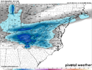
Nice Carolina winter storm at day 8 on the euro View attachment 141756

Radiational cooling?That is really weird View attachment 141759View attachment 141760
One of those images is lying to usThat is really weird View attachment 141759View attachment 141760
Not the snow totalOne of those images is lying to us
Probably some front end snow that’s a few hours in duration Vs the rain that has a longer duration so the 6hr is gonna pick up on the dominant ptypeRadiational cooling?
That is really weird View attachment 141759View attachment 141760
That is really weird View attachment 141759View attachment 141760
Cmon man?This is easy to explain. The rain/snow line will be in Virginia by go time.Congratulations @LukeBarrette.
Oh heck no. Single digit and low teens for highs????
I agree. The one late next week is poorly timed, as modeled, but things will likely change between now and then. I'm done watching the Tuesday one. I'm back to checking the GEFS at 5:30 pm.This threat for late next week is deja vu all over again. Very similar to early next week where we are looking for a TPV extension out into the 50/50 region and trying to get the northern stream to dig way south and sharpen at the right time. Ugh. I think the early week one has the better chance of the 2, and that one doesn't look good at the moment....but we'll see
We've had that all winter. Im BN temps so far this season and astronomically above qpf.Folks... It's almost time. The pieces are coming together.
View attachment 141785View attachment 141786
I agree. Happy western guys will score, good for them. Interested to watch this unfold , Modelogy wise tommorow. The canadian suite is consistent on amping things up more. Its slower with trailing energy. But it has that tpv the furthest west. Which will cold rain you. If it has it placed wrong by 75- 100 miles, could make a big difference.This threat for late next week is deja vu all over again. Very similar to early next week where we are looking for a TPV extension out into the 50/50 region and trying to get the northern stream to dig way south and sharpen at the right time. Ugh. I think the early week one has the better chance of the 2, and that one doesn't look good at the moment....but we'll see
This remains the same until we see a bigger change with the overall flowIf your East of the Mountains In NC , VA and upper SC winter is going to have to wait for snow. West or NW winds will dry any moisture up anywhere East of the Apps. West of Apps, Tenn., Northern ALA, Miss., Southern SC and GA should see some snow if you look at the overall Jet structure and High placement , and more than likely we will see several l clippers during this period then those close to the gulf will probably see some small disturbance riding south along gulf during this Arctic outbreak. Just going off past history
Until I see a high pressure funneling the cold air down the east side of APPs. and not the brutal cold , we are in a holding pattern for winter storms that produce SNOW. Things can change fast but as of now this is how i see it.
Seems we're always misssing something. But we have also been in supposedly great shape for classic NC snow storms a few times the past few years and ended up with nothing.As fro mentioned somewhere here. Need the mjo, +pna and the overall pattern with a -nao on board. Maybe aligns in fab feb
It's always thread the needle in any pattern imo Ive seen 0 in supposedly the best patterns and over a foot the first week in December in the worst.Seems we're always misssing something. But we have also been in supposedly great shape for classic NC snow storms a few times the past few years and ended up with nothing.
I'm a lay person here on winter weather but cannot seem to square this with an actual solid opportunity in the next two weeks. Not saying it cannot happen but not in alignment.Seems we're always misssing something. But we have also been in supposedly great shape for classic NC snow storms a few times the past few years and ended up with nothing.

This was a topic that Grit and Webb got into last weekend and it had me doing some research and you would honestly be surprised, I know I was, at some of the winter storms we had in the Carolinas in phase 3-6. Below are just a fewI'm a lay person here on winter weather but cannot seem to square this with an actual solid opportunity in the next two weeks. Not saying it cannot happen but not in alignment.
View attachment 141847
We have definitely not been in good shape for any sort of a classic NC snow storm the past few years.Seems we're always misssing something. But we have also been in supposedly great shape for classic NC snow storms a few times the past few years and ended up with nothing.
The MJO has become discovered in just the last few years in the weather forum world and has more magical power attributed to it than it actually deserves. It's a fine tool to have in the toolbox, but it's not the Holy grail of winter weather forecasting that some weenies think it is.This was a topic that Grit and Webb got into last weekend and it had me doing some research and you would honestly be surprised, I know I was, at some of the winter storms we had in the Carolinas in phase 3-6. Below are just a few
January 1987- phase 3/4
February 1989- phase 4
March 1993- phase 4
December 1993- phase 5
February 1994- phase 4
February 2004-phase 6
March 2009- phase 5
February 2014-phase 5
Obviously there are a lot others but these really stood out to me. Also look at where the MJO was last January…phases 8,1,2 and we absolutely torched. Not to say that the MJO isn’t important, but we gotta remember it’s one of many indicies.
Of course it is…you want all the indicies in your camp. However, let’s remember that the last true boardwide winter storm, January 1988, occurred with a +NAO/+AO/-PNAIt's good to have in your camp though
I had no idea it had been that long. If that’s true then we really are in trouble for the future.Of course it is…you want all the indicies in your camp. However, let’s remember that the last true boardwide winter storm, January 1988, occurred with a +NAO/+AO/-PNA
I would put snowpack to the NW as more importance… simply because the number of significant widespread winter storms in the Carolinas without snowpack to our NW is truly very few and very far between.Question: Would you rank up there with snowpack to the NW?
When I say boardwide, major winter storm I’m basically meaning Texas Panhandle to Carolina coast and those historically happen every 30-40 years. January 2011 was close but the storm dampened out and brought very little to the eastern CarolinasI had no idea it had been that long. If that’s true then we really are in trouble for the future.
