-
Hello, please take a minute to check out our awesome content, contributed by the wonderful members of our community. We hope you'll add your own thoughts and opinions by making a free account!
You are using an out of date browser. It may not display this or other websites correctly.
You should upgrade or use an alternative browser.
You should upgrade or use an alternative browser.
Pattern Jammin January 2024
- Thread starter SD
- Start date
accu35
Member
CNCsnwfan1210
Member
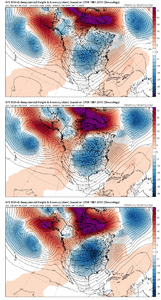
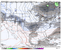
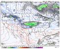
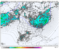
Piece of energy over New Mexico with a baroclinic zone along the Gulf coast. Boy that would be a weenie run if those came together.

Sent from my SM-A136U1 using Tapatalk

Sent from my SM-A136U1 using Tapatalk
2018 redux? December? Cant remember
accu35
Member
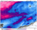
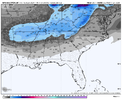
Newfound gap obliteratedView attachment 140641
One more
Drizzle Snizzle
Member
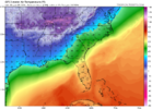
It would be crazy if Nashville can get down to -15 or even -20 !View attachment 140640Holy smokes
This looks very familiar to January 2018. All we need is some Lee side enhancement2018 redux? December? Cant remember
Cary_Snow95
Member
That was an awesome storm. Our qpf went up like 300% in the final 36 hours of model runsThis looks very familiar to January 2018. All we need is some Lee side enhancement
Cary_Snow95
Member
Cary_Snow95
Member
It really is remarkable how the mountains just stop all fronts from pushing into the Carolina’s. Just hits a wall and goes stagnant
NBAcentel
Member
This looks very familiar to January 2018. All we need is some Lee side enhancement
Nah drop by trough into the SW deeper with a stronger western ridge and go full blown December 2017. Go Big or go home
accu35
Member
lexxnchloe
Member
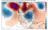
Of courseSouthern stream looks quiet this run with the vortex in placeView attachment 140649
This is why it’s so hard to see ANY wintry precipitation in South Carolina.It really is remarkable how the mountains just stop all fronts from pushing into the Carolina’s. Just hits a wall and goes stagnant
- Joined
- Jan 23, 2021
- Messages
- 4,602
- Reaction score
- 15,197
- Location
- Lebanon Township, Durham County NC
TNweathergurl62
Member
It has got down -17 before. i was pregnant with my son. It was 1985 and a lot of snow on the ground. By 11 that morning the lights got dim all over Nashville proper. NES was asking their customers to cut back on all the power they could.It would be crazy if Nashville can get down to -15 or even -20 !
severestorm
Member
NBAcentel
Member
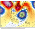
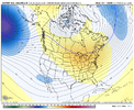
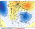
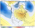
Gefs oth has a slighty weaker TPV in SE can, but the overall height field is more suppressed towards the SE so it’s colder so far
Cold air in place then the energy stops flowing. ?
accu35
Member
NBAcentel
Member
1994 but that’s it. Epic sledding and days of bitter cold. It was depressing how long it took to go below freezing.
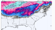
Keeps trending colder but it just seems like the true cold air is struggling to get past the Apps. Either way, we need the energy to keep firing after the Mid South system. This place is going to be a dumpster fire if they get slammed with the same looking Winter storm they have got the last 3 Winters & the cold moves in & out with nothing to show for it East of the Apps.
But, positive vibes only.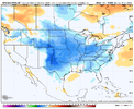
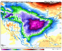
But, positive vibes only.


Looking good for a lot west of the apps.
Just got to give it time and let the pattern marinate like a good steak. May mess up and over cook it on the grill, but it could be luscious if things come together. And we still have Fab Webb Feb to look forward toKeeps trending colder but it just seems like the true cold air is struggling to get past the Apps. Either way, we need the energy to keep firing after the Mid South system. This place is going to be a dumpster fire if they get slammed with the same looking Winter storm they have got the last 3 Winters & the cold moves in & out with nothing to show for it East of the Apps.
But, positive vibes only.View attachment 140658View attachment 140659
NBAcentel
Member
CNCsnwfan1210
Member
Need the tail end of the arctic front to hang along the Gulf coast long enough to induce cyclogenesis, it's alot to ask for but possible I guess.
Sent from my SM-A136U1 using Tapatalk
Sent from my SM-A136U1 using Tapatalk
NBAcentel
Member
NBAcentel
Member
Exactly what happened in Jan 2000. Little northern vort dropped straight down undetected on a stalled artic front in GOM and off she went.Need the tail end of the arctic front to hang along the Gulf coast long enough to induce cyclogenesis, it's alot to ask for but possible I guess.
Sent from my SM-A136U1 using Tapatalk
Showmeyourtds
Member
Mods, sorry if banter- but if anyone has an Eric Webb level synopsis of how this happened (or even half that), I’d love to see this. Not sure if Larry (GaWx) is still around or not but I figured he’d know1994 but that’s it. Epic sledding and days of bitter cold. It was depressing how long it took to go below freezing.
Last edited:
lexxnchloe
Member
Eric Webb level?Mods, sorry if banter- but if anyone has an Eric Webb level (or even half that), I’d love to see this.
- Joined
- Jan 23, 2021
- Messages
- 4,602
- Reaction score
- 15,197
- Location
- Lebanon Township, Durham County NC
- Joined
- Jan 23, 2021
- Messages
- 4,602
- Reaction score
- 15,197
- Location
- Lebanon Township, Durham County NC
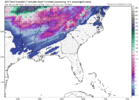
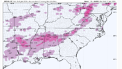
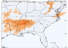
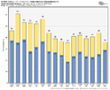
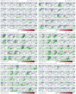
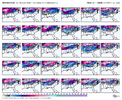
I counted 20/30 members at TDF with at least a trace of snow within the 24 hour window provided by the GEFS. There’s nothing obscene accumulation wise but I would say that’s a pretty decent signal at this lead time.
- Joined
- Jan 23, 2021
- Messages
- 4,602
- Reaction score
- 15,197
- Location
- Lebanon Township, Durham County NC
Signal seems to be the strongest in the border counties in the north central and northeastern piedmont. Even Halifax airport in Northampton had 21/30

