• Hello, please take a minute to check out our awesome content, contributed by the wonderful members of our community. We hope you'll add your own thoughts and opinions by making a free account!

Pattern Jammin January 2024

All we need is a small shift south or weaker shortwave and we get majority snow. If we are not in NAM range then more changes are still possible. Either way I think we see at least a few inches of snow which we should be very grateful.
Yea, and at least the euro is on our side for the moment!
 
Yea, and at least the euro is on our side for the moment!
Euro is my number 1 model this season thus far

ps2png-worker-commands-757f6bfb4f-chq4r-6fe5cac1a363ec1525f54343b6cc9fd8-4lC1Tj.png
 
I'm thinking there's going to be widespread icing Saturday morning in CAD regions. Possibly damaging ice along the escarpment in NC. All the models have temps/dews around 35/22 after we cloud up Saturday night. Then precip quickly breaks out and gets heavy before daylight. That sounds like a recipe for wetbulbing down to 27-28 in the prime CAD regions to me, especially considering they never lose northeast winds throughout the day.
 
I'm thinking there's going to be widespread icing Saturday morning in CAD regions. Possibly damaging ice along the escarpment in NC. All the models have temps/dews around 35/22 after we cloud up Saturday night. Then precip quickly breaks out and gets heavy before daylight. That sounds like a recipe for wetbulbing down to 27-28 in the prime CAD regions to me, especially considering they never lose northeast winds throughout the day.
i'm not as enthused as you are outside of areas with elevation. The parent high for this storm is well into canada- any CAD will be in-situ in nature. with that you're relying on solid diurnal temp drop friday night with radiational cooling to even give you a shot of something frozen. i made a comment earlier this week mentioning the preceding air mass will be "chilly", and it may be enough to give some novelty sleet/zr, but i think the flip to rain will be quick and widespread.

different story for areas of elevation where it will be colder... dependent on the microclimate.

my hedge is that as other have pointed out the piedmont isn't thaaaaat far off. and posting this right before the 12z suite i'm putting myself at risk of looking like a big idiot if there are south shifts. i should also give the CAMs a chance to sniff things before writing it off. but to me this just looks like a storm for coal country and i think any impacts for us will be marginal
This is actually a situation where snowpack to the north would be helpful, if you desire ice. But since we don't, I agree with your analysis here, and I think it will prove to be spot on. Unless the models turn around on the high pressure strength and placement, about the best one could hope for is a bit of minor icing before the inevitable change over to rain.
 
i'm not as enthused as you are outside of areas with elevation. The parent high for this storm is well into canada- any CAD will be in-situ in nature. with that you're relying on solid diurnal temp drop friday night with radiational cooling to even give you a shot of something frozen. i made a comment earlier this week mentioning the preceding air mass will be "chilly", and it may be enough to give some novelty sleet/zr, but i think the flip to rain will be quick and widespread.

different story for areas of elevation where it will be colder... dependent on the microclimate.

my hedge is that as other have pointed out the piedmont isn't thaaaaat far off. and posting this right before the 12z suite i'm putting myself at risk of looking like a big idiot if there are south shifts. i should also give the CAMs a chance to sniff things before writing it off. but to me this just looks like a storm for coal country and i think any impacts for us will be marginal
Nah you're probably spot on, "damaging" probably wasn't the best word to use, haha, But I think some of the preferred escarpment area's with a little elevation could reach 1/4 inch/warning criteria ice. Advisory ice accumulations are definitely achievable for a wide swath of piedmont NC as well.

But like you said, I'm curious to see what the hi-res models do with this storm when they get in range.
 
i'm not as enthused as you are outside of areas with elevation. The parent high for this storm is well into canada- any CAD will be in-situ in nature. with that you're relying on solid diurnal temp drop friday night with radiational cooling to even give you a shot of something frozen. i made a comment earlier this week mentioning the preceding air mass will be "chilly", and it may be enough to give some novelty sleet/zr, but i think the flip to rain will be quick and widespread.

different story for areas of elevation where it will be colder... dependent on the microclimate.

my hedge is that as other have pointed out the piedmont isn't thaaaaat far off. and posting this right before the 12z suite i'm putting myself at risk of looking like a big idiot if there are south shifts. i should also give the CAMs a chance to sniff things before writing it off. but to me this just looks like a storm for coal country and i think any impacts for us will be marginal
Yeah, my thinking is areas 85 and north in NC, brief chance at a quick glaze to rain, areas closer to I-40, glaze to .1, with initial IP, and mountains gets front end snow/sleet to ZR then rain
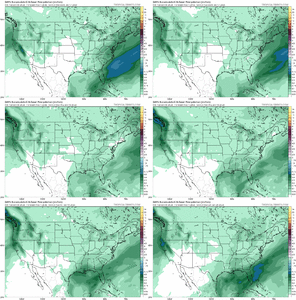
FE1E0FCA-CBA1-4921-B503-217BC0E58DE9.png280E499A-E8F5-4EF7-A7FE-C362F6C7E0EC.png
59770C45-91B8-46B2-BD37-C7A85DAFD675.pngA0B40351-B081-4A48-8E97-93220A163739.png

691C9243-673E-4CAC-963A-E1FD0730AB8C.png5063561D-B549-4043-910A-853010389210.png
 
Looks like the first few weeks of January are a toss, even for the mountain folks (outside of a trace here or there.) If they can't even score with elevation... Just disappointing to see another dud of a year. At least it's chilly?
GEFS is advertising a significant cold intrusion around 1/10. I don't think it's the much vaulted pattern change, though. If there's a trailing wave after that possible severe weather generator early next week, we might get a "surprise" shot at frozen somewhere in the southeast.
 
Back
Top