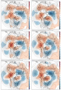
-
Hello, please take a minute to check out our awesome content, contributed by the wonderful members of our community. We hope you'll add your own thoughts and opinions by making a free account!
You are using an out of date browser. It may not display this or other websites correctly.
You should upgrade or use an alternative browser.
You should upgrade or use an alternative browser.
Pattern Jammin January 2024
- Thread starter SD
- Start date
JLL1973
Member
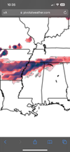
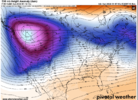
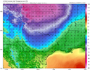
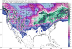
Not gonna be as good as 18z but that’s no surpriseNew here but possible incoming on the GFS??
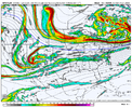
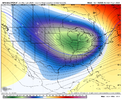
Yep likely same scenario as the last run.Atlantic ridging nudging I’m on us. Gonna be a mess. Prob cut or transferView attachment 140327
JLL1973
Member
Gfs not quite as cold this run
Once again, a perfect track slider=rain for most.


Brent
Member
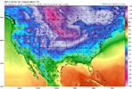
GFS has me below 20 degrees for 3 days ?
JLL1973
Member
NBAcentel
Member
CMC and icon is nice
- Joined
- Jan 5, 2017
- Messages
- 3,774
- Reaction score
- 5,985
NBAcentel
Member
Euro is westward dumpage, southeast ridge even. Right back to square 1. Pack it up boys
LickWx
Member
See y’all same time tomorrow for the party ! It’s gon be back on boys take your Xanax change your underwear cuz it’s gon get rowdy! Trust and believe …. The cold is coming
NBAcentel
Member
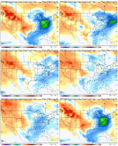
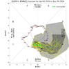
This really should make anyone think twice about any pattern flip mid month. I saw this yesterday but kept my mouth shut. Didnt want to ruin the party. A solid run at phase 4 around the 15th never supported what models showed yesterday. And sure enough they flipped back overnight to a more likely scenario giving the MJO forecast. Hopefully I'm wrong and other factors can take over, but I'm not betting on it. That little loop trying to hang out in 2 or 3 is not doing us any favors. I wish it would just step on the gas and get the inevitable pass through 4,5 and 6 over with. It's going to take until Feb to get to good phases. And by then it'll probably collapse into the COD or loop back to 4 knowing our luck.

- Joined
- Jan 23, 2021
- Messages
- 4,602
- Reaction score
- 15,197
- Location
- Lebanon Township, Durham County NC
- Joined
- Jan 23, 2021
- Messages
- 4,602
- Reaction score
- 15,197
- Location
- Lebanon Township, Durham County NC
You need to look at Grit and Webber’s info about the MJO phases in the Winter Discussion Thread…as we go deeper into January in a Nino it’s very different from what I had always understood. I don’t think we’re done with model flip flopping around a pattern change.This really should make anyone think twice about any pattern flip mid month. I saw this yesterday but kept my mouth shut. Didnt want to ruin the party. A solid run at phase 4 around the 15th never supported what models showed yesterday. And sure enough they flipped back overnight to a more likely scenario giving the MJO forecast. Hopefully I'm wrong and other factors can take over, but I'm not betting on it. That little loop trying to hang out in 2 or 3 is not doing us any favors. I wish it would just step on the gas and get the inevitable pass through 4,5 and 6 over with. It's going to take until Feb to get to good phases. And by then it'll probably collapse into the COD or loop back to 4 knowing our luck.
View attachment 140354
packfan98
Moderator
There‘s a signal for a possible SE storm pretty early in the period around the 15th.


- Joined
- Jan 23, 2021
- Messages
- 4,602
- Reaction score
- 15,197
- Location
- Lebanon Township, Durham County NC
Was just about ready to say that. Literally as soon as next SundayThere‘s a signal for a possible SE storm pretty early in the period around the 15th.

I'll have to go back and find it. I did glance at it and saw phase 1 was about the worst phase possible for a winter storm. I found that strange since you always here phase 8 and 1 are good.You need to look at Grit and Webber’s info about the MJO phases in the Winter Discussion Thread…as we go deeper into January in a Nino it’s very different from what I had always understood. I don’t think we’re done with model flip flopping around a pattern change.
Honestly the whole 6z GEFS had a weenie run look about it.
After making some progress yesterday, the 00z Op and Ensemble suite punched us in the mouth for the most part...but the very last 00z run I looked at was the UKMet, and I thought it looked like the best of the bunch (only goes out to hr168)...and the 06z GEFS backed it up and pretty much looked just like it. Obviously, we gotta get the trough out of the west (1st order of business)...then the 2nd is seeing how long of a timing window we can get with some colder air.Honestly the whole 6z GEFS had a weenie run look about it.

Brent
Member
Looks like the PNA will head positive in the LR. But, the AO and NAO will head towards neutral (from current strongly negative). As said before, give me a positive PNA any day.
Flotown
Member
canadian looks better
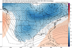
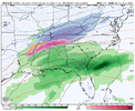
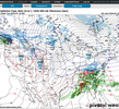
Most models show big storms coming up. Tues,Fri,late next Monday. You can pretty much bank on this as they are having an easy time pegging, forecasting these in their 10 day grids this season. Exact tracks will wobble from run to run. Each one carves its track futher and futher SE the GFS Op 8-9 day gives my area a decent chance, still needs some help staying all frozen. Also the upslope areas and even TN ,extreme north GA,AL have a shot at wrap around next Saturday.

Cary_Snow95
Member
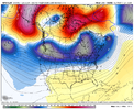
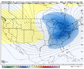
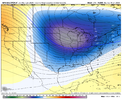
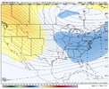
The days are starting to get longerPretty soon snowpak enthusiasts are going to have to find another excuse as to why we can’t get snow here. Your days are numbered View attachment 140381
Yea we really need this upcoming chance to avoid the western dump and get up under the block. We lose this window , then its all about a fab feb hail mary. Gonna be Juda Cohen Chapter 2 if we dont.Pretty soon snowpak enthusiasts are going to have to find another excuse as to why we can’t get snow here. Your days are numbered View attachment 140381
We are sitting at -3.5 BN GSO with January 1/4 the way through. We cross the halfway point of Met winter this time next weekend and officially enter the second half of winter.
Webberweather53
Meteorologist
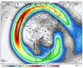
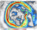
GFS Op looks fine, still 8-10 days out and it’s more than close enough in general at this range.

