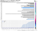
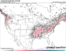
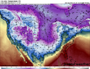
I'll be honest delaying dumping the cold into the SE a few days like the euro/cmc probably isn't a bad thing. There's a better chance to capitalize on what they have at d10 than what the gfs has
-
Hello, please take a minute to check out our awesome content, contributed by the wonderful members of our community. We hope you'll add your own thoughts and opinions by making a free account!
You are using an out of date browser. It may not display this or other websites correctly.
You should upgrade or use an alternative browser.
You should upgrade or use an alternative browser.
Pattern Jammin January 2024
- Thread starter SD
- Start date
I think the GFS is a bit too fast and will adjust slower in time.I'll be honest delaying dumping the cold into the SE a few days like the euro/cmc probably isn't a bad thing. There's a better chance to capitalize on what they have at d10 than what the gfs has
Webberweather53
Meteorologist
We may very well see the cold shot slow up a bit more over the Rockies in the medium-extended range (days 5-8), but it’s not going to stay there for too long in this case. The -NAO and trailing Pacific jet extension will force this mass eastward
And the next day...

Yes please!
I actually think there’s some truth to what you’re saying. It seems that whenever we see the cold come straight southeast, that’s when it overtakes the pattern to squash energy and moisture too far south…December 2002 for example.I'll be honest delaying dumping the cold into the SE a few days like the euro/cmc probably isn't a bad thing. There's a better chance to capitalize on what they have at d10 than what the gfs has
Agree with Grit & you.Pretty much that's correct. The chances are less in those phases though. The composites here likely focus on the overall pattern in general. Not that we can't time something and snow but I'm not sure any great pattern flip is coming a little after mid month. We are almost certain headed to phase 4 around the 15th which is the worst possible timing for that. It's not a torch pattern moving forward but the cutter pattern probably isn't going anywhere. Now when you get to Feb these stats do change and the MJO holds less influence.
View attachment 140399
I'm not arguing that we don't want every Teleconnection on our side.
I know certain patterns are much more productive than others but it often still a thread the needle situation.
I'm staying positive Bc in the 100+ years of record keeping 2 snowless winters B2B haven't happened yet at GSP.
So this is our year.
Timing is going to work.
Yep you never want to go full dump. I'm sure someone may have stats to prove me wrong but I remember very few significant snow events at the front of an arctic outbreakI actually think there’s some truth to what you’re saying. It seems that whenever we see the cold come straight southeast, that’s when it overtakes the pattern to squash energy and moisture too far south…December 2002 for example.
Webberweather53
Meteorologist
Nothing wrong with this.
I legitimately see more than one way score in this pattern
(I.e classic overrunning as the big vortex passes over the Lakes and SE Canada and/or a cold air damming event as the vortex ejects out into Atlantic Canada w/ subsidence and surface pressure rises out ahead of the trailing ridge)
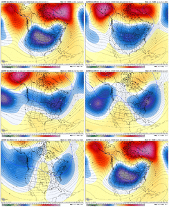
I legitimately see more than one way score in this pattern
(I.e classic overrunning as the big vortex passes over the Lakes and SE Canada and/or a cold air damming event as the vortex ejects out into Atlantic Canada w/ subsidence and surface pressure rises out ahead of the trailing ridge)

NBAcentel
Member
Worth noting to the slower this airmass moves and progresses, the colder it will probably be. You can see that on runs that are more consolidated out west initially before they start to slide eastI'll be honest delaying dumping the cold into the SE a few days like the euro/cmc probably isn't a bad thing. There's a better chance to capitalize on what they have at d10 than what the gfs has
12z eps has alot more snow activity on the plumes. Nothing massive but more active than 0z
I would agree, we could see the pattern change slow a bit more but I also think that could be a good thing as well.We may very well see the cold shot slow up a bit more over the Rockies in the medium-extended range (days 5-8), but it’s not going to stay there for too long in this case. The -NAO and trailing Pacific jet extension will force this mass eastward
NoSnowATL
Member
I would agree, we could see the pattern change slow a bit more but I also think that could be a good thing as well.
I would agree, we could see the pattern change slow a bit more but I also think that could be a good thing as well
NBAcentel
Member
I would agree, we could see the pattern change slow a bit more but I also think that could be a good thing as wellI would agree, we could see the pattern change slow a bit more but I also think that could be a good thing as well
I would agree, we could see the pattern change slow a bit more but I also think that could be a good thing as wellI would agree, we could see the pattern change slow a bit more but I also think that could be a good thing as well
lol fixed!
math_professor
Member
Been an observer for many years from the previous site to others you that have been around know my reference up to this excellent site. I don’t get to worked up these days over the lack of snow but sure miss the 60’s, 70’s, and 80’s as far as snowfall goes. Super glad to read everyone’s input from an intellectual, professional, and enthusiast stand point.
Def nice to see that 50/50 signal still there at the end of the run. Still some skin in the gameNothing wrong with this.
I legitimately see more than one way score in this pattern
(I.e classic overrunning as the big vortex passes over the Lakes and SE Canada and/or a cold air damming event as the vortex ejects out into Atlantic Canada w/ subsidence and surface pressure rises out ahead of the trailing ridge)
View attachment 140401
Webberweather53
Meteorologist
I would agree, we could see the pattern change slow a bit more but I also think that could be a good thing as well.
Patterns like these are nice in that there’s more than usual wiggle room to keep legit threats around. I wouldn’t sell the farm on it yet, but there’s a real chance we end up seeing more than one threat out of this.
I will always vote for the window of opportunity to stretch out. Espeacilly this year as we get hit repeatedly every 3-5 days with precip events. I love pipe busting vodka cold, but not needed to get the ground white. Thats Goal #1Yep you never want to go full dump. I'm sure someone may have stats to prove me wrong but I remember very few significant snow events at the front of an arctic outbreak
Bare with me guys while I clean clean this board up. @packfan98 you on the clock I need MNGR now
The only storm on the front end of an Arctic outbreak that really stands out to me is February 1996. That cold airmass came into the south right as the storm was moving across the south. Most of the time, you either see the Arctic either fully established or kinda relaxing a bit before we score.Yep you never want to go full dump. I'm sure someone may have stats to prove me wrong but I remember very few significant snow events at the front of an arctic outbreak
Eps plumes are impressive there's a 3-4 day period where 50+% of the members are 32-39 for highs. If that cold cluster is right can't ----- about it not being cold anymore
1988The only storm on the front end of an Arctic outbreak that really stands out to me is February 1996. That cold airmass came into the south right as the storm was moving across the south. Most of the time, you either see the Arctic either fully established or kinda relaxing a bit before we score.
Not really… in KCLT, the 5 days preceding that storm saw highs of 44, 35, 40, 38, and 31. That airmass had been established for a few days.1988
NBAcentel
Member
You are correct. Probably hard to zero out again. I'm not even close to entertaining that possibility. I'm trying to figure out if this winter is indeed going to follow the progression of some of our nice Nino years. 65-66, 82-83, 86-87, 09-10. It may be others but right off the top of my head those are moderate to strong Ninos that had great runs after mid Jan. I'd be curious if someone @Webberweather53 or @Myfrotho704 or some others who know how to find it what the MJO was doing in those winters during the great periods? Although I don't think MJO data goes back to the 60s though.Agree with Grit & you.
I'm not arguing that we don't want every Teleconnection on our side.
I know certain patterns are much more productive than others but it often still a thread the needle situation.
I'm staying positive Bc in the 100+ years of record keeping 2 snowless winters B2B haven't happened yet at GSP.
So this is our year.
Timing is going to work.
You are correct. Probably hard to zero out again. I'm not even close to entertaining that possibility. I'm trying to figure out if this winter is indeed going to follow the progression of some of our nice Nino years. 65-66, 82-83, 86-87, 09-10. It may be others but right off the top of my head those are moderate to strong Ninos that had great runs after mid Jan. I'd be curious if someone @Webberweather53 or @Myfrotho704 or some others who know how to find it what the MJO was doing in those winters during the great periods? Although I don't think MJO data goes back to the 60s though.
Here's a good link for those that want to look it up
Just looking at this at first glance, it appears that we were in phase 3/4 during the January 1987 storm.
Here's a good link for those that want to look it up
Yeah it looks like Jan 83 started in 7 and 8 then moved through 3-6 in Feb. Jan 10 was low amp 5 and 6 then Feb was phase 7 and 8Just looking at this at first glance, it appears that we were in phase 3/4 during the January 1987 storm.
accu35
Member
So we appear in good shape for Feb either way. The end of this month I guess it depends on how strong it is running through 4, 5 and 6. Of the ones I mentioned Jan 2010 was the only one in those phases and it was weak. Jan 87 was mostly in the COD after mid Jan.Yeah it looks like Jan 83 started in 7 and 8 then moved through 3-6 in Feb. Jan 10 was low amp 5 and 6 then Feb was phase 7 and 8
- Joined
- Jan 23, 2021
- Messages
- 4,602
- Reaction score
- 15,197
- Location
- Lebanon Township, Durham County NC
I wouldn’t be shocked at all to see a snow to ice to rain event north of 85 in the next ten days. Still think there’s good money in the last week of the month(along with in the banana stand).
I’m just putting in different years and I’m really surprised at some of the storms that were in supposedly bad phases.
Here's a good link for those that want to look it up
January 1987- phase 3/4
February 1996- phase 3
January 2003- COD but close to phase 6
February 2004- phase 5
March 2009- phase 4
January 2011- phase 5/6
February 2014- COD but close to phase 5
January 2022- COD but borderline 6/7.
Of course most of January 2023 it was in COD but close to phase 8,1,2 and it was an absolute torch.
I wouldn't be surprised to see some snow in TN and Northern parts of Ms, AL, GA behind the big system this week. Those areas tend to do well in the CAA of these amped cutters the last few years
With the snow cover getting put down in the interior NE I actually think even areas south of I-85 might be in play in the 1/16-1/21 timeframe.I wouldn’t be shocked at all to see a snow to ice to rain event north of 85 in the next ten days. Still think there’s good money in the last week of the month(along with in the banana stand).
NBAcentel
Member
Hope nobody gets to upset if the pacific jet overextends late month once the cold moves on. Probably gonna happen as the MJO progresses east and +EAMT comes back. Then after that, the GOAK/Aleutian low and undercut western ridge look will probably arrive, along with renewed blocking.
Yep that's what I was saying you can't go phase x is always result y. Enso state, subseasonal effects of the Enso state, residual blocking and other things play in.I’m just putting in different years and I’m really surprised at some of the storms that were in supposedly bad phases.
January 1987- phase 3/4
February 1996- phase 3
January 2003- COD but close to phase 6
February 2004- phase 5
March 2009- phase 4
January 2011- phase 5/6
February 2014- COD but close to phase 5
January 2022- COD but borderline 6/7.
Of course most of January 2023 it was in COD but close to phase 8,1,2 and it was an absolute torch.
NBAcentel
Member
Really wish I could find VP maps for those years sometimes RMM phase charts don’t do justice
What would get really interesting is to see how many occurred in bad phase mjo but if you go back 5, 7, 10 days was the mjo in the favorable phase that dropped in the cold but we were suppressed then as it relaxed we scoredI’m just putting in different years and I’m really surprised at some of the storms that were in supposedly bad phases.
January 1987- phase 3/4
February 1996- phase 3
January 2003- COD but close to phase 6
February 2004- phase 5
March 2009- phase 4
January 2011- phase 5/6
February 2014- COD but close to phase 5
January 2022- COD but borderline 6/7.
Of course most of January 2023 it was in COD but close to phase 8,1,2 and it was an absolute torch.
severestorm
Member
Eyewall(Meteorologist) on americanwx is very concerned about the SER being a issue

