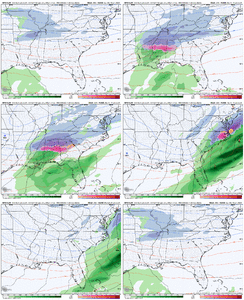
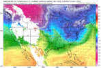
Interesting seeing 1/31/1996 on there. Much of the south had a major Ice/Sleet/Snow event 2/1-2/2 that was followed by a major Arctic outbreak and pieces of energy that helped bring snow deep into the southeast and even coastal sections of Georgia.CPC Analog Map for day 8-14 forecast, centered on Jan 17th

-
Hello, please take a minute to check out our awesome content, contributed by the wonderful members of our community. We hope you'll add your own thoughts and opinions by making a free account!
You are using an out of date browser. It may not display this or other websites correctly.
You should upgrade or use an alternative browser.
You should upgrade or use an alternative browser.
Pattern Jammin January 2024
- Thread starter SD
- Start date
Early Jan ‘82 was frigid of course. Freezer Bowl in Cincy followed by Atl snow jamInteresting seeing 1/31/1996 on there. Much of the south had a major Ice/Sleet/Snow event 2/1-2/2 that was followed by a major Arctic outbreak and pieces of energy that helped bring snow deep into the southeast and even coastal sections of Georgia.
I remember that. It was rough we had no power for like 4 days. It was a bad ice storm here.Interesting seeing 1/31/1996 on there. Much of the south had a major Ice/Sleet/Snow event 2/1-2/2 that was followed by a major Arctic outbreak and pieces of energy that helped bring snow deep into the southeast and even coastal sections of Georgia.
That storm gave me my first experience with thunder sleet.I remember that. It was rough we had no power for like 4 days. It was a bad ice storm here.
WEATHERBOYROY
Member
About that Jan 07 1982 analog.....it was the beginning of the huge Jan 11,1982 snow and ice storm for north and central Alabama. In west Al. (Livingston) we had 8 inches of snow after sunset. In Bham, they were 10 degrees colder with freezing rain and sleet that began around noon. behind it bitter cold Arctic air set in for several days. It shut down everything and left many stranded because it began in the middle of the day while people were at work. It took the Blizzard on March 93 for Alabama residents to forget it.
Flotown
Member
waz actually gonna bring up early feb 96 earlier
Twister
Member
Yeah I will gladly take a 2" Snow over the Big Winter storms any day. Who Likes to be without power or able to get out for days?!I remember that. It was rough we had no power for like 4 days. It was a bad ice storm here.
Sent from my SM-S911U using Tapatalk
NBAcentel
Member
This pattern if it verifies look better with low level cold/sfc cold. Could be icy
Interesting seeing 1/31/1996 on there. Much of the south had a major Ice/Sleet/Snow event 2/1-2/2 that was followed by a major Arctic outbreak and pieces of energy that helped bring snow deep into the southeast and even coastal sections of Georgia.
Ice Storm of February 1-2, 1996
www.weather.gov
W
WSW
Guest
Haha i remember February 2010 really well. 50 inches of snow that month. Unreal. No power lost and they did the roads really well. We got out of the neighborhood the day after we had 30 inches.Yeah I will gladly take a 2" Snow over the Big Winter storms any day. Who Likes to be without power or able to get out for days?!
Sent from my SM-S911U using Tapatalk
W
WSW
Guest
Ice really sucks. Much better to have snow.I remember that. It was rough we had no power for like 4 days. It was a bad ice storm here.
* Raises handYeah I will gladly take a 2" Snow over the Big Winter storms any day. Who Likes to be without power or able to get out for days?!
Sent from my SM-S911U using Tapatalk
Twister
Member
If it's Ice I'll gladly pass and Take 90° Summer!This pattern if it verifies look better with low level cold/sfc cold. Could be icy
Sent from my SM-S911U using Tapatalk
Twister
Member
Hope you have fun* Raises hand
Sent from my SM-S911U using Tapatalk
597DM
Member
AWESOME!If it's Ice I'll gladly pass and Take 90° Summer!
Sent from my SM-S911U using Tapatalk
597DM
Member
I'll take roof collapsing tree breaking deafening thunder snow or ice.
What does everyone else want?
What does everyone else want?
If it snows we end up dealing with ice anyway once it refreezes at night but I’m with y’all on not having power outages.
GritEarly Jan ‘82 was frigid of course. Freezer Bowl in Cincy followed by Atl snow jam
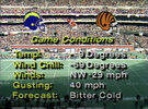
Will never forget that game.
The Freezer Bowl
They kept showing the steam rising from the players heads & from the frozen river next to the stadium.
Everyone knew Dan Fouts & the SD Chargers had no chance in that weather.
At one point they had a wind-chill of -59°.
The entire EC was in the freezer at that point..
Boy I miss those winters from the 70's & 80's.
I’ll take ice, snow, sleet and lots of it. I don’t care if the power goes out and I can’t go anywhere. Those are some of the best memories I had growing up.
You know there's a direct correlation between birth rates going up drastically 9 months after big winter storms in Southern states.
You can always find something to do...
?
Oh yeah! Unfortunately I guess the southern states have been playing their part in population control for the last 10-15 years then lolYou know there's a direct correlation between birth rates going up drastically 9 months after big winter storms in Southern states.
You can always find something to do...
?
Grit
Will never forget that game.
The Freezer Bowl
They kept showing the steam rising from the players heads & from the frozen river next to the stadium.
Everyone knew Dan Fouts & the SD Chargers had no chance in that weather.
At one point they had a wind-chill of -59°.
The entire EC was in the freezer at that point..
Boy I miss those winters from the 70's & 80's.

I didn't choose my screen name for no reason. The wilder, the better.I'll take roof collapsing tree breaking deafening thunder snow or ice.
What does everyone else want?
CNCsnwfan1210
Member
Here's a writeup of weather events in January 1982 in NC. Severe thunderstorms around the 4th followed by a cold wave and snow 10th-15th

Sent from my SM-A136U1 using Tapatalk

Sent from my SM-A136U1 using Tapatalk
NBAcentel
Member
Why are you not weenietag anymoreI'll take roof collapsing tree breaking deafening thunder snow or ice.
What does everyone else want?
If you remember, the week before the Chargers had played on that 3OT game at Miami where guys were going down with cramps because of the heat and humidity. What a shock that must have been for them to play a week later in that kind of cold
Your rightIf you remember, the week before the Chargers had played on that 3OT game at Miami where guys were going down with cramps because of the heat and humidity. What a shock that must have been for them to play a week later in that kind of cold
I'd forgotten that game.
I see your old too huh?
?
Cary_Snow95
Member
That’s from yesterday ?
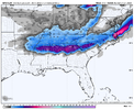
The massive Great Lakes blizzard for next Friday has gone poof on the 00Z ICON. May work out better in the long run for the following systems. We'll see.
Last edited:
Nerman
Member
Uhm, I think you might be in the minority hereYeah I will gladly take a 2" Snow over the Big Winter storms any day. Who Likes to be without power or able to get out for days?!
Sent from my SM-S911U using Tapatalk
Brent
Member
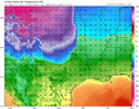
Big-time blue-norther. -40 into Wyoming.Good griefView attachment 140319
GFS is sticking to its guns. CMC and ICON hold back on the TPV into the Pacific NW.


Brent
Member
TWC has me below freezing for 5 days. That would be longer than Christmas 22
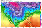
Playing with fireColdest run yet!!! ? View attachment 140322
LukeBarrette
im north of 90% of people on here so yeah
Meteorology Student
Member
2024 Supporter
2017-2023 Supporter

