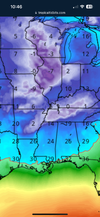
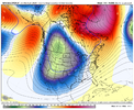
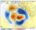
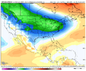
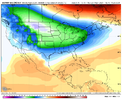
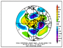
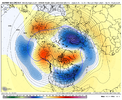
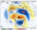
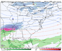
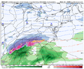
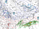
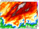
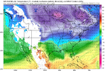
Gfs is going to be too slow for most of nc sc ga looks good for TN northern AL ms
-
Hello, please take a minute to check out our awesome content, contributed by the wonderful members of our community. We hope you'll add your own thoughts and opinions by making a free account!
You are using an out of date browser. It may not display this or other websites correctly.
You should upgrade or use an alternative browser.
You should upgrade or use an alternative browser.
Pattern Jammin January 2024
- Thread starter SD
- Start date
JLL1973
Member
GFS:

ICON:

CMC:


ICON:
CMC:

Still a decent spot to be for most compared to having nothing at all to watch. 6 days out from our Jan 11 wave dropping south. Wherever the digital snow is showing several days after that doesn’t matter if we don’t get that first wave right. And for now, getting that first wave right is still on the table.
Brent
Member
I think we are seeing signs of things to come. Maybe extraordinary even.
Yeah some of the talk I've seen here is pretty up there too. Something big is definitely coming
Models have no trouble identifying storms 1-10 days out this year. Courtesy of strong el nino. Amazing how they all peg em out in unison unlike most years. Noticed this all season.
Oh we see them rolling in alright. That's not a problem. Whether they will snow or not is the question. Also not really an issue to identify the cutters either. We need some **** honest solid cold to work with
Brent
Member
Oh we see them rolling in alright. That's not a problem. Whether they will snow or not is the question. Also not really an issue to identify the cutters either. We need some **** honest solid cold to work with
Yeah even out here so far temps are just killing us and Tuesday may follow the same path tbh. It's really cutting into our snow potential
UKMet run dropping in nicely, avoiding Seattle


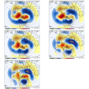
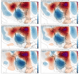
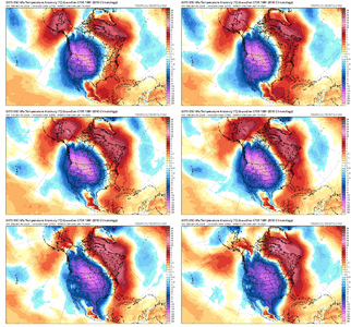
Last night's GEFS run vs. tonight's. Weaker AK ridge / Stronger Greenland ridge *thumbs up*


NBAcentel
Member
NBAcentel
Member
NBAcentel
Member
Demolishing the big AK block is doing us big favors.
1. The -NAO is becoming the key feature (which we want)
2. Prevents amplification of the pattern
3. Speeds up the pattern over the US
Also note how the -NAO has trended stronger, from a model suite that was looking bleak before, these are some pretty positive changes
1. The -NAO is becoming the key feature (which we want)
2. Prevents amplification of the pattern
3. Speeds up the pattern over the US
Also note how the -NAO has trended stronger, from a model suite that was looking bleak before, these are some pretty positive changes


Webberweather53
Meteorologist
A couple warning shots fired on the long range gfs.
I still generally like the possibility of something happening just after mid-month as the vortex over Canada ejects out into the Atlantic. Most of the ingredients are there for a southern slider/overrunning event
I still generally like the possibility of something happening just after mid-month as the vortex over Canada ejects out into the Atlantic. Most of the ingredients are there for a southern slider/overrunning event
packfan98
Moderator
384 hours to glory!


Cad Wedge NC
Member
We know it won't verify but looking at the soundings/set up of that storm for NC, NGA, and the SC upstate, .... mid to upper 20's, saturation all the way to 300mb's, solid snow sounding, big banana high pressure, and a perfect storm track. Now, let's get something like this within 72 hours and I will believe.
Get that look on the Euro in the day 9-10 range closer and this place is humming.
This is the first over performing rain event here in months. Some models showed less than .25” but we got .84”. Baby steps
The run to run changes on all of the models and the ENS guidance is laughable at best. I am hoping yall get a good storm track by the middle of the month for sure.
ForsythSnow
Moderator
1.62" of rain here from this system alone. Helps get us further from our deficit.This is the first over performing rain event here in months. Some models showed less than .25” but we got .84”. Baby steps
1.5" overnight here, bottomed out at 36.5F.
MichaelJ
Member
Temps were right on target here pretty much but the moisture amounts over performed, will be a good trend after the 20th or so with cold funneling down before a mild break after the 28th or so. I think the winter will be back loaded this year and look for a big Feb in the SE. GOD knows we are due a fab February
That was going to be massive. I would’ve liked to see that run all the way through for fun.384 hours to glory!

iGRXY
Member
12 hours*384 hours to glory!

Webberweather53
Meteorologist
the end of the Euro is even about roll to glory.This is the time in a while I’ve looked at fantasy land GFS runs and thought these weren’t completely crazy solutions in a general sense. (Exact timing and placement sure).
View attachment 140186
View attachment 140185
Webberweather53
Meteorologist
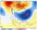
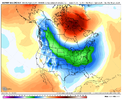
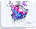
Fantasy model runs are great, but I’ve always been more of a general ingredients guy when it comes to medium-long range forecasting. To be honest, we really do have the right basic ingredients in place to get a classic southern slider just after mid-Jan (Jan 16-20th ish.).
-High-latitude blocking over both the North Pacific and Greenland/Baffin Bay. It’s pretty rare you get the -EPO and a west-based -NAO to line up like this. Iirc from my teleconnection statistics, winter storms are ~4x more likely than climo when -EPO/-NAO/-AO are present.
-Big vortex anomaly progresses from west-central N America to New England and Atlantic Canada, favoring deep push of arctic air and a suppressed storm track. Usually when these vortex anomalies slide eastward like this, there’s often an overrunning type system waiting to sneak up from behind. Also, this vortex would help to keep any system pinned down and discouraging it from being handed off to the mid-Atlantic.
-Active southern jet stream (thanks El Niño) should give us beefier waves to work with before they possibly get sheared out as they run into the Lakes + SE Canada vortex.
-A deep, fresh, and extensive snowpack will probably be over the CONUS, thanks to several prior weather systems. Favorable for keeping any Arctic air masses refrigerated on their way southward, as well as forcing pressure rises upstream (thru hydrostatic effects), keeping our parent highs strong ?
There’s a lot to like about where we’re headed day 10-14


So even though we have an opportunity here in a couple weeks, do you still think our best opportunities will come in Feb? Will we really get things to line up any better than what they are showing in day 10-14?Fantasy model runs are great, but I’ve always been more of a general ingredients guy when it comes to medium-long range forecasting. To be honest, we really do have the right basic ingredients in place to get a classic southern slider just after mid-Jan (Jan 16-20th ish.).
-High-latitude blocking over both the North Pacific and Greenland/Baffin Bay. It’s pretty rare you get the -EPO and a west-based -NAO to line up like this. Iirc from my teleconnection statistics, winter storms are ~4x more likely than climo when -EPO/-NAO/-AO are present.
-Big vortex anomaly progresses from west-central N America to New England and Atlantic Canada, favoring deep push of arctic air and a suppressed storm track. Usually when these vortex anomalies slide eastward like this, there’s often an overrunning type system waiting to sneak up from behind. Also, this vortex would help to keep any system pinned down and discouraging it from being handed off to the mid-Atlantic.
-Active southern jet stream (thanks El Niño) should give us beefier waves to work with before they possibly get sheared out as they run into the Lakes + SE Canada vortex.
-A deep, fresh, and extensive snowpack will probably be over the CONUS, thanks to several prior weather systems. Favorable for keeping any Arctic air masses refrigerated on their way southward, as well as forcing pressure rises upstream (thru hydrostatic effects), keeping our parent highs strong ?
There’s a lot to like about where we’re headed day 10-14
View attachment 140188
View attachment 140189
View attachment 140190
Most of the time we get storms then things relax, then it comes back again. I would expect Fab Feb will be good. However nothing guaranteed in southeastSo even though we have an opportunity here in a couple weeks, do you still think our best opportunities will come in Feb? Will we really get things to line up any better than what they are showing in day 10-14?
It's been a LONG time since we've seen an artic airmass of this magnitude poised to plunge into the lower 48.

It seems we are settling on a solution for next week's game changer.

Webberweather53
Meteorologist
It seems we are settling on a solution for next week's game changer.

The table is being set for us to score in the long-term.
Wow. This monster is actually trending SE.


That's shaping up to be a very large and impactful storm. It's nice to see some interesting weather showing up.Wow. This monster is actually trending SE.


