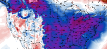
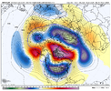
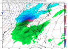
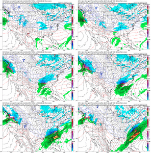
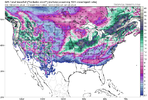
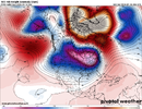
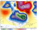
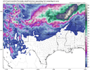
The models, all of them, are struggling more than usual past day 7. We've seen this whenever a major pattern change is looming.I Caution you because the way it folded a couple days ago. 12z EPS View attachment 140087View attachment 140088View attachment 140089View attachment 140090
-
Hello, please take a minute to check out our awesome content, contributed by the wonderful members of our community. We hope you'll add your own thoughts and opinions by making a free account!
You are using an out of date browser. It may not display this or other websites correctly.
You should upgrade or use an alternative browser.
You should upgrade or use an alternative browser.
Pattern Jammin January 2024
- Thread starter SD
- Start date
packfan98
Moderator
Happy Hour is delivering the cold and digital snow for 1/19
NBAcentel
Member
Gfs makes -NAO the dominant block. Which is key
lexxnchloe
Member
Happy Hour is delivering the cold and digital snow for 1/19

CltNative90
Member
Stormlover
Member
18Z GFS brings the goods...in two weeks


D
Deleted member 609
Guest
I will take this and call it a winter. Check please.
Ron Burgundy
Member
Picture. Perfect. Looks like the early ‘80s. If only…
Kudos to Grit and Fro pointing out the Greenland block being dominant player. If it happens id put the chances for my area at 80-85% + seeing accumulating snow, frozen mix. Nice window of opportunity if we win the battle of the ridges up north.
Flotown
Member
crazy thing is ,that looks scary like th euro control somebody posted yesterday18Z GFS brings the goods...in two weeks
GSO runing -2.6 so far this young January. Far cry from the +5.7 we ran Jan 23
We logged a +2.6 for Month of Dec. So for Met winter (D,J,F) we will be runing slightly BN temp wise after todays numbers are crunched in. Qpf is through the roof AN.
Sooner or latter the odds will work in our favor if this keeps up.
We logged a +2.6 for Month of Dec. So for Met winter (D,J,F) we will be runing slightly BN temp wise after todays numbers are crunched in. Qpf is through the roof AN.
Sooner or latter the odds will work in our favor if this keeps up.
dsaur
Member
Makes a world of difference if the cold air is pressing down instead of sliding across. Blocking for the win!Kudos to Grit and Fro pointing out the Greenland block being dominant player. If it happens id put the chances for my area at 80-85% + seeing accumulating snow, frozen mix. Nice window of opportunity if we win the battle of the ridges up north.
iGRXY
Member
Models flip flopping every other run as a pattern change looms? Call me shocked
Psalm 148:8
Member
- Joined
- Dec 25, 2016
- Messages
- 344
- Reaction score
- 789
This is fabulous!! Last few years we couldn’t even buy a fantasy run!!! BTW.. James Spann is encouraged by what he sees heading into the next 10-15 days!18Z GFS brings the goods...in two weeks
What now? Nonsense, that isn’t NSFW, if it verifies its NSFM because what our wives will do to us by spending so much time tracking that.
18z GFS does 2 things that the good model runs are doing. 1) The low/wave that drops down out of SW Canada on Jan 11 slides east of Seattle instead of plopping down right on top of them, and 2) The big cutter wave that subsequently comes out of the S Plains is strong, and it pumps ridging out ahead of it that reinforces the Greenland block as it gets stuck underneath it.

12z GFS does the opposite. Drops the wave on top of Seattle and has a weak wave coming out of the S Plains into the Great Lakes


12z GFS does the opposite. Drops the wave on top of Seattle and has a weak wave coming out of the S Plains into the Great Lakes

0z GFS looks like another positive trend regarding your first point. Dropping into Montana this run18z GFS does 2 things that the good model runs are doing. 1) The low/wave that drops down out of SW Canada on Jan 11 slides east of Seattle instead of plopping down right on top of them, and 2) The big cutter wave that subsequently comes out of the S Plains is strong, and it pumps ridging out ahead of it that reinforces the Greenland block as it gets stuck underneath it.
12z GFS does the opposite. Drops the wave on top of Seattle and has a weak wave coming out of the S Plains into the Great Lakes
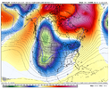
This is really close to a phase. In any, much further east and on the move.


?
Liking what I'm seeing with that cutter. Should make the -NAO ridge go nuts.This is really close to a phase. In any, much further east and on the move.

Lol 967 over lake Michigan
Let's see what happens with the next sw coming ashore in the Pac NW.


2 feet from St. Louis to ChicagoLol 967 over lake Michigan
good grief

someone is getting a historic storm lol (not us)
safest bet is to write off any long range stuff after this storm crescendos until we get better consensus on this beast. because how it evolves will be critical to how blocking progresses after

someone is getting a historic storm lol (not us)
safest bet is to write off any long range stuff after this storm crescendos until we get better consensus on this beast. because how it evolves will be critical to how blocking progresses after
What's a couple of thousand miles among friends anyway?


no doubt the run to run changes are laughable at best.good grief

someone is getting a historic storm lol (not us)
safest bet is to write off any long range stuff after this storm crescendos until we get better consensus on this beast. because how it evolves will be critical to how blocking progresses after
Well, well.?What's a couple of thousand miles among friends anyway?


If that block doesn't kick out that'll be a massive snow storm around d10/11 on the gfs
Brent
Member
JLL1973
Member
Gfs could be a good run for the midsouth around 240 hours
Jeez. If this happens, I'm moving north.


