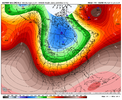
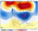
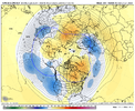
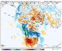
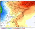
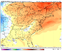
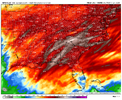
Good thing everyone always says the GFS is ?Your daily 300 h EPS continues to look great. Meanwhile, the GFS lost the block. I guess we're down again.
-
Hello, please take a minute to check out our awesome content, contributed by the wonderful members of our community. We hope you'll add your own thoughts and opinions by making a free account!
You are using an out of date browser. It may not display this or other websites correctly.
You should upgrade or use an alternative browser.
You should upgrade or use an alternative browser.
Pattern Jammin January 2024
- Thread starter SD
- Start date
- Joined
- Jan 23, 2021
- Messages
- 4,602
- Reaction score
- 15,197
- Location
- Lebanon Township, Durham County NC
Your daily 300 h EPS continues to look great. Meanwhile, the GFS lost the block. I guess we're down again.
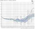
I mean I'd rather have the EPS on my side but it does weaken towards the end on the GEFS. I definitely wouldnt term this as "gone" though. Even with the mean rising toward neutral, it doesnt look too bad.
- Joined
- Jan 23, 2021
- Messages
- 4,602
- Reaction score
- 15,197
- Location
- Lebanon Township, Durham County NC
I don't disagree. I'm just saying for weeks we've been watching 300+ hour nice patterns. Then, we get a few days of crap, followed by 300+ hours of nice patterns. Then, repeat. I honestly don't think the model suite matters all that much. The algorithms produce a result that is counter to what the actual atmosphere wants to do, and that's to place a trough in the west almost every winter.I mean I'd rather have the EPS on my side but it does weaken towards the end on the GEFS. I definitely wouldnt term this as "gone" though. Even with the mean rising toward neutral, it doesnt look too bad.
View attachment 140024
Anyway, today is January 5th. We're going to have a very good idea as to which seasonal forecasts are right and which are wrong in 14 days. My guess is by then, the MJO will be headed into the null phase just as it approaches phase 8 (unless it decides to do a loop through 4, 5, and 6 again). We better hope and pray the big blocking sets up and actually moves forward in time or we're going to roast the heart of winter away.
I miss the days of tracking storms instead of tracking patterns
You remember when we used to have to worry about things like warm noses, Gulf convection robbing moisture transport, dry air eating up all the precip, etc.? We thought we had it rough then! ?I miss the days of tracking storms instead of tracking patterns
For sure...I mentioned yesterday you know we in trouble when we all go to check a model and immediately drag the hour over to day 12+ for hope.I miss the days of tracking storms instead of tracking patterns
NBAcentel
Member
Looks more like the reflection of the pacific jet picking up, which we actually want in time because down the line that would eventually favor a Aleutian lowAnd this is how the GEPS ends...?
It's starting to become clear the staple of this winter will be western trough and the transient pattern will be a eastern trough.
View attachment 140027
View attachment 140028
Thats my hope too....maybe we start seeing that in Feb I guess. I want to see snow this winter, last year we didn't even record a trace I think.Looks more like the reflection of the pacific jet picking up, which we actually want in time because down the line that would eventually favor a Aleutian low
NBAcentel
Member
Same man. I’m not even banking on this Arctic intrusion for scoring. I’m banking on the MJO going back to the whem later on and the Aleutian low/+PNA pattern that normally follows with it. That’s my hope honestlyThats my hope too....maybe we start seeing that in Feb I guess. I want to see snow this winter, last year we didn't even record a trace I think.
I would give anything to get snow robbed by gulf convection again.You remember when we used to have to worry about things like warm noses, Gulf convection robbing moisture transport, dry air eating up all the precip, etc.? We thought we had it rough then! ?
tennessee storm
Member
Yeah now it’s robbed my climate change … lolI would give anything to get snow robbed by gulf convection again.
Cary_Snow95
Member
I think people got unrealistic expectations that this 01/15 timeline was the flip. There’s a chance for like a week window there but it was always early Feb I feel like. When that goes down the crapper I’ll fold
tennessee storm
Member
Agree. And with a quickly developing La Niña fixing take shape , wonder how fast will this winter exit out .I think people got unrealistic expectations that this 01/15 timeline was the flip. There’s a chance for like a week window there but it was always early Feb I feel like. When that goes down the crapper I’ll fold
NBAcentel
Member
If we get another weakened spv episode this Feb like ens show late winter/early spring is gonna suck for warmth when we start to want it, especially with the MJO by then probably bring in colder phases and HLB with shortened wavelengths. Gonna be a crapper early springAgree. And with a quickly developing La Niña fixing take shape , wonder how fast will this winter exit out .
It'll say omg la nina and leave ASAPAgree. And with a quickly developing La Niña fixing take shape , wonder how fast will this winter exit out .
tennessee storm
Member
Going be interesting see how that plays out …If we get another weakened spv episode this Feb like ens show late winter/early spring is gonna suck for warmth when we start to want it, especially with the MJO by then probably bring in colder phases and HLB with shortened wavelengths. Gonna be a crapper early spring
- Joined
- Jan 5, 2017
- Messages
- 3,774
- Reaction score
- 5,985
So you end up with a an El Nino for December and beginning of January and then La Nina for late January through the rest of the year. You get anomalous warmth for December and early January in the SE due to El Nino and then anomalous warmth for late January and February due to La Nina. You get a cold spring. Why is this any different than any other winter over the past five winters? For the SE, you get above average temps all winter. Again, moving to a uni-climate. Summers less hot, winters less cold until you are just experiencing "meh" weather all the time.Agree. And with a quickly developing La Niña fixing take shape , wonder how fast will this winter exit out .
Putting my desires aside for a second here. I think it's important to remember that it's January 5th. The ensembles go out 15 days & they change like a fart in the wind past day 7-10. And you mise well just forget about the extended or whatever the hell a control run is. Let's go back to what 95% of the people on this board have been saying since last Summer regarding this Winter.. And that is that this Winter was always supposed to be backloaded. We aren't at the backend yet. Now I will be with everyone else if we get to January 31st & we are looking two weeks out & seeing nothing but disappointment. But I think we look so hard at these models sometimes that it's like we live in the future. I don't know if that makes sense or not, but hopefully it does.
It's amazing how high & low we get in here from not just day to day, but the switch ups every 12 hours. It's like we know better, but we don't. Lol we post way to much on the highs, then way to much on the lows, which is something that's awesome about this place.. But it also is just a set up to be disappointed. Let's just relax and enjoy the ride.
Again, it's January 5th. We are going to pull in a banger in the coming weeks.
NoSnowATL
Member
AM has lost his luster the past few years. He is right as much as Brick.
Last edited:
Back in the day I would look at this map with a wide continental trough and think “wow, great opportunity for a good overrunning winter storm”. Those have become a unicorn, so it will probably just be cool and wet.It would seem the block gets established by 180-200 hours out and the sensible weather effects happen down stream 4-5 days later which is absolutely how this should propogate:
View attachment 140025
View attachment 140026
- Joined
- Jan 5, 2017
- Messages
- 3,774
- Reaction score
- 5,985
You've got to with persistence with regards to weather patterns. Western troughs have been persistent and likely will remain so. Some day it may change, but until it surprises you, keep going with the trend.Back in the day I would look at this map with a wide continental trough and think “wow, great opportunity for a food overrunning winter storm”. Those have become a unicorn, so it will probably just be cool and wet.
lexxnchloe
Member
Im still waiting for winter to show up, lolAgree. And with a quickly developing La Niña fixing take shape , wonder how fast will this winter exit out .
I don't think so...but yeah a deep south snow is a tough call.AM has lost his luster the past few years. He is right much as Brick.
597DM
Member
It will be glorious because we're used to seeing it go the other way with climo and NW trends.
NBAcentel
Member
Bro, heck no. At least wait until late February when it's 80 degrees. You know things are getting bad when we start seeing the Golfing emojis with the ole "pErFeCt GoLf WeAtHeR"It’s not a torch, but it’s above normal. I’ll take it. Yeah fro is posting warminista maps again. Come at me @weenietag View attachment 140039View attachment 140040
- Joined
- Jan 5, 2017
- Messages
- 3,774
- Reaction score
- 5,985
New England is torching! 12 over in Maine! I bet they love saving money on snow plowing and snow removal not to mention savings on heating fuels.It’s not a torch, but it’s above normal. I’ll take it. Yeah fro is posting warminista maps again. Come at me @weenietag View attachment 140039
If that is the best you've got then we are okay. Those won't feel much different.It’s not a torch, but it’s above normal. I’ll take it. Yeah fro is posting warminista maps again. Come at me @weenietag View attachment 140039View attachment 140040
NBAcentel
Member
Flotown
Member
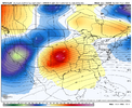
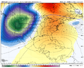
canadian and gfs are just a smidge different lol
NBAcentel
Member
Yeah, Canadian is completely different. No idea which one is correct. Could easily say the one that gives us the SE ridge, but that doesn't feel like a good approach either.canadian and gfs are just a smidge different lol

NBAcentel
Member
What we need is the -NAO ridge to be dominant over the pacific ridge. Stronger -NAO ridge and we undercut. Stronger Aleutian-AK ridge and it gets stuckYeah, Canadian is completely different. No idea which one is correct. Could easily say the one that gives us the SE ridge, but that doesn't feel like a good approach either.

The difference seems to lie in the AK ridge. The modeling that goes big with the AK ridge are tucking the W Canada trough forcefully down into the western U.S. We want the Greenland Block to be the dominant entity, not the AK ridge as it is too far west and not oriented into W Canada
When there is a toss-up, go with persistence.Yeah, Canadian is completely different. No idea which one is correct. Could easily say the one that gives us the SE ridge, but that doesn't feel like a good approach either.


