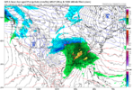
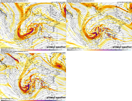
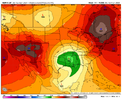
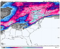
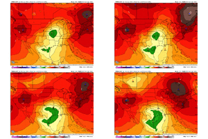
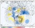
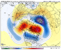
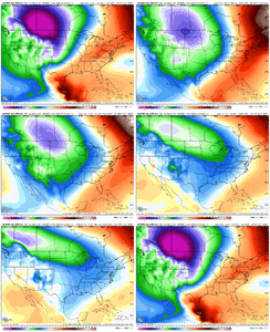
If that actually came to pass it would a record-breaking (temp wise) middle third of winter.
-
Hello, please take a minute to check out our awesome content, contributed by the wonderful members of our community. We hope you'll add your own thoughts and opinions by making a free account!
You are using an out of date browser. It may not display this or other websites correctly.
You should upgrade or use an alternative browser.
You should upgrade or use an alternative browser.
Pattern Jammin January 2024
- Thread starter SD
- Start date
iGRXY
Member

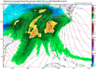
RGEM upped the totals slightly.
Makeitsnow
Member
Keep in mind that when there is appreciable dry air already in place, which we have here, models will normally over estimate temps between 1 to 3 degrees if the depth of the cold layer is deep enough.. This general rule doesn't apply when you see moisture already in place and then caa. However the near surface cold air is very shallow...950 to 975mb temps are not very impressive down into Georgia. So I think areas in the upstate into nc are much more inclined to see icing. Any icing in ga will be brief and likely restricted to areas above 1000 feet.
Likely going to see more icing this run on the NAM
Correct me if I'm wrong but can't these situations lead to a meso High south of the retreating parent High?Yes to an extent. Not a super strong HP but it's there supplying an addition push of cold air on the retreating Mid Atlantic HP.
SimeonNC
Member
Also RGEM does try to warm temps very quickly, for example temps going from 33 to 39 in CLT in only three hours. I think it's too quick considering the HP giving the additional cold push is stronger.
SWVAwxfan
Member
Think we need a separate thread for the weekend storm potential
accu35
Member
I feel a chase
- Joined
- Jan 5, 2017
- Messages
- 3,773
- Reaction score
- 5,983
Are you going to Snowshoe, WV on Saturday? WV looks like a good target for snow from this system.I feel a chase
Last edited:
accu35
Member
I just may do thatAre you going to Snowshoe, WV on Saturday? WV looks like a good target for snow from this system.
accu35
Member
I was being sarcastic. Honestly, I’m more focus now days on my family, kids, grandson, church and work that I don’t have time to really chase like I use to. I’m getting closer to 50 and I’m perfectly happy for what we have now in the weather department. Sure, I’ll take some road trips but not as much like I use to.Are you going to Snowshoe, WV on Saturday? WV looks like a good target for snow from this system.
- Joined
- Jan 5, 2017
- Messages
- 3,773
- Reaction score
- 5,983
I bet in about an hour or two, Cheaha Mountain will start to see some snow falling.I was being sarcastic. Honestly, I’m more focus now days on my family, kids, grandson, church and work that I don’t have time to really chase like I use to. I’m getting closer to 50 and I’m perfectly happy for what we have now in the weather department. Sure, I’ll take some road trips but not as much like I use to.
- Joined
- Jan 23, 2021
- Messages
- 4,602
- Reaction score
- 15,197
- Location
- Lebanon Township, Durham County NC
One interesting thing i'm noting about the mid week event, it seems like there's a high causing some CAA that might lead to just a bit of snow and sleet wednesday morning.
accu35
Member
View attachment 139859
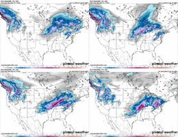
This storm here gonna be pretty wild for someone
It's trended rapidly further SE over past couple of days...bringing the MA in the game.
Drizzle Snizzle
Member
Dallas in the game too ?It's trended rapidly further SE over past couple of days...bringing the MA in the game.
View attachment 139861
W
WSW
Guest
Maybe the 10th storm is better than the 7th for the MA.It's trended rapidly further SE over past couple of days...bringing the MA in the game.
View attachment 139861
Iceagewhereartthou
Member
That's awesome. But maybe the difference is the dog might be trying to scare the car away because it's territorial, whereas we're trying to lure the snow here. Maybe that's our problem. All the nerdy stuff we do is just scaring the snow away rather than bringing it to us? ??I liken it to a dog chasing a car,
What is the dog going to do when it catches the car?
Bury it? ??????
It's just in our DNA and there's not a soul that comes in here that doesn't have it or you wouldn't be here at all.
Also looking for the Holy Grail of Patterns that leads to Board wide glory with a Big Dog.
??️
Flotown
Member
looks like a trip to my maw n laws in missouri is coming up
LukeBarrette
im north of 90% of people on here so yeah
Meteorology Student
Member
2024 Supporter
2017-2023 Supporter
NBAcentel
Member
This GFS run is full of cold air damming setups that fall short
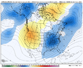
Per the Raleigh NWS office studies, the most prevalent teleconnection that occurs during winter storms outside of the mountains in NC is the -NAO. Something I’ve also pointed out is that 2 of the 3 biggest snowfalls I’ve experienced in NC outside the mountains occurred with a negative PNA… January 1988 and February 2004. I’m not saying that I wouldn’t prefer a +PNA but I’ll still take my chances with the right set up and that TPV in eastern Canada and cold building up in NW Canada has definitely worked in the past even with the cold starting in the west.The PNA being negative is not good. I know there will be folks that talk about the strong negative NAO. But I read somewhere in most cases it only helps the mid-Atlantic and NE. And from everything I've seen over the years, we need the PNA positive (...in most cases).
accu35
Member
I noticed the wrap around behind the storm. If it can trend further south parts of the upper south would see some wrap around if temps are there.View attachment 139867
Wow this thing is trending south
Brent
Member
It's trended rapidly further SE over past couple of days...bringing the MA in the game.
View attachment 139861
Yeah I'm seeing some people bring up the blizzard word
It's gonna be interesting to see how it pans out for sure
Looks like wraparound snow here so far
Last edited:
accu35
Member
I also noticed couple GEFS members has a backside snow pretty far south into MS/Al. Trying hard here ?View attachment 139867
Wow this thing is trending south
NBAcentel
Member
severestorm
Member
Lakes lowThis GFS run is full of cold air damming setups that fall short
NBAcentel
Member
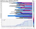
Building that packSeattles mean is higher then there average snow per year. What’s new View attachment 139883
Euro dumps a trough on Seattle and the hurricane freaks are happy because the CANSIPS shows us headed for La Nina this summer with a warm Atlantic. Anybody got any good news to share?
NoSnowATL
Member
We can get rainEuro dumps a trough on Seattle and the hurricane freaks are happy because the CANSIPS shows us headed for La Nina this summer with a warm Atlantic. Anybody got any good news to share?
NBAcentel
Member
packfan98
Moderator
Same. Pretty frustrating. We can't even get digital snow.My optimism is running out really quick. Im about to become a warm weenie again. Being a cold and snow weenie is to painful View attachment 139885
What is even going on. How has everything turned to trash so fast.My optimism is running out really quick. Im about to become a warm weenie again. Being a cold and snow weenie is to painful View attachment 139885
Said trough then slides east and unleashes the mother lode? I'm trying lol.Euro dumps a trough on Seattle and the hurricane freaks are happy because the CANSIPS shows us headed for La Nina this summer with a warm Atlantic. Anybody got any good news to share?

Euro Control says yes! I really don't think the heavy blocking shown here is far fetched. We just gotta somehow get the trough to kick eastSaid trough then slides east and unleashes the mother lode? I'm trying lol.


NBAcentel
Member

